 |
|
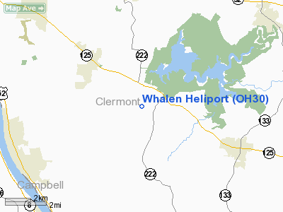
Location & QuickFacts
| FAA Information Effective: | 2008-09-25 |
| Airport Identifier: | OH30 |
| Airport Status: | Operational |
| Longitude/Latitude: | 084-10-13.0000W/38-59-35.0000N
-84.170278/38.993056 (Estimated) |
| Elevation: | 890 ft / 271.27 m (Estimated) |
| Land: | 0 acres |
| From nearest city: | 2 nautical miles SE of Amelia, OH |
| Location: | Clermont County, OH |
| Magnetic Variation: | 05W (2000) |
Owner & Manager
| Ownership: | Privately owned |
| Owner: | Daniel L. Whalen |
| Address: | 2165 Berry Rd.
Amelia, OH 45102 |
| Phone number: | 513-734-4040 |
| Manager: | Daniel L. Whalen |
| Address: | 2165 Berry Rd.
Amelia, OH 45102 |
| Phone number: | 513-734-4040 |
Airport Operations and Facilities
| Airport Use: | Private |
| Wind indicator: | Yes |
| Segmented Circle: | No |
| Control Tower: | No |
| Lighting Schedule: | PHONE REQ
FLOOD LGTS BY REQUEST ONLY, CONTACT MANAGER (513) 734-4040. |
| Sectional chart: | Cincinnati |
| Region: | AGL - Great Lakes |
| Boundary ARTCC: | ZID - Indianapolis |
| Tie-in FSS: | DAY - Dayton |
| FSS Toll Free: | 1-800-WX-BRIEF |
Runway Information
Helipad H1
| Dimension: | 65 x 65 ft / 19.8 x 19.8 m |
| Surface: | TURF-GRVL, |
| |
Runway H1 |
Runway |
| Traffic Pattern: | Left | Left |
|
Radio Navigation Aids
| ID |
Type |
Name |
Ch |
Freq |
Var |
Dist |
| PWF | NDB | Sportys | | 245.00 | 04W | 5.5 nm |
| LUK | NDB | Cincinnati | | 335.00 | 04W | 12.8 nm |
| MDE | NDB | Madeira | | 379.00 | 04W | 16.3 nm |
| ISZ | NDB | Cincinnati-blue Ash | | 388.00 | 04W | 18.5 nm |
| HW | NDB | Cubla | | 299.00 | 04W | 25.6 nm |
| UR | NDB | Burln | | 321.00 | 04W | 28.3 nm |
| HAO | NDB | Hamilton | | 260.00 | 04W | 29.5 nm |
| AMT | NDB | West Union | | 359.00 | 04W | 29.5 nm |
| HOC | NDB | Hillsboro | | 278.00 | 05W | 31.5 nm |
| HKF | NDB | Hook Field | | 239.00 | 04W | 33.0 nm |
| XW | NDB | Flmng | | 400.00 | 05W | 35.2 nm |
| IL | NDB | Airbo | | 407.00 | 04W | 36.1 nm |
| PZO | NDB | Peebles | | 329.00 | 02W | 39.7 nm |
| OXD | NDB | Oxford | | 282.00 | 04W | 42.0 nm |
| XEN | NDB | Xenia | | 395.00 | 03W | 44.8 nm |
| FFO | TACAN | Patterson | 099X | | 04W | 49.9 nm |
| FLM | VOR/DME | Falmouth | 117X | 117.00 | 04W | 21.7 nm |
| MXQ | VOR/DME | Midwest | 076X | 112.90 | 04W | 31.4 nm |
| CVG | VORTAC | Cincinnati | 120X | 117.30 | 04W | 24.9 nm |
| LUK | VOT | Cincinnati Muni/lunken | | 108.40 | | 13.0 nm |
Remarks
- PREFERRED INGRESS/EGRESS ROUTES 355 AND 165 DEG MAG.
- PRVDD ALL APCH/DEP ROUTES ARE CLEAR OF OBSTN; AREA IS MARKED; WIND INDICATOR IS MAINTAINED; COMPLY WITH 14 CFR PART 91.126(B)(2).
Images and information placed above are from
http://www.airport-data.com/airport/OH30/
We thank them for the data!
|
|


