 |
|
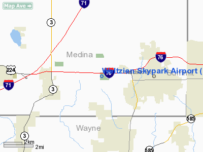
Location & QuickFacts
| FAA Information Effective: | 2008-09-25 |
| Airport Identifier: | 15G |
| Airport Status: | Operational |
| Longitude/Latitude: | 081-47-54.4810W/41-01-42.1960N
-81.798467/41.028388 (Estimated) |
| Elevation: | 1210 ft / 368.81 m (Estimated) |
| Land: | 26 acres |
| From nearest city: | 3 nautical miles W of Wadsworth, OH |
| Location: | Medina County, OH |
| Magnetic Variation: | 06W (1985) |
Owner & Manager
| Ownership: | Privately owned |
| Owner: | Daniel Weltzien |
| Address: | 3071 Greenwich Road
Wadsworth, OH 44281 |
| Phone number: | 330-336-9921 |
| Manager: | Daniel Weltzien |
| Address: | 3071 Greenwich Road
Wadsworth, OH 44281 |
| Phone number: | 330-334-9921 |
Airport Operations and Facilities
| Airport Use: | Open to public |
| Wind indicator: | Yes |
| Segmented Circle: | No |
| Control Tower: | No |
| Lighting Schedule: | DUSK-DAWN
ACTVT LIRL RY 03/21 - CTAF. |
| Beacon Color: | Clear-Green (lighted land airport) |
| Landing fee charge: | No |
| Sectional chart: | Detroit |
| Region: | AGL - Great Lakes |
| Traffic Pattern Alt: | 790 ft |
| Boundary ARTCC: | ZOB - Cleveland |
| Tie-in FSS: | CLE - Cleveland |
| FSS on Airport: | No |
| FSS Toll Free: | 1-800-WX-BRIEF |
| NOTAMs Facility: | CLE (NOTAM-d service avaliable) |
Airport Communications
| CTAF: | 123.050 |
| Unicom: | 123.050 |
Airport Services
| Fuel available: | 100LL |
| Airframe Repair: | MAJOR |
| Power Plant Repair: | MAJOR |
| Bottled Oxygen: | NONE |
| Bulk Oxygen: | NONE |
Runway Information
Runway 03/21
| Dimension: | 2410 x 37 ft / 734.6 x 11.3 m |
| Surface: | ASPH, Good Condition |
| Edge Lights: | Non-standard lighting system
NSTD LIRL DUE TO SPACING & NOT FAA APPROVED L-800 SERIES. |
| |
Runway 03 |
Runway 21 |
| Longitude: | 081-48-00.6100W | 081-47-48.3400W |
| Latitude: | 41-01-31.4900N | 41-01-52.8800N |
| Elevation: | 1210.00 ft | 1210.00 ft |
| Traffic Pattern: | Left | Left |
| Markings: | Basic, Good Condition | Basic, Good Condition |
| Displaced threshold: | 178.00 ft | 50.00 ft |
| VASI: | | pulsating/steady burning on left side |
| Runway End Identifier: | No | No |
| Centerline Lights: | No | No |
| Touchdown Lights: | No | No |
| Obstruction: | 75 ft trees, 2240.0 ft from runway, 60 ft left of centerline, 27:1 slope to clear
RY 03 APCH RATIO 0:1 TO DSPLCD THLD BASED ON +25 FT HANGAR AT RY END 100 FT LEFT.
+15 FT ROAD 0 FT FM RY END 55 FT R; +7 FT SIGN 30 FT FM RY END 80 FT L; +22 FT TREES 30 FT FM RY END 113 FT R; +14 FT PANELS MKD & LGTD 70 FT FM RY END; +30 FT PLINE 0 FT FM RY END 114 FT R. | 54 ft trees, 421.0 ft from runway, 142 ft right of centerline, 4:1 slope to clear
RWY 21 0:1 TO DSPLCD THRESHOLD DUE TO +47 FT TREES, 0 FT FM RWY END, 100 FT L.
55 TREES 0-75 FT FM RY END 97 FT L; +3-+15 FT BRUSH & TREES 0-200 FT FM 125 FT R & L; +1 FT GUARD RAIL 0 FT FM R & L EXTEND 35 FT FM R & L. |
|
Radio Navigation Aids
| ID |
Type |
Name |
Ch |
Freq |
Var |
Dist |
| AK | NDB | Akron | | 362.00 | 07W | 18.8 nm |
| CL | NDB | Harri | | 344.00 | 07W | 20.1 nm |
| AAU | NDB | Ashland | | 329.00 | 07W | 21.0 nm |
| EZE | NDB | Engel | | 226.00 | 07W | 27.9 nm |
| MLR | NDB | Millersburg/dcmsnd | | 382.00 | 06W | 29.4 nm |
| BKL | NDB | Burke Lakefront | | 416.00 | 07W | 30.7 nm |
| MF | NDB | Manns | | 372.00 | 06W | 33.3 nm |
| TSO | NDB | Tolson | | 395.00 | 07W | 43.1 nm |
| LQL | NDB | Lakeland | | 263.00 | 08W | 43.6 nm |
| BSV | VOR/DME | Briggs | 071X | 112.40 | 04W | 24.0 nm |
| DJB | VOR/DME | Dryer | 083X | 113.60 | 05W | 25.7 nm |
| ACO | VOR/DME | Akron | 091X | 114.40 | 04W | 27.5 nm |
| TVT | VOR/DME | Tiverton | 112X | 116.50 | 03W | 37.4 nm |
| CXR | VOR/DME | Chardon | 074X | 112.70 | 05W | 41.1 nm |
| LNN | VOR/DME | Lost Nation | 039X | 110.20 | 08W | 43.5 nm |
| SKY | VOR/DME | Sandusky | 029X | 109.20 | 04W | 45.8 nm |
| MFD | VORTAC | Mansfield | 025X | 108.80 | 03W | 37.2 nm |
| CAK | VOT | Akron/canton Regional | | 110.60 | | 17.5 nm |
| CLE | VOT | Cleveland | | 110.40 | | 23.1 nm |
Remarks
- RY 03/21 NO TOUCH AND GO LNDGS.
- VFR ONLY
Images and information placed above are from
http://www.airport-data.com/airport/15G/
We thank them for the data!
| General Info
|
| Country |
United States
|
| State |
OHIO
|
| FAA ID |
15G
|
| Latitude |
41-01-42.196N
|
| Longitude |
081-47-54.481W
|
| Elevation |
1210 feet
|
| Near City |
WADSWORTH
|
We don't guarantee the information is fresh and accurate. The data may
be wrong or outdated.
For more up-to-date information please refer to other sources.
|
|


