 |
|
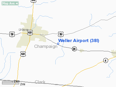
Location & QuickFacts
| FAA Information Effective: | 2008-09-25 |
| Airport Identifier: | 38I |
| Airport Status: | Operational |
| Longitude/Latitude: | 083-41-21.7400W/40-05-28.2100N
-83.689372/40.091169 (Estimated) |
| Elevation: | 1150 ft / 350.52 m (Estimated) |
| Land: | 0 acres |
| From nearest city: | 3 nautical miles SE of Urbana, OH |
| Location: | Champaign County, OH |
| Magnetic Variation: | 04W (1985) |
Owner & Manager
| Ownership: | Privately owned |
| Owner: | Wendell Weller |
| Address: | 3138 Route 29 East
Urbana, OH 43078 |
| Phone number: | 937-653-5081 |
| Manager: | Tim Weller |
| Address: | 3138 Route 29 East
Urbana, OH 43078 |
| Phone number: | 937-484-7222 |
Airport Operations and Facilities
| Airport Use: | Open to public |
| Wind indicator: | Yes |
| Segmented Circle: | No |
| Control Tower: | No |
| Landing fee charge: | No |
| Sectional chart: | Detroit |
| Region: | AGL - Great Lakes |
| Boundary ARTCC: | ZID - Indianapolis |
| Tie-in FSS: | DAY - Dayton |
| FSS on Airport: | No |
| FSS Toll Free: | 1-800-WX-BRIEF |
| NOTAMs Facility: | DAY (NOTAM-d service avaliable) |
Airport Communications
| CTAF: | 123.000 |
| Unicom: | 123.000 |
Airport Services
| Airframe Repair: | NONE |
| Power Plant Repair: | NONE |
| Bottled Oxygen: | NONE |
| Bulk Oxygen: | NONE |
Runway Information
Runway 09/27
| Dimension: | 2534 x 75 ft / 772.4 x 22.9 m |
| Surface: | TURF, Good Condition |
| |
Runway 09 |
Runway 27 |
| Longitude: | 083-41-38.7000W | 083-41-04.7600W |
| Latitude: | 40-05-26.9500N | 40-05-29.4600N |
| Elevation: | 1150.00 ft | 1150.00 ft |
| Traffic Pattern: | Left | Left |
| Runway End Identifier: | No | No |
| Centerline Lights: | No | No |
| Touchdown Lights: | No | No |
| Obstruction: | 75 ft trees, 70 ft right of centerline | 25 ft pline, 45.0 ft from runway, 125 ft left of centerline, 1:1 slope to clear |
|
Radio Navigation Aids
| ID |
Type |
Name |
Ch |
Freq |
Var |
Dist |
| CCJ | NDB | Clark County | | 341.00 | 04W | 13.7 nm |
| UYF | NDB | London | | 263.00 | 06W | 14.0 nm |
| MRT | NDB | Marysville | | 403.00 | 05W | 17.6 nm |
| EDJ | NDB | Bellefontaine | | 242.00 | 05W | 17.8 nm |
| RUV | NDB | Rushsylvania | | 326.00 | 05W | 22.1 nm |
| OS | NDB | Fuler | | 515.00 | 05W | 22.6 nm |
| XEN | NDB | Xenia | | 395.00 | 03W | 25.2 nm |
| BU | NDB | Boutn | | 230.00 | 05W | 27.7 nm |
| DKG | NDB | Don Scott | | 348.00 | 05W | 28.1 nm |
| DLZ | NDB | Delaware | | 215.00 | 06W | 29.1 nm |
| CHC | NDB | Grens | | 272.00 | 04W | 30.8 nm |
| CSS | NDB | Court House | | 414.00 | 05W | 32.5 nm |
| IL | NDB | Airbo | | 407.00 | 04W | 36.1 nm |
| VES | NDB | Versailles | | 356.00 | 04W | 38.9 nm |
| LYL | NDB | Lima | | 362.00 | 04W | 39.9 nm |
| MNN | NDB | Marion | | 201.00 | 05W | 42.5 nm |
| CM | NDB | Sumie | | 391.00 | 05W | 43.5 nm |
| HW | NDB | Cubla | | 299.00 | 04W | 45.2 nm |
| CQA | NDB | Lakefield | | 205.00 | 04W | 46.5 nm |
| CYO | NDB | Circleville | | 366.00 | 05W | 47.3 nm |
| RZT | NDB | Ross County | | 236.00 | 05W | 49.7 nm |
| HKF | NDB | Hook Field | | 239.00 | 04W | 49.9 nm |
| XSF | TACAN | Springfield | 065X | | 04W | 16.7 nm |
| FFO | TACAN | Patterson | 099X | | 04W | 23.5 nm |
| LCK | TACAN | Rickenbacker | 069X | | 05W | 39.0 nm |
| AOH | VOR | Allen County | | 108.40 | 04W | 39.2 nm |
| BUD | VOR | Buckeye | | 109.80 | 05W | 42.6 nm |
| XUB | VOR | Yellow Bud | | 112.50 | 05W | 47.2 nm |
| SGH | VOR/DME | Springfield | 079X | 113.20 | 04W | 16.9 nm |
| DQN | VOR/DME | Dayton | 092X | 114.50 | 01W | 32.9 nm |
| MXQ | VOR/DME | Midwest | 076X | 112.90 | 04W | 40.1 nm |
| ROD | VORTAC | Rosewood | 122X | 117.50 | 05W | 20.1 nm |
| DAY | VOT | Dayton J M Cox-day | | 111.00 | | 27.0 nm |
| CMH | VOT | Port Columbus | | 111.00 | | 37.5 nm |
Remarks
Images and information placed above are from
http://www.airport-data.com/airport/38I/
We thank them for the data!
| General Info
|
| Country |
United States
|
| State |
OHIO
|
| FAA ID |
38I
|
| Latitude |
40-05-28.210N
|
| Longitude |
083-41-21.740W
|
| Elevation |
1150 feet
|
| Near City |
URBANA
|
We don't guarantee the information is fresh and accurate. The data may
be wrong or outdated.
For more up-to-date information please refer to other sources.
|
|


