 |
|
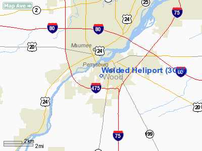
Location & QuickFacts
| FAA Information Effective: | 2008-09-25 |
| Airport Identifier: | 3OI5 |
| Airport Status: | Operational |
| Longitude/Latitude: | 083-38-39.7660W/41-32-42.1860N
-83.644379/41.545052 (Estimated) |
| Elevation: | 635 ft / 193.55 m (Estimated) |
| Land: | 0 acres |
| From nearest city: | 1 nautical miles SW of Perrysburg, OH |
| Location: | Wood County, OH |
| Magnetic Variation: | 05W (1985) |
Owner & Manager
| Ownership: | Privately owned |
| Owner: | Welded Construction Co |
| Address: | 26933 Eckel Road
Perrysburg, OH 43551 |
| Phone number: | 419-874-3540 |
| Manager: | Dave Dice |
| Address: | 2156 S. Holland Sylvania Dr.
Maumee, OH 43537 |
| Phone number: | 419-867-0302 |
Airport Operations and Facilities
| Airport Use: | Private |
| Wind indicator: | Yes |
| Segmented Circle: | Yes |
| Control Tower: | No |
| Landing fee charge: | No |
| Sectional chart: | Detroit |
| Region: | AGL - Great Lakes |
| Boundary ARTCC: | ZOB - Cleveland |
| Tie-in FSS: | CLE - Cleveland |
| FSS on Airport: | No |
| FSS Toll Free: | 1-800-WX-BRIEF |
Runway Information
Helipad H1
| Dimension: | 95 x 50 ft / 29.0 x 15.2 m |
| Surface: | CONC, |
| |
Runway H1 |
Runway |
| Traffic Pattern: | Left | Left |
|
Radio Navigation Aids
| ID |
Type |
Name |
Ch |
Freq |
Var |
Dist |
| USE | NDB | Fulton | | 375.00 | 05W | 22.3 nm |
| FZI | NDB | Fostoria | | 379.00 | 05W | 24.2 nm |
| ADG | NDB | Adrian | | 278.00 | 06W | 27.6 nm |
| TCU | NDB | Tecumseh | | 239.00 | 04W | 31.4 nm |
| BNR | NDB | Benton Ridge | | 334.00 | 05W | 31.5 nm |
| TII | NDB | Tiffin | | 269.00 | 05W | 33.3 nm |
| PDR | NDB | Ottawa | | 233.00 | 05W | 34.3 nm |
| PCW | NDB | Port Clinton | | 423.00 | 06W | 34.9 nm |
| BYN | NDB | Bryan | | 260.00 | 04W | 37.2 nm |
| DFI | NDB | Defiance | | 246.00 | 05W | 37.5 nm |
| RYS | NDB | Grosse Ile | | 419.00 | 06W | 40.0 nm |
| PT | NDB | Pelee Island | | 283.00 | 05W | 46.0 nm |
| G | NDB | Golf | | 398.00 | 05W | 49.8 nm |
| TOL | TACAN | Toledo | 072X | | 05W | 7.6 nm |
| MAH | VOR | Marathon | | 114.90 | 05W | 31.9 nm |
| VWV | VOR/DME | Waterville | 078X | 113.10 | 02W | 5.6 nm |
| DXO | VOR/DME | Detroit | 081X | 113.40 | 06W | 42.0 nm |
| SKY | VOR/DME | Sandusky | 029X | 109.20 | 04W | 45.0 nm |
| CRL | VORTAC | Carleton | 104X | 115.70 | 03W | 31.4 nm |
| FDY | VORTAC | Findlay | 019X | 108.20 | 02W | 35.8 nm |
| YIP | VOT | Willow Run | | 112.00 | | 41.8 nm |
| DTW | VOT | Detroit Met Wayne | | 109.80 | | 42.9 nm |
Remarks
- (E111-2) APPROPRIATELY MARKED; NON-OBSTRUCTING WIND INDICATOR IS MAINTAINED ADJACENT TO THE TAKEOFF/LANDING AREA.
- ALL APCH/DEPARTURE ROUTE HELICOPTER OPERATIONS ARE CONDUCTED IN AN AREA FROM 30 DEGS CLOCKWISE TO 90 DEGS AND FROM 200 DEGS CLOCKWISE. TO 230 DEGS AND FROM 270 DEGS CLOCKWISE TO 310 DEGS USING THE TOUCHDOWN PAD AS THE CENTER OF A COMPASS ROSE; TAKEOFF/LANDING AREA IS.
Images and information placed above are from
http://www.airport-data.com/airport/3OI5/
We thank them for the data!
| General Info
|
| Country |
United States
|
| State |
OHIO
|
| FAA ID |
3OI5
|
| Latitude |
41-32-42.186N
|
| Longitude |
083-38-39.766W
|
| Elevation |
635 feet
|
| Near City |
PERRYSBURG
|
We don't guarantee the information is fresh and accurate. The data may
be wrong or outdated.
For more up-to-date information please refer to other sources.
|
|


