 |
|
Coordinates: 40°52′29″N 081°53′18″W / 40.87472°N 81.88833°W / 40.87472; -81.88833
| Wayne County Airport |
| IATA: BJJ – ICAO: KBJJ – FAA LID: BJJ |
| Summary |
| Airport type |
Public |
| Owner |
Wayne County Airport Authority |
| Serves |
Wayne County, Ohio |
| Location |
Wooster, Ohio |
| Elevation AMSL |
1,136 ft / 346 m |
| Runways |
| Direction |
Length |
Surface |
| ft |
m |
| 10/28 |
5,191 |
1,582 |
Asphalt |
| Statistics (2005) |
| Aircraft operations |
96,520 |
| Based aircraft |
54 |
| Source: Federal Aviation Administration |
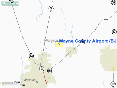
Wayne County Airport (IATA: BJJ, ICAO: KBJJ, FAA LID: BJJ) is a public airport located six miles (10 km) northeast of the central business district of Wooster, a city in Wayne County, Ohio, United States. It is owned by the Wayne County Airport Authority.
Facilities and aircraft
Wayne County Airport covers an area of 331 acres (134 ha) which contains one asphalt paved runway (10/28) measuring 5,191 x 100 ft (1,582 x 30 m).
For the 12-month period ending November 7, 2005, the airport had 96,520 aircraft operations, an average of 264 per day: 83% general aviation, 16% air taxi and 1% military. There are 54 aircraft based at this airport: 72% single-engine, 20% multi-engine, 6% jet and 2% helicopter.
The above content comes from Wikipedia and is published under free licenses – click here to read more.
Location & QuickFacts
| FAA Information Effective: | 2008-09-25 |
| Airport Identifier: | BJJ |
| Airport Status: | Operational |
| Longitude/Latitude: | 081-53-17.7000W/40-52-29.4000N
-81.888250/40.874833 (Estimated) |
| Elevation: | 1136 ft / 346.25 m (Surveyed) |
| Land: | 331 acres |
| From nearest city: | 6 nautical miles NE of Wooster, OH |
| Location: | Wayne County, OH |
| Magnetic Variation: | 07W (2000) |
Owner & Manager
| Ownership: | Publicly owned |
| Owner: | Wayne Co Arpt Auth |
| Address: | Wayne County Courthouse
Wooster, OH 44691 |
| Phone number: | 330-262-2015
ARLENE MOORE, ARPT AUTHORITY SECRETARY. |
| Manager: | Jedd Sprunger |
| Address: | 6020 N Honeytown Rd
Smithville, OH 44677 |
| Phone number: | 330-669-9212
FAX 330-669-9249. |
Airport Operations and Facilities
| Airport Use: | Open to public |
| Wind indicator: | Yes |
| Segmented Circle: | Yes |
| Control Tower: | No |
| Lighting Schedule: | DUSK-DAWN
HIRL RY 10/28 PRESET LOW INTST DUSK TO DAWN ; TO INCREASE INTST AND ACTVT REILS RY 10/28 - CTAF. |
| Beacon Color: | Clear-Green (lighted land airport) |
| Landing fee charge: | No |
| Sectional chart: | Detroit |
| Region: | AGL - Great Lakes |
| Boundary ARTCC: | ZOB - Cleveland |
| Tie-in FSS: | CLE - Cleveland |
| FSS on Airport: | No |
| FSS Toll Free: | 1-800-WX-BRIEF |
| NOTAMs Facility: | BJJ (NOTAM-d service avaliable) |
| Federal Agreements: | NGY |
Airport Communications
| CTAF: | 122.800 |
| Unicom: | 122.800 |
Airport Services
| Fuel available: | 100LLA1+ |
| Airframe Repair: | MAJOR |
| Power Plant Repair: | MAJOR |
| Bottled Oxygen: | LOW |
Runway Information
Runway 10/28
| Dimension: | 5191 x 100 ft / 1582.2 x 30.5 m |
| Surface: | ASPH, Good Condition |
| Weight Limit: | Single wheel: 30000 lbs. |
| Edge Lights: | High |
| |
Runway 10 |
Runway 28 |
| Longitude: | 081-53-51.5253W | 081-52-43.9615W |
| Latitude: | 40-52-29.4352N | 40-52-29.4329N |
| Elevation: | 1112.00 ft | 1136.00 ft |
| Alignment: | 90 | 127 |
| Traffic Pattern: | Left | Left |
| Markings: | Non-precision instrument, Fair Condition | Non-precision instrument, Fair Condition |
| Crossing Height: | 0.00 ft | 33.00 ft |
| Displaced threshold: | 0.00 ft | 218.00 ft |
| VASI: | | 4-box on right side
UNUSBL BYD 8 DEG LEFT OF CENTERLINE. |
| Visual Glide Angle: | 0.00° | 3.00° |
| Runway End Identifier: | Yes | Yes |
| Obstruction: | 85 ft trees, 2456.0 ft from runway, 350 ft right of centerline, 26:1 slope to clear | 5 ft road, 201.0 ft from runway
APCH RATIO 18:1 TO DSPLCD THLD; +20 FT POLE 377 FT TO DSPLCD THLD 230 FT R.
+5 FT ROAD 180-200 FT FM RY END; +20 FT LGTD POLE 157 FT FM RY END 230 FT R. |
|
Radio Navigation Aids
| ID |
Type |
Name |
Ch |
Freq |
Var |
Dist |
| AAU | NDB | Ashland | | 329.00 | 07W | 17.4 nm |
| MLR | NDB | Millersburg/dcmsnd | | 382.00 | 06W | 20.0 nm |
| AK | NDB | Akron | | 362.00 | 07W | 25.6 nm |
| MF | NDB | Manns | | 372.00 | 06W | 26.2 nm |
| CL | NDB | Harri | | 344.00 | 07W | 28.1 nm |
| EZE | NDB | Engel | | 226.00 | 07W | 37.7 nm |
| BKL | NDB | Burke Lakefront | | 416.00 | 07W | 40.6 nm |
| TSO | NDB | Tolson | | 395.00 | 07W | 41.4 nm |
| BSV | VOR/DME | Briggs | 071X | 112.40 | 04W | 22.3 nm |
| TVT | VOR/DME | Tiverton | 112X | 116.50 | 03W | 27.3 nm |
| DJB | VOR/DME | Dryer | 083X | 113.60 | 05W | 31.6 nm |
| ACO | VOR/DME | Akron | 091X | 114.40 | 04W | 34.2 nm |
| CTW | VOR/DME | Newcomerstown | 055X | 111.80 | 07W | 43.1 nm |
| SKY | VOR/DME | Sandusky | 029X | 109.20 | 04W | 48.3 nm |
| MFD | VORTAC | Mansfield | 025X | 108.80 | 03W | 31.9 nm |
| CAK | VOT | Akron/canton Regional | | 110.60 | | 20.4 nm |
| CLE | VOT | Cleveland | | 110.40 | | 32.2 nm |
Images and information placed above are from
http://www.airport-data.com/airport/BJJ/
We thank them for the data!
| General Info
|
| Country |
United States
|
| State |
OHIO
|
| FAA ID |
BJJ
|
| Latitude |
40-52-29.300N
|
| Longitude |
081-53-17.700W
|
| Elevation |
1135 feet
|
| Near City |
WOOSTER
|
We don't guarantee the information is fresh and accurate. The data may
be wrong or outdated.
For more up-to-date information please refer to other sources.
|
|


