 |
|
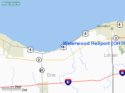
Location & QuickFacts
| FAA Information Effective: | 2008-09-25 |
| Airport Identifier: | OH76 |
| Airport Status: | Operational |
| Longitude/Latitude: | 082-27-00.6020W/41-23-21.1700N
-82.450167/41.389214 (Estimated) |
| Elevation: | 587 ft / 178.92 m (Estimated) |
| Land: | 0 acres |
| From nearest city: | 5 nautical miles W of Vermilion, OH |
| Location: | Erie County, OH |
| Magnetic Variation: | 06W (1985) |
Owner & Manager
| Ownership: | Privately owned |
| Owner: | Donald Brown |
| Address: | 5605 West Lake Rd
Vermilion, OH 44089 |
| Phone number: | 216-967-1805
OR 216-967-7600. |
| Manager: | Andrew Overly |
| Address: | 5605 West Lake Rd
Vermilion, OH 44089 |
| Phone number: | 216-967-1805
OR 216-967-7600/419-433-7288. |
Airport Operations and Facilities
| Airport Use: | Private |
| Wind indicator: | Yes |
| Segmented Circle: | No |
| Control Tower: | No |
| Sectional chart: | Detroit |
| Region: | AGL - Great Lakes |
| Boundary ARTCC: | ZOB - Cleveland |
| Tie-in FSS: | CLE - Cleveland |
| FSS Toll Free: | 1-800-WX-BRIEF |
Airport Communications
Airport Services
Runway Information
Helipad H1
| Dimension: | 88 x 28 ft / 26.8 x 8.5 m |
| Surface: | CONC-TURF, |
| |
Runway H1 |
Runway |
| Traffic Pattern: | Left | Left |
|
Radio Navigation Aids
| ID |
Type |
Name |
Ch |
Freq |
Var |
Dist |
| PCW | NDB | Port Clinton | | 423.00 | 06W | 20.4 nm |
| CL | NDB | Harri | | 344.00 | 07W | 22.1 nm |
| PT | NDB | Pelee Island | | 283.00 | 05W | 25.5 nm |
| AAU | NDB | Ashland | | 329.00 | 07W | 27.1 nm |
| EZE | NDB | Engel | | 226.00 | 07W | 33.3 nm |
| BKL | NDB | Burke Lakefront | | 416.00 | 07W | 36.4 nm |
| MF | NDB | Manns | | 372.00 | 06W | 37.5 nm |
| TII | NDB | Tiffin | | 269.00 | 05W | 38.4 nm |
| FZI | NDB | Fostoria | | 379.00 | 05W | 44.4 nm |
| SKY | VOR/DME | Sandusky | 029X | 109.20 | 04W | 9.6 nm |
| DJB | VOR/DME | Dryer | 083X | 113.60 | 05W | 13.1 nm |
| MFD | VORTAC | Mansfield | 025X | 108.80 | 03W | 31.9 nm |
| CLE | VOT | Cleveland | | 110.40 | | 27.1 nm |
Remarks
- ALL APP/DEP ARE CONDUCTED TO THE NORTH & SOUTH; AREA IS MARKED; WIND INDICATOR IS MAINTAINED.
Images and information placed above are from
http://www.airport-data.com/airport/OH76/
We thank them for the data!
| General Info
|
| Country |
United States
|
| State |
OHIO
|
| FAA ID |
OH76
|
| Latitude |
41-23-21.170N
|
| Longitude |
082-27-00.602W
|
| Elevation |
587 feet
|
| Near City |
VERMILION
|
We don't guarantee the information is fresh and accurate. The data may
be wrong or outdated.
For more up-to-date information please refer to other sources.
|
|


