 |
|
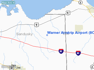
Location & QuickFacts
| FAA Information Effective: | 2008-09-25 |
| Airport Identifier: | 8OA6 |
| Airport Status: | Operational |
| Longitude/Latitude: | 082-53-49.6830W/41-23-10.1880N
-82.897134/41.386163 (Estimated) |
| Elevation: | 611 ft / 186.23 m (Surveyed) |
| Land: | 0 acres |
| From nearest city: | 2 nautical miles E of Vickery, OH |
| Location: | Sandusky County, OH |
| Magnetic Variation: | 06W (1985) |
Owner & Manager
| Ownership: | Privately owned |
| Owner: | William I. Warner |
| Address: | 6214 Co Rd 247
Vickery, OH 43464 |
| Phone number: | 419-547-0727 |
| Manager: | William I. Warner |
| Address: | 6191 Co Rd 247
Vickery, OH 43464 |
| Phone number: | 419-547-0727 |
Airport Operations and Facilities
| Airport Use: | Private |
| Wind indicator: | Yes |
| Segmented Circle: | No |
| Control Tower: | No |
| Landing fee charge: | No |
| Sectional chart: | Detroit |
| Region: | AGL - Great Lakes |
| Boundary ARTCC: | ZOB - Cleveland |
| Tie-in FSS: | CLE - Cleveland |
| FSS on Airport: | No |
| FSS Toll Free: | 1-800-WX-BRIEF
OR LOCAL CALL 625-6050. |
Airport Services
| Airframe Repair: | NONE |
| Power Plant Repair: | NONE |
| Bottled Oxygen: | NONE |
| Bulk Oxygen: | NONE |
Runway Information
Runway 09/27
| Dimension: | 2600 x 55 ft / 792.5 x 16.8 m |
| Surface: | TURF, |
| |
Runway 09 |
Runway 27 |
| Traffic Pattern: | Left | Left |
| Displaced threshold: | 0.00 ft | 600.00 ft |
|
Radio Navigation Aids
| ID |
Type |
Name |
Ch |
Freq |
Var |
Dist |
| PCW | NDB | Port Clinton | | 423.00 | 06W | 8.1 nm |
| TII | NDB | Tiffin | | 269.00 | 05W | 22.3 nm |
| FZI | NDB | Fostoria | | 379.00 | 05W | 25.5 nm |
| PT | NDB | Pelee Island | | 283.00 | 05W | 25.8 nm |
| AAU | NDB | Ashland | | 329.00 | 07W | 38.7 nm |
| BNR | NDB | Benton Ridge | | 334.00 | 05W | 41.2 nm |
| CL | NDB | Harri | | 344.00 | 07W | 42.2 nm |
| MF | NDB | Manns | | 372.00 | 06W | 42.5 nm |
| RYS | NDB | Grosse Ile | | 419.00 | 06W | 44.5 nm |
| MNN | NDB | Marion | | 201.00 | 05W | 46.9 nm |
| TOL | TACAN | Toledo | 072X | | 05W | 42.5 nm |
| MAH | VOR | Marathon | | 114.90 | 05W | 41.3 nm |
| BUD | VOR | Buckeye | | 109.80 | 05W | 46.9 nm |
| SKY | VOR/DME | Sandusky | 029X | 109.20 | 04W | 11.3 nm |
| DJB | VOR/DME | Dryer | 083X | 113.60 | 05W | 33.2 nm |
| VWV | VOR/DME | Waterville | 078X | 113.10 | 02W | 33.7 nm |
| MFD | VORTAC | Mansfield | 025X | 108.80 | 03W | 34.1 nm |
| FDY | VORTAC | Findlay | 019X | 108.20 | 02W | 46.7 nm |
| CRL | VORTAC | Carleton | 104X | 115.70 | 03W | 47.1 nm |
| CLE | VOT | Cleveland | | 110.40 | | 47.3 nm |
Images and information placed above are from
http://www.airport-data.com/airport/8OA6/
We thank them for the data!
| General Info
|
| Country |
United States
|
| State |
OHIO
|
| FAA ID |
8OA6
|
| Latitude |
41-23-10.188N
|
| Longitude |
082-53-49.683W
|
| Elevation |
611 feet
|
| Near City |
VICKERY
|
We don't guarantee the information is fresh and accurate. The data may
be wrong or outdated.
For more up-to-date information please refer to other sources.
|
|


