 |
|
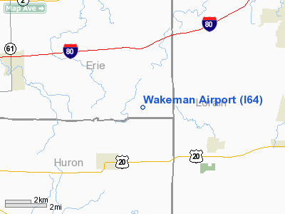
Location & QuickFacts
| FAA Information Effective: | 2008-09-25 |
| Airport Identifier: | I64 |
| Airport Status: | Operational |
| Longitude/Latitude: | 082-22-14.5930W/41-17-35.1810N
-82.370720/41.293106 (Estimated) |
| Elevation: | 848 ft / 258.47 m (Surveyed) |
| Land: | 120 acres |
| From nearest city: | 3 nautical miles NE of Wakeman, OH |
| Location: | Erie County, OH |
| Magnetic Variation: | 06W (1985) |
Owner & Manager
| Ownership: | Privately owned |
| Owner: | Donald & Karen Paolucci |
| Address: | 20800 Parkcliff Dr
Fairview Park, OH 44126 |
| Phone number: | 440-356-1670 |
| Manager: | Donald A. Paolucci |
| Address: | 9620 Rte 60 N
Wakeman, OH 44889 |
| Phone number: | 440-965-7787 |
Airport Operations and Facilities
| Airport Use: | Open to public |
| Wind indicator: | Yes |
| Segmented Circle: | No |
| Control Tower: | No |
| Lighting Schedule: | RDO-CTL
ACTVT LIRL RY 03/21 - CTAF. |
| Landing fee charge: | No |
| Sectional chart: | Detroit |
| Region: | AGL - Great Lakes |
| Boundary ARTCC: | ZOB - Cleveland |
| Tie-in FSS: | CLE - Cleveland |
| FSS on Airport: | No |
| FSS Toll Free: | 1-800-WX-BRIEF |
| NOTAMs Facility: | CLE (NOTAM-d service avaliable) |
Airport Communications
| CTAF: | 122.800 |
| Unicom: | 122.800 |
Airport Services
| Fuel available: | 100LL |
| Airframe Repair: | MAJOR |
| Power Plant Repair: | MAJOR |
| Bottled Oxygen: | NONE |
| Bulk Oxygen: | NONE |
Runway Information
Runway 03/21
| Dimension: | 3800 x 55 ft / 1158.2 x 16.8 m |
| Surface: | ASPH, Fair Condition |
| Edge Lights: | Non-standard lighting system
NSTD LIRL. RY 03/21 RY 21 LGTS LCTD 135 FT UP RY. |
| |
Runway 03 |
Runway 21 |
| Longitude: | 082-22-26.8400W | 082-22-02.3300W |
| Latitude: | 41-17-18.8400N | 41-17-51.5100N |
| Elevation: | 848.00 ft | 848.00 ft |
| Traffic Pattern: | Left | Left |
| Markings: | Numbers only, Good Condition
WEATHERED | Numbers only, Good Condition
WEATHERED |
| Runway End Identifier: | No | No |
| Centerline Lights: | No | No |
| Touchdown Lights: | No | No |
| Obstruction: | 40 ft tree, 525.0 ft from runway, 60 ft right of centerline, 8:1 slope to clear | 28 ft trees, 380.0 ft from runway, 100 ft left of centerline, 6:1 slope to clear |
|
Radio Navigation Aids
| ID |
Type |
Name |
Ch |
Freq |
Var |
Dist |
| CL | NDB | Harri | | 344.00 | 07W | 18.5 nm |
| AAU | NDB | Ashland | | 329.00 | 07W | 20.5 nm |
| PCW | NDB | Port Clinton | | 423.00 | 06W | 26.2 nm |
| EZE | NDB | Engel | | 226.00 | 07W | 31.5 nm |
| MF | NDB | Manns | | 372.00 | 06W | 31.9 nm |
| PT | NDB | Pelee Island | | 283.00 | 05W | 32.2 nm |
| BKL | NDB | Burke Lakefront | | 416.00 | 07W | 34.9 nm |
| TII | NDB | Tiffin | | 269.00 | 05W | 39.6 nm |
| AK | NDB | Akron | | 362.00 | 07W | 46.5 nm |
| FZI | NDB | Fostoria | | 379.00 | 05W | 46.8 nm |
| DJB | VOR/DME | Dryer | 083X | 113.60 | 05W | 10.2 nm |
| SKY | VOR/DME | Sandusky | 029X | 109.20 | 04W | 15.4 nm |
| MFD | VORTAC | Mansfield | 025X | 108.80 | 03W | 27.4 nm |
| CLE | VOT | Cleveland | | 110.40 | | 24.6 nm |
| CAK | VOT | Akron/canton Regional | | 110.60 | | 47.8 nm |
Remarks
- PRVDD OBSTNS IN APCH SFC ARE RMVD/LWRD, THRS DSPLCD TO PRVD 20:1 CLRNC, PRIM SFC CLRD/MAINTD.
Images and information placed above are from
http://www.airport-data.com/airport/I64/
We thank them for the data!
| General Info
|
| Country |
United States
|
| State |
OHIO
|
| FAA ID |
I64
|
| Latitude |
41-17-35.181N
|
| Longitude |
082-22-14.593W
|
| Elevation |
848 feet
|
| Near City |
WAKEMAN
|
We don't guarantee the information is fresh and accurate. The data may
be wrong or outdated.
For more up-to-date information please refer to other sources.
|
|


