 |
|
Location & QuickFacts
| FAA Information Effective: | 2008-09-25 |
| Airport Identifier: | 3G3 |
| Airport Status: | Operational |
| Longitude/Latitude: | 081-45-23.1842W/41-00-11.3660N
-81.756440/41.003157 (Estimated) |
| Elevation: | 974 ft / 296.88 m (Estimated) |
| Land: | 183 acres |
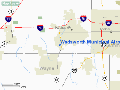
| From nearest city: | 2 nautical miles SW of Wadsworth, OH |
| Location: | Medina County, OH |
| Magnetic Variation: | 07W (1990) |
Owner & Manager
| Ownership: | Publicly owned |
| Owner: | City Of Wadsworth |
| Address: | Wadsworth Muni Bldg
Wadsworth, OH 44281 |
| Manager: | Richard Hopkins |
| Address: | 840 Airport Rd
Wadsworth, OH 44281 |
| Phone number: | 330-334-9861 |
Airport Operations and Facilities
| Airport Use: | Open to public |
| Wind indicator: | Yes |
| Segmented Circle: | No |
| Control Tower: | No |
| Lighting Schedule: | DUSK-DAWN
ACTVT MIRL RY 02/20 & VASI RYS 02 & 20 - CTAF. |
| Beacon Color: | Clear-Green (lighted land airport) |
| Landing fee charge: | No |
| Sectional chart: | Detroit |
| Region: | AGL - Great Lakes |
| Boundary ARTCC: | ZOB - Cleveland |
| Tie-in FSS: | CLE - Cleveland |
| FSS on Airport: | No |
| FSS Toll Free: | 1-800-WX-BRIEF |
| NOTAMs Facility: | CLE (NOTAM-d service avaliable) |
| Federal Agreements: | N |
Airport Communications
| CTAF: | 122.800 |
| Unicom: | 122.800 |
Airport Services
| Fuel available: | 100LLA1+ |
| Bottled Oxygen: | NONE |
| Bulk Oxygen: | NONE |
Runway Information
Runway 02/20
| Dimension: | 3529 x 75 ft / 1075.6 x 22.9 m |
| Surface: | ASPH, Good Condition |
| Edge Lights: | Medium |
| |
Runway 02 |
Runway 20 |
| Longitude: | 081-45-22.6610W | 081-45-14.2390W |
| Latitude: | 40-59-48.5700N | 41-00-22.8530N |
| Elevation: | 965.00 ft | 974.00 ft |
| Alignment: | 11 | 127 |
| Traffic Pattern: | Left | Left |
| Markings: | Non-precision instrument, Good Condition
RWY O2 MARKINGS POOR - WEATHERED. | Non-precision instrument, |
| Crossing Height: | 27.00 ft | 48.00 ft |
| Displaced threshold: | 129.00 ft | 0.00 ft |
| VASI: | 2-box on right side | 2-box on left side |
| Visual Glide Angle: | 3.50° | 3.50° |
| Runway End Identifier: | No | No |
| Centerline Lights: | No | No |
| Touchdown Lights: | No | No |
| Obstruction: | 26 ft tree, 525.0 ft from runway, 102 ft right of centerline, 12:1 slope to clear
RWY 02 APCH RATIO 0:1 TO DSPLCD THLD DUE TO ADDITIONAL OBSTRUCTION +27 FT TREES 0 FT FM 225 FT R. | 37 ft pline, 240.0 ft from runway, 230 ft left of centerline, 1:1 slope to clear
RWY 20 +33' FT TREES IN DITCH 200 FT R 100 FT FM RWY. |
|
Runway 10/28
| Dimension: | 2392 x 35 ft / 729.1 x 10.7 m |
| Surface: | ASPH, Fair Condition |
| |
Runway 10 |
Runway 28 |
| Longitude: | 081-45-45.7680W | 081-45-14.5694W |
| Latitude: | 41-00-19.7500N | 41-00-19.6665N |
| Elevation: | 963.00 ft | 972.00 ft |
| Alignment: | 90 | 127 |
| Traffic Pattern: | Left | Left |
| Markings: | Numbers only, Fair Condition | Numbers only, Fair Condition |
| Displaced threshold: | 0.00 ft | 237.00 ft |
| Runway End Identifier: | No | No |
| Centerline Lights: | No | No |
| Touchdown Lights: | No | No |
| Obstruction: | 37 ft tree, 285.0 ft from runway, 100 ft right of centerline, 2:1 slope to clear | 16 ft tree, 396.0 ft from runway, 52 ft right of centerline, 12:1 slope to clear |
|
Radio Navigation Aids
| ID |
Type |
Name |
Ch |
Freq |
Var |
Dist |
| AK | NDB | Akron | | 362.00 | 07W | 17.2 nm |
| CL | NDB | Harri | | 344.00 | 07W | 22.3 nm |
| AAU | NDB | Ashland | | 329.00 | 07W | 22.7 nm |
| MLR | NDB | Millersburg/dcmsnd | | 382.00 | 06W | 28.2 nm |
| EZE | NDB | Engel | | 226.00 | 07W | 29.2 nm |
| BKL | NDB | Burke Lakefront | | 416.00 | 07W | 31.9 nm |
| MF | NDB | Manns | | 372.00 | 06W | 34.4 nm |
| TSO | NDB | Tolson | | 395.00 | 07W | 40.7 nm |
| LQL | NDB | Lakeland | | 263.00 | 08W | 44.2 nm |
| BSV | VOR/DME | Briggs | 071X | 112.40 | 04W | 21.6 nm |
| ACO | VOR/DME | Akron | 091X | 114.40 | 04W | 25.9 nm |
| DJB | VOR/DME | Dryer | 083X | 113.60 | 05W | 28.1 nm |
| TVT | VOR/DME | Tiverton | 112X | 116.50 | 03W | 36.9 nm |
| CXR | VOR/DME | Chardon | 074X | 112.70 | 05W | 40.9 nm |
| LNN | VOR/DME | Lost Nation | 039X | 110.20 | 08W | 44.2 nm |
| SKY | VOR/DME | Sandusky | 029X | 109.20 | 04W | 48.2 nm |
| CTW | VOR/DME | Newcomerstown | 055X | 111.80 | 07W | 48.2 nm |
| MFD | VORTAC | Mansfield | 025X | 108.80 | 03W | 38.7 nm |
| CAK | VOT | Akron/canton Regional | | 110.60 | | 15.2 nm |
| CLE | VOT | Cleveland | | 110.40 | | 24.8 nm |
Remarks
- CTN: GLIDER ACTVTY USE RY 10/28.
- RY 10 CLSD TKOF WHEN WIND LESS THAN 15 KTS FM THE EAST.
- NO LINE OF SIGHT BTN RY 02 & 10.
- RY 20 CALM RY BLO 4 KTS FOR NOISE ABATEMENT. AVOID HOSPITAL TO THE N.
- VFR ONLY.
Images and information placed above are from
http://www.airport-data.com/airport/3G3/
We thank them for the data!
| General Info
|
| Country |
United States
|
| State |
OHIO
|
| FAA ID |
3G3
|
| Latitude |
41-00-11.000N
|
| Longitude |
081-45-23.500W
|
| Elevation |
974 feet
|
| Near City |
WADSWORTH
|
We don't guarantee the information is fresh and accurate. The data may
be wrong or outdated.
For more up-to-date information please refer to other sources.
|
|


