 |
|
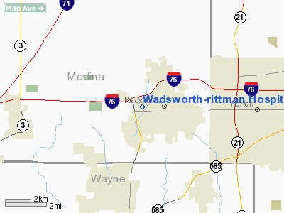
Wadsworth-rittman Hospital Heliport |
Location & QuickFacts
| FAA Information Effective: | 2008-09-25 |
| Airport Identifier: | 47OI |
| Airport Status: | Operational |
| Longitude/Latitude: | 081-45-03.4710W/41-01-40.1950N
-81.750964/41.027832 (Estimated) |
| Elevation: | 1115 ft / 339.85 m (Estimated) |
| Land: | 0 acres |
| From nearest city: | 2 nautical miles W of Wadsworth, OH |
| Location: | Medina County, OH |
| Magnetic Variation: | 06W (1985) |
Owner & Manager
| Ownership: | Publicly owned |
| Owner: | Wadsworth-rittman Hospital |
| Address: | 195 Wadsworth Rd
Wadsworth, OH 44281-9505 |
| Phone number: | 216-334-1504 |
| Manager: | Tom L. Flath |
| Address: | 195 Wadsworth Rd
Wadsworth, OH 44281-9505 |
| Phone number: | 216-334-1504 |
Airport Operations and Facilities
| Airport Use: | Private
MEDICAL USE. |
| Wind indicator: | Yes |
| Segmented Circle: | No |
| Control Tower: | No |
| Sectional chart: | Detroit |
| Region: | AGL - Great Lakes |
| Boundary ARTCC: | ZOB - Cleveland |
| Tie-in FSS: | CLE - Cleveland |
| FSS on Airport: | No |
| FSS Toll Free: | 1-800-WX-BRIEF |
Runway Information
Helipad H1
| Dimension: | 45 x 45 ft / 13.7 x 13.7 m |
| Surface: | ASPH, |
| |
Runway H1 |
Runway |
| Traffic Pattern: | Left | Left |
|
Radio Navigation Aids
| ID |
Type |
Name |
Ch |
Freq |
Var |
Dist |
| AK | NDB | Akron | | 362.00 | 07W | 16.7 nm |
| CL | NDB | Harri | | 344.00 | 07W | 21.0 nm |
| AAU | NDB | Ashland | | 329.00 | 07W | 23.1 nm |
| EZE | NDB | Engel | | 226.00 | 07W | 27.7 nm |
| MLR | NDB | Millersburg/dcmsnd | | 382.00 | 06W | 29.7 nm |
| BKL | NDB | Burke Lakefront | | 416.00 | 07W | 30.4 nm |
| MF | NDB | Manns | | 372.00 | 06W | 35.2 nm |
| TSO | NDB | Tolson | | 395.00 | 07W | 41.5 nm |
| LQL | NDB | Lakeland | | 263.00 | 08W | 42.8 nm |
| BSV | VOR/DME | Briggs | 071X | 112.40 | 04W | 22.5 nm |
| ACO | VOR/DME | Akron | 091X | 114.40 | 04W | 25.4 nm |
| DJB | VOR/DME | Dryer | 083X | 113.60 | 05W | 27.2 nm |
| TVT | VOR/DME | Tiverton | 112X | 116.50 | 03W | 38.3 nm |
| CXR | VOR/DME | Chardon | 074X | 112.70 | 05W | 39.6 nm |
| LNN | VOR/DME | Lost Nation | 039X | 110.20 | 08W | 42.7 nm |
| SKY | VOR/DME | Sandusky | 029X | 109.20 | 04W | 47.6 nm |
| CTW | VOR/DME | Newcomerstown | 055X | 111.80 | 07W | 49.6 nm |
| MFD | VORTAC | Mansfield | 025X | 108.80 | 03W | 39.3 nm |
| CAK | VOT | Akron/canton Regional | | 110.60 | | 15.5 nm |
| CLE | VOT | Cleveland | | 110.40 | | 23.4 nm |
Remarks
- PRVDD OPNS ARE CONDD IN AN AREA 090-300 DEG, AREA MKD, WIND INDCR MAINTD, LGT POLE IS RMVD.
Images and information placed above are from
http://www.airport-data.com/airport/47OI/
We thank them for the data!
| General Info
|
| Country |
United States
|
| State |
OHIO
|
| FAA ID |
47OI
|
| Latitude |
41-01-40.195N
|
| Longitude |
081-45-03.471W
|
| Elevation |
1115 feet
|
| Near City |
WADSWORTH
|
We don't guarantee the information is fresh and accurate. The data may
be wrong or outdated.
For more up-to-date information please refer to other sources.
|
|


