 |
|
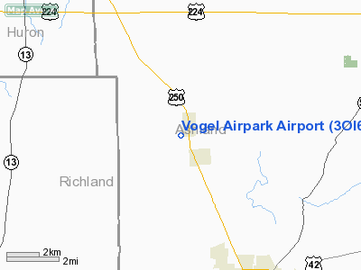
Location & QuickFacts
| FAA Information Effective: | 2008-09-25 |
| Airport Identifier: | 3OI6 |
| Airport Status: | Closed Indefinitely |
| Longitude/Latitude: | 082-22-14.5930W/40-57-40.1990N
-82.370720/40.961166 (Estimated) |
| Elevation: | 1028 ft / 313.33 m (Estimated) |
| Land: | 5 acres |
| From nearest city: | 0 nautical miles SW of Savannah, OH |
| Location: | Ashland County, OH |
| Magnetic Variation: | 06W (1985) |
Owner & Manager
| Ownership: | Privately owned |
| Owner: | Joseph L Vogel |
| Address: | 3030 Sudbury Rd
Columbus, OH 43221 |
| Phone number: | 614-486-2732 |
| Address: |
|
| Phone number: | 614-486-2732 |
Airport Operations and Facilities
| Airport Use: | Private |
| Wind indicator: | No |
| Segmented Circle: | No |
| Control Tower: | No |
| Landing fee charge: | No |
| Sectional chart: | Detroit |
| Region: | AGL - Great Lakes |
| Boundary ARTCC: | ZOB - Cleveland |
| Tie-in FSS: | CLE - Cleveland |
| FSS on Airport: | No |
| FSS Toll Free: | 1-800-WX-BRIEF |
Runway Information
Runway 13/31
| Dimension: | 2000 x 75 ft / 609.6 x 22.9 m |
| Surface: | TURF, |
| |
Runway 13 |
Runway 31 |
| Traffic Pattern: | Left | Left |
| Obstruction: | 20 ft trees, 200.0 ft from runway | 4 ft fence |
|
Radio Navigation Aids
| ID |
Type |
Name |
Ch |
Freq |
Var |
Dist |
| AAU | NDB | Ashland | | 329.00 | 07W | 5.3 nm |
| MF | NDB | Manns | | 372.00 | 06W | 12.2 nm |
| CL | NDB | Harri | | 344.00 | 07W | 29.2 nm |
| MLR | NDB | Millersburg/dcmsnd | | 382.00 | 06W | 33.9 nm |
| MNN | NDB | Marion | | 201.00 | 05W | 38.0 nm |
| TII | NDB | Tiffin | | 269.00 | 05W | 38.8 nm |
| PCW | NDB | Port Clinton | | 423.00 | 06W | 40.4 nm |
| EZE | NDB | Engel | | 226.00 | 07W | 43.2 nm |
| AK | NDB | Akron | | 362.00 | 07W | 45.1 nm |
| BKL | NDB | Burke Lakefront | | 416.00 | 07W | 46.8 nm |
| FZI | NDB | Fostoria | | 379.00 | 05W | 48.4 nm |
| BUD | VOR | Buckeye | | 109.80 | 05W | 37.7 nm |
| DJB | VOR/DME | Dryer | 083X | 113.60 | 05W | 25.7 nm |
| SKY | VOR/DME | Sandusky | 029X | 109.20 | 04W | 31.2 nm |
| TVT | VOR/DME | Tiverton | 112X | 116.50 | 03W | 32.2 nm |
| BSV | VOR/DME | Briggs | 071X | 112.40 | 04W | 44.7 nm |
| MFD | VORTAC | Mansfield | 025X | 108.80 | 03W | 11.4 nm |
| APE | VORTAC | Appleton | 114X | 116.70 | 06W | 49.7 nm |
| CLE | VOT | Cleveland | | 110.40 | | 35.9 nm |
| CAK | VOT | Akron/canton Regional | | 110.60 | | 42.3 nm |
Remarks
- (ARPT STATUS) ARPT CLSD INDEFLY.
Images and information placed above are from
http://www.airport-data.com/airport/3OI6/
We thank them for the data!
| General Info
|
| Country |
United States
|
| State |
OHIO
|
| FAA ID |
3OI6
|
| Latitude |
40-57-40.199N
|
| Longitude |
082-22-14.593W
|
| Elevation |
1028 feet
|
| Near City |
SAVANNAH
|
We don't guarantee the information is fresh and accurate. The data may
be wrong or outdated.
For more up-to-date information please refer to other sources.
|
|


