 |
|
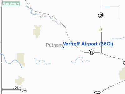
Location & QuickFacts
| FAA Information Effective: | 2008-09-25 |
| Airport Identifier: | 36OI |
| Airport Status: | Operational |
| Longitude/Latitude: | 084-12-45.8040W/41-04-23.1800N
-84.212723/41.073106 (Estimated) |
| Elevation: | 728 ft / 221.89 m (Estimated) |
| Land: | 0 acres |
| From nearest city: | 2 nautical miles NW of Continental, OH |
| Location: | Putnam County, OH |
| Magnetic Variation: | 04W (1985) |
Owner & Manager
| Ownership: | Privately owned |
| Owner: | Leonard Verhoff |
| Address: | Rr 2
Continental, OH 45831 |
| Phone number: | 419-596-3202 |
| Manager: | Leonard Verhoff |
| Address: | Rr 2
Continental, OH 45831 |
| Phone number: | 419-596-3202 |
Airport Operations and Facilities
| Airport Use: | Private |
| Wind indicator: | Yes |
| Segmented Circle: | No |
| Control Tower: | No |
| Sectional chart: | Detroit |
| Region: | AGL - Great Lakes |
| Boundary ARTCC: | ZOB - Cleveland |
| Tie-in FSS: | CLE - Cleveland |
| FSS on Airport: | No |
| FSS Toll Free: | 1-800-WX-BRIEF |
Runway Information
Runway E/W
| Dimension: | 2600 x 60 ft / 792.5 x 18.3 m |
| Surface: | TURF, |
| |
Runway E |
Runway W |
| Traffic Pattern: | Left | Left |
| Displaced threshold: | 0.00 ft | 600.00 ft |
| Obstruction: | | 40 ft pline, 30.0 ft from runway |
|
Radio Navigation Aids
| ID |
Type |
Name |
Ch |
Freq |
Var |
Dist |
| PDR | NDB | Ottawa | | 233.00 | 05W | 11.1 nm |
| DFI | NDB | Defiance | | 246.00 | 05W | 18.5 nm |
| VFU | NDB | Stanley | | 411.00 | 05W | 22.2 nm |
| LYL | NDB | Lima | | 362.00 | 04W | 23.8 nm |
| BNR | NDB | Benton Ridge | | 334.00 | 05W | 24.8 nm |
| BYN | NDB | Bryan | | 260.00 | 04W | 27.0 nm |
| USE | NDB | Fulton | | 375.00 | 05W | 32.4 nm |
| FZI | NDB | Fostoria | | 379.00 | 05W | 37.6 nm |
| CQA | NDB | Lakefield | | 205.00 | 04W | 39.0 nm |
| RUV | NDB | Rushsylvania | | 326.00 | 05W | 44.5 nm |
| TII | NDB | Tiffin | | 269.00 | 05W | 45.6 nm |
| EDJ | NDB | Bellefontaine | | 242.00 | 05W | 46.0 nm |
| ADG | NDB | Adrian | | 278.00 | 06W | 48.3 nm |
| TOL | TACAN | Toledo | 072X | | 05W | 36.4 nm |
| AOH | VOR | Allen County | | 108.40 | 04W | 24.6 nm |
| MAH | VOR | Marathon | | 114.90 | 05W | 25.1 nm |
| VWV | VOR/DME | Waterville | 078X | 113.10 | 02W | 34.5 nm |
| FDY | VORTAC | Findlay | 019X | 108.20 | 02W | 21.9 nm |
| FWA | VORTAC | Fort Wayne | 125X | 117.80 | 00E | 44.6 nm |
| ROD | VORTAC | Rosewood | 122X | 117.50 | 05W | 47.8 nm |
| FWA | VOT | Fort Wayne Baer | | 111.00 | | 44.7 nm |
Images and information placed above are from
http://www.airport-data.com/airport/36OI/
We thank them for the data!
| General Info
|
| Country |
United States
|
| State |
OHIO
|
| FAA ID |
36OI
|
| Latitude |
41-04-23.180N
|
| Longitude |
084-12-45.804W
|
| Elevation |
728 feet
|
| Near City |
CONTINENTAL
|
We don't guarantee the information is fresh and accurate. The data may
be wrong or outdated.
For more up-to-date information please refer to other sources.
|
|


