 |
|
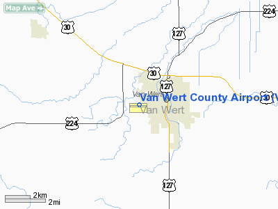
Location & QuickFacts
| FAA Information Effective: | 2008-09-25 |
| Airport Identifier: | VNW |
| Airport Status: | Operational |
| Longitude/Latitude: | 084-36-34.0000W/40-51-53.0000N
-84.609444/40.864722 (Estimated) |
| Elevation: | 785 ft / 239.27 m (Surveyed) |
| Land: | 140 acres |
| From nearest city: | 2 nautical miles SW of Van Wert, OH |
| Location: | Van Wert County, OH |
| Magnetic Variation: | 05W (2000) |
Owner & Manager
| Ownership: | Publicly owned |
| Owner: | Van Wert Co. Regional Airport Auth. |
| Address: | 1400 Leeson Ave
Van Wert, OH 45891 |
| Phone number: | 419-232-4500 |
| Manager: | Thomas Dunno |
| Address: | 1400 Leeson Ave
Van Wert, OH 45891 |
| Phone number: | 419-232-4500 |
Airport Operations and Facilities
| Airport Use: | Open to public |
| Wind indicator: | Yes |
| Segmented Circle: | No |
| Control Tower: | No |
| Lighting Schedule: | DUSK-DAWN
ACTVT MIRL RY 09/27, REIL RYS 09 & 27 AND PAPI RYS 09 & 27 - CTAF. |
| Beacon Color: | Clear-Green (lighted land airport) |
| Landing fee charge: | No |
| Sectional chart: | Detroit |
| Region: | AGL - Great Lakes |
| Traffic Pattern Alt: | 812 ft |
| Boundary ARTCC: | ZID - Indianapolis |
| Responsible ARTCC: | ZAU - Chicago |
| Tie-in FSS: | DAY - Dayton |
| FSS on Airport: | No |
| FSS Toll Free: | 1-800-WX-BRIEF |
| NOTAMs Facility: | DAY (NOTAM-d service avaliable) |
| Federal Agreements: | NGY |
Airport Communications
| CTAF: | 123.000 |
| Unicom: | 123.000 |
Airport Services
| Fuel available: | 100LLA |
| Airframe Repair: | MAJOR |
| Power Plant Repair: | NONE |
Runway Information
Runway 09/27
| Dimension: | 4000 x 75 ft / 1219.2 x 22.9 m |
| Surface: | ASPH, Good Condition |
| Weight Limit: | Single wheel: 8000 lbs. |
| Edge Lights: | Medium |
| |
Runway 09 |
Runway 27 |
| Longitude: | 084-37-00.0590W | 084-36-07.9980W |
| Latitude: | 40-51-52.8220N | 40-51-53.1320N |
| Elevation: | 783.00 ft | 785.00 ft |
| Alignment: | 90 | 127 |
| Traffic Pattern: | Left | Left |
| Markings: | Non-precision instrument, Fair Condition | Non-precision instrument, Fair Condition |
| VASI: | 4-light PAPI on left side | 4-light PAPI on left side |
| Runway End Identifier: | Yes
OTS INDEFLY. | Yes |
| Centerline Lights: | No | No |
| Obstruction: | 47 ft pline, 1420.0 ft from runway, 435 ft left of centerline, 25:1 slope to clear | 72 ft trees, 1300.0 ft from runway, 140 ft right of centerline, 15:1 slope to clear |
|
Runway 18/36
| Dimension: | 2610 x 105 ft / 795.5 x 32.0 m |
| Surface: | TURF, Good Condition |
| |
Runway 18 |
Runway 36 |
| Longitude: | 084-36-05.8400W | 084-36-06.3420W |
| Latitude: | 40-51-58.7870N | 40-51-32.9980N |
| Alignment: | 127 | 1 |
| Traffic Pattern: | Left | Left |
| Displaced threshold: | 315.00 ft | 510.00 ft |
| Obstruction: | 46 ft tree, 25.0 ft from runway, 132 ft right of centerline
RY 18 RY 18 APCH RATIO 9:1 TO DSPLD THLD DUE TO +46 FT TREE 438 FT FROM DSPLD THLD 132 FT R. | 28 ft pline, 0.0 ft from runway
RY 36 RY 36 APCH RATIO 10:1 TO DSPLCD THLD DUE TO +58 FT TREE 594 FT FROM DSPLCD THLD 40 FT R. |
|
Radio Navigation Aids
| ID |
Type |
Name |
Ch |
Freq |
Var |
Dist |
| VFU | NDB | Stanley | | 411.00 | 05W | 0.2 nm |
| CQA | NDB | Lakefield | | 205.00 | 04W | 23.1 nm |
| LYL | NDB | Lima | | 362.00 | 04W | 28.4 nm |
| DFI | NDB | Defiance | | 246.00 | 05W | 29.4 nm |
| PLD | NDB | Portland | | 257.00 | 03W | 30.0 nm |
| PDR | NDB | Ottawa | | 233.00 | 05W | 30.5 nm |
| BYN | NDB | Bryan | | 260.00 | 04W | 37.5 nm |
| HHG | NDB | Huntington | | 417.00 | 03W | 38.9 nm |
| VES | NDB | Versailles | | 356.00 | 04W | 39.8 nm |
| BNR | NDB | Benton Ridge | | 334.00 | 05W | 43.7 nm |
| EDJ | NDB | Bellefontaine | | 242.00 | 05W | 46.9 nm |
| RUV | NDB | Rushsylvania | | 326.00 | 05W | 49.4 nm |
| USE | NDB | Fulton | | 375.00 | 05W | 49.7 nm |
| AOH | VOR | Allen County | | 108.40 | 04W | 30.7 nm |
| MAH | VOR | Marathon | | 114.90 | 05W | 43.9 nm |
| OLK | VOR | Wolf Lake | | 110.40 | 03W | 46.3 nm |
| FWA | VORTAC | Fort Wayne | 125X | 117.80 | 00E | 27.2 nm |
| FDY | VORTAC | Findlay | 019X | 108.20 | 02W | 39.1 nm |
| ROD | VORTAC | Rosewood | 122X | 117.50 | 05W | 43.3 nm |
| FWA | VOT | Fort Wayne Baer | | 111.00 | | 27.3 nm |
Remarks
- RY 36 ADDITIONAL OBSTN +35 FT PLINE MKD WITH BALLS 58 FT FM 0 FT B & +50 FT TREES 95 FT FR 55 FT R.
Images and information placed above are from
http://www.airport-data.com/airport/VNW/
We thank them for the data!
| General Info
|
| Country |
United States
|
| State |
OHIO
|
| FAA ID |
VNW
|
| Latitude |
40-51-53.000N
|
| Longitude |
084-36-34.000W
|
| Elevation |
785 feet
|
| Near City |
VAN WERT
|
We don't guarantee the information is fresh and accurate. The data may
be wrong or outdated.
For more up-to-date information please refer to other sources.
|
|


