 |
|
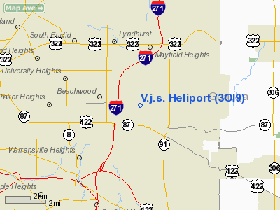
Location & QuickFacts
| FAA Information Effective: | 2008-09-25 |
| Airport Identifier: | 3OI9 |
| Airport Status: | Operational |
| Longitude/Latitude: | 081-27-57.4260W/41-28-35.1910N
-81.465952/41.476442 (Estimated) |
| Elevation: | 1050 ft / 320.04 m (Estimated) |
| Land: | 10 acres |
| From nearest city: | 0 nautical miles N of Pepper Pike, OH |
| Location: | Cuyahoga County, OH |
| Magnetic Variation: | 07W (1985) |
Owner & Manager
| Ownership: | Privately owned |
| Owner: | Victor J. Scaravilli |
| Address: | 3007 Kersdale Rd
Pepper Pike, OH 44124 |
| Phone number: | 216-248-0376 |
| Manager: | Victor J. Scaravilli |
| Address: | 3007 Kersdale Rd
Pepper Pike, OH 44124 |
| Phone number: | 216-248-0376 |
Airport Operations and Facilities
| Airport Use: | Private
PERSONAL USE. |
| Wind indicator: | No |
| Segmented Circle: | No |
| Control Tower: | No |
| Landing fee charge: | No |
| Sectional chart: | Detroit |
| Region: | AGL - Great Lakes |
| Boundary ARTCC: | ZOB - Cleveland |
| Tie-in FSS: | CLE - Cleveland |
| FSS on Airport: | No |
| FSS Toll Free: | 1-800-WX-BRIEF |
Runway Information
Helipad H1
| Dimension: | 80 x 80 ft / 24.4 x 24.4 m |
| Surface: | TURF, |
| |
Runway H1 |
Runway |
| Traffic Pattern: | Left | Left |
|
Radio Navigation Aids
| ID |
Type |
Name |
Ch |
Freq |
Var |
Dist |
| BKL | NDB | Burke Lakefront | | 416.00 | 07W | 9.4 nm |
| EZE | NDB | Engel | | 226.00 | 07W | 11.6 nm |
| LQL | NDB | Lakeland | | 263.00 | 08W | 13.0 nm |
| CL | NDB | Harri | | 344.00 | 07W | 24.0 nm |
| AK | NDB | Akron | | 362.00 | 07W | 24.7 nm |
| HBD | NDB | Hubbard | | 408.00 | 08W | 46.5 nm |
| AAU | NDB | Ashland | | 329.00 | 07W | 47.1 nm |
| LNN | VOR/DME | Lost Nation | 039X | 110.20 | 08W | 13.0 nm |
| CXR | VOR/DME | Chardon | 074X | 112.70 | 05W | 13.8 nm |
| ACO | VOR/DME | Akron | 091X | 114.40 | 04W | 25.2 nm |
| DJB | VOR/DME | Dryer | 083X | 113.60 | 05W | 32.2 nm |
| JFN | VOR/DME | Jefferson | 099X | 115.20 | 05W | 36.5 nm |
| BSV | VOR/DME | Briggs | 071X | 112.40 | 04W | 44.3 nm |
| YNG | VORTAC | Youngstown | 027X | 109.00 | 05W | 36.7 nm |
| CLE | VOT | Cleveland | | 110.40 | | 17.7 nm |
| CAK | VOT | Akron/canton Regional | | 110.60 | | 33.7 nm |
Remarks
- A SAFE OPERATION CANNOT BE CONDUCTED WITHOUT CREATING A HAZARD TO PERSONS AND PROPERTY IN THE AREA DUE TO A LACK OF EMERGENCY LANDING AREAS ADJACENT TO THE HELIPAD.
Images and information placed above are from
http://www.airport-data.com/airport/3OI9/
We thank them for the data!
| General Info
|
| Country |
United States
|
| State |
OHIO
|
| FAA ID |
3OI9
|
| Latitude |
41-28-35.191N
|
| Longitude |
081-27-57.426W
|
| Elevation |
1050 feet
|
| Near City |
PEPPER PIKE
|
We don't guarantee the information is fresh and accurate. The data may
be wrong or outdated.
For more up-to-date information please refer to other sources.
|
|


