 |
|
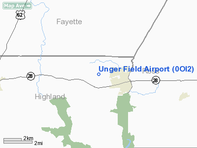
Location & QuickFacts
| FAA Information Effective: | 2008-09-25 |
| Airport Identifier: | 0OI2 |
| Airport Status: | Operational |
| Longitude/Latitude: | 083-25-03.6970W/39-21-35.2290N
-83.417694/39.359786 (Estimated) |
| Elevation: | 940 ft / 286.51 m (Estimated) |
| Land: | 0 acres |
| From nearest city: | 1 nautical miles NW of Greenfield, OH |
| Location: | Highland County, OH |
| Magnetic Variation: | 04W (1985) |
Owner & Manager
| Ownership: | Privately owned |
| Owner: | Richard C. Unger, Sr. |
| Address: | 13045 Rt 28 W.
Greenfield, OH 45123 |
| Phone number: | 513-981-3953 |
| Manager: | Richard C. Unger, Sr. |
| Address: | 13045 Rt 28 W.
Greenfield, OH 45123 |
| Phone number: | 513-981-3953 |
Airport Operations and Facilities
| Airport Use: | Private |
| Wind indicator: | Yes |
| Segmented Circle: | No |
| Control Tower: | No |
| Landing fee charge: | No |
| Sectional chart: | Cincinnati |
| Region: | AGL - Great Lakes |
| Boundary ARTCC: | ZID - Indianapolis |
| Tie-in FSS: | DAY - Dayton |
| FSS on Airport: | No |
| FSS Toll Free: | 1-800-WX-BRIEF |
Runway Information
Runway 14/32
| Dimension: | 2200 x 80 ft / 670.6 x 24.4 m |
| Surface: | TURF, |
| |
Runway 14 |
Runway 32 |
| Traffic Pattern: | Left | Left |
| Obstruction: | 30 ft trees | 30 ft trees, 0.0 ft from runway |
|
Radio Navigation Aids
| ID |
Type |
Name |
Ch |
Freq |
Var |
Dist |
| HOC | NDB | Hillsboro | | 278.00 | 05W | 12.0 nm |
| CSS | NDB | Court House | | 414.00 | 05W | 14.5 nm |
| IL | NDB | Airbo | | 407.00 | 04W | 16.8 nm |
| RZT | NDB | Ross County | | 236.00 | 05W | 18.7 nm |
| HW | NDB | Cubla | | 299.00 | 04W | 21.3 nm |
| CYO | NDB | Circleville | | 366.00 | 05W | 22.6 nm |
| EOP | NDB | Waverly | | 385.00 | 06W | 25.4 nm |
| PZO | NDB | Peebles | | 329.00 | 02W | 26.7 nm |
| BU | NDB | Boutn | | 230.00 | 05W | 29.3 nm |
| AMT | NDB | West Union | | 359.00 | 04W | 31.0 nm |
| XEN | NDB | Xenia | | 395.00 | 03W | 31.9 nm |
| UYF | NDB | London | | 263.00 | 06W | 34.6 nm |
| CCJ | NDB | Clark County | | 341.00 | 04W | 35.1 nm |
| PWF | NDB | Sportys | | 245.00 | 04W | 40.9 nm |
| CHC | NDB | Grens | | 272.00 | 04W | 43.0 nm |
| PMH | NDB | Portsmouth | | 373.00 | 04W | 43.8 nm |
| OS | NDB | Fuler | | 515.00 | 05W | 44.1 nm |
| MDE | NDB | Madeira | | 379.00 | 04W | 44.4 nm |
| LUK | NDB | Cincinnati | | 335.00 | 04W | 44.6 nm |
| ISZ | NDB | Cincinnati-blue Ash | | 388.00 | 04W | 45.7 nm |
| DKG | NDB | Don Scott | | 348.00 | 05W | 46.1 nm |
| XW | NDB | Flmng | | 400.00 | 05W | 48.5 nm |
| HKF | NDB | Hook Field | | 239.00 | 04W | 48.5 nm |
| CM | NDB | Sumie | | 391.00 | 05W | 48.6 nm |
| XSF | TACAN | Springfield | 065X | | 04W | 34.8 nm |
| LCK | TACAN | Rickenbacker | 069X | | 05W | 35.2 nm |
| FFO | TACAN | Patterson | 099X | | 04W | 40.4 nm |
| XUB | VOR | Yellow Bud | | 112.50 | 05W | 22.7 nm |
| MXQ | VOR/DME | Midwest | 076X | 112.90 | 04W | 18.3 nm |
| SGH | VOR/DME | Springfield | 079X | 113.20 | 04W | 34.8 nm |
| YRK | VORTAC | York | 075X | 112.80 | 05W | 47.7 nm |
| CMH | VOT | Port Columbus | | 111.00 | | 45.4 nm |
| LUK | VOT | Cincinnati Muni/lunken | | 108.40 | | 48.0 nm |
| DAY | VOT | Dayton J M Cox-day | | 111.00 | | 49.4 nm |
Images and information placed above are from
http://www.airport-data.com/airport/0OI2/
We thank them for the data!
| General Info
|
| Country |
United States
|
| State |
OHIO
|
| FAA ID |
0OI2
|
| Latitude |
39-21-35.229N
|
| Longitude |
083-25-03.697W
|
| Elevation |
940 feet
|
| Near City |
GREENFIELD
|
We don't guarantee the information is fresh and accurate. The data may
be wrong or outdated.
For more up-to-date information please refer to other sources.
|
|


