 |
|
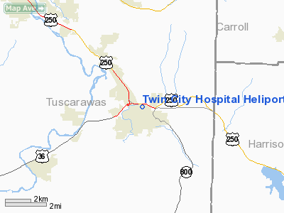
Twin City Hospital Heliport |
Location & QuickFacts
| FAA Information Effective: | 2008-09-25 |
| Airport Identifier: | 15OH |
| Airport Status: | Operational |
| Longitude/Latitude: | 081-20-13.4000W/40-24-08.2400N
-81.337056/40.402289 (Estimated) |
| Elevation: | 940 ft / 286.51 m (Estimated) |
| Land: | 0 acres |
| From nearest city: | 0 nautical miles N of Dennison, OH |
| Location: | Tuscarawas County, OH |
| Magnetic Variation: | 07W (1990) |
Owner & Manager
| Ownership: | Privately owned |
| Owner: | Twin City Hospital |
| Address: | 819 North First St
Dennison, OH 44621 |
| Phone number: | 614-922-2800 |
| Manager: | Robert A Victor |
| Address: | 819 North First St
Dennison, OH 44621 |
| Phone number: | 614-922-2800
ADDL PHONE: 614-254-9214. |
Airport Operations and Facilities
| Airport Use: | Private
MEDICAL USE. |
| Wind indicator: | Yes |
| Segmented Circle: | No |
| Control Tower: | No |
| Lighting Schedule: | PHONE REQ
FOR ROTG BCN CALL 614-922-2800. |
| Beacon Color: | Clear-Green-Yellow (heliport) |
| Sectional chart: | Detroit |
| Region: | AGL - Great Lakes |
| Boundary ARTCC: | ZOB - Cleveland |
| Tie-in FSS: | CLE - Cleveland |
| FSS on Airport: | No |
| FSS Toll Free: | 1-800-WX-BRIEF |
Runway Information
Helipad H1
| Dimension: | 50 x 50 ft / 15.2 x 15.2 m |
| Surface: | CONC, |
| |
Runway H1 |
Runway |
| Traffic Pattern: | Left | Left |
|
Radio Navigation Aids
| ID |
Type |
Name |
Ch |
Freq |
Var |
Dist |
| TSO | NDB | Tolson | | 395.00 | 07W | 15.3 nm |
| CFX | NDB | Cadiz | | 239.00 | 07W | 17.9 nm |
| MLR | NDB | Millersburg/dcmsnd | | 382.00 | 06W | 25.9 nm |
| HRA | NDB | Zanesville | | 204.00 | 06W | 40.1 nm |
| AK | NDB | Akron | | 362.00 | 07W | 40.2 nm |
| CTW | VOR/DME | Newcomerstown | 055X | 111.80 | 07W | 12.2 nm |
| BSV | VOR/DME | Briggs | 071X | 112.40 | 04W | 20.8 nm |
| AIR | VOR/DME | Bellaire | 118X | 117.10 | 07W | 33.3 nm |
| HLG | VOR/DME | Wheeling | 059X | 112.20 | 07W | 36.2 nm |
| TVT | VOR/DME | Tiverton | 112X | 116.50 | 03W | 36.3 nm |
| ZZV | VOR/DME | Zanesville | 051X | 111.40 | 06W | 37.7 nm |
| ACO | VOR/DME | Akron | 091X | 114.40 | 04W | 42.9 nm |
| CAK | VOT | Akron/canton Regional | | 110.60 | | 31.3 nm |
Remarks
- PRVDD APCH/DEP OPNS 210-330 DEGS. OPNS 360-180 DEGS CAN BE CONDUCTED PRVDD THE TREES FROM THE S PERIMETER OF LNDG/TKOF AREA ARE REMOVED. THE TKOF/LNDG AREA IS APROPRIATELY MARKED. A NON-OBSTRUCTING WIND INDICATOR IS MAINTAINED.
Images and information placed above are from
http://www.airport-data.com/airport/15OH/
We thank them for the data!
| General Info
|
| Country |
United States
|
| State |
OHIO
|
| FAA ID |
15OH
|
| Latitude |
40-24-08.240N
|
| Longitude |
081-20-13.400W
|
| Elevation |
940 feet
|
| Near City |
DENNISON
|
We don't guarantee the information is fresh and accurate. The data may
be wrong or outdated.
For more up-to-date information please refer to other sources.
|
|


