 |
|
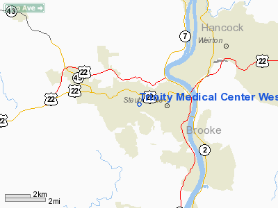
Trinity Medical Center West Heliport |
Location & QuickFacts
| FAA Information Effective: | 2008-09-25 |
| Airport Identifier: | 8OI4 |
| Airport Status: | Operational |
| Longitude/Latitude: | 080-39-30.2730W/40-22-01.2450N
-80.658409/40.367013 (Estimated) |
| Elevation: | 1220 ft / 371.86 m (Estimated) |
| Land: | 0 acres |
| From nearest city: | 5 nautical miles W of Steubenville, OH |
| Location: | Jefferson County, OH |
| Magnetic Variation: | 07W (1985) |
Owner & Manager
| Ownership: | Privately owned |
| Owner: | Trinity Medical Center West |
| Address: | 400 Johnson Road
Steubenville, OH 43952 |
| Phone number: | 740-264-8011 |
| Manager: | Director Of Maintenance |
| Address: | Trinity Medical Center West, 400 Johnson Rd
Steubenville, OH 43952 |
| Phone number: | 740-264-8011 |
Airport Operations and Facilities
| Airport Use: | Private
MEDICAL USE. |
| Wind indicator: | Yes |
| Segmented Circle: | No |
| Control Tower: | No |
| Lighting Schedule: | PHONE REQ
FOR PERIMETER LGTS CALL 614-264-8179. |
| Landing fee charge: | No |
| Sectional chart: | Detroit |
| Region: | AGL - Great Lakes |
| Boundary ARTCC: | ZOB - Cleveland |
| Tie-in FSS: | CLE - Cleveland |
| FSS on Airport: | No |
| FSS Toll Free: | 1-800-WX-BRIEF |
Runway Information
Helipad H1
| Dimension: | 72 x 72 ft / 21.9 x 21.9 m |
| Surface: | ASPH, |
| |
Runway H1 |
Runway |
| Traffic Pattern: | Left | Left |
|
Radio Navigation Aids
| ID |
Type |
Name |
Ch |
Freq |
Var |
Dist |
| CFX | NDB | Cadiz | | 239.00 | 07W | 18.0 nm |
| TSO | NDB | Tolson | | 395.00 | 07W | 22.5 nm |
| PNU | NDB | Washington County | | 255.00 | 08W | 26.4 nm |
| MKP | NDB | Mc Keesport | | 287.00 | 07W | 40.2 nm |
| UCP | NDB | Castle | | 272.00 | 09W | 41.0 nm |
| HBD | NDB | Hubbard | | 408.00 | 08W | 47.6 nm |
| HLG | VOR/DME | Wheeling | 059X | 112.20 | 07W | 7.6 nm |
| AIR | VOR/DME | Bellaire | 118X | 117.10 | 07W | 22.3 nm |
| AGC | VOR/DME | Allegheny | 037X | 110.00 | 09W | 28.8 nm |
| CTW | VOR/DME | Newcomerstown | 055X | 111.80 | 07W | 38.4 nm |
| BSV | VOR/DME | Briggs | 071X | 112.40 | 04W | 41.9 nm |
| MMJ | VORTAC | Montour | 057X | 112.00 | 08W | 22.5 nm |
| EWC | VORTAC | Ellwood City | 105X | 115.80 | 08W | 34.3 nm |
| CAK | VOT | Akron/canton Regional | | 110.60 | | 48.7 nm |
Remarks
- ALL APP/DEP OPS FROM 070 CLOCKWISE TO 250 USING PAD AS CENTER OF COMPASS ROSE; TAKEOFF/LANDING AREA IS APPROPRIATELY MARKED; WIND INDICATOR IS MAINTAINED.
Images and information placed above are from
http://www.airport-data.com/airport/8OI4/
We thank them for the data!
| General Info
|
| Country |
United States
|
| State |
OHIO
|
| FAA ID |
8OI4
|
| Latitude |
40-22-01.245N
|
| Longitude |
080-39-30.273W
|
| Elevation |
1220 feet
|
| Near City |
STEUBENVILLE
|
We don't guarantee the information is fresh and accurate. The data may
be wrong or outdated.
For more up-to-date information please refer to other sources.
|
|


