 |
|
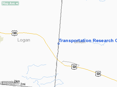
Transportation Research Center Of Ohio Airport |
Location & QuickFacts
| FAA Information Effective: | 2008-09-25 |
| Airport Identifier: | 9OI5 |
| Airport Status: | Operational |
| Longitude/Latitude: | 083-32-30.2370W/40-18-29.2050N
-83.541733/40.308112 (Estimated) |
| Elevation: | 1100 ft / 335.28 m (Estimated) |
| Land: | 1600 acres |
| From nearest city: | 2 nautical miles NW of East Liberty, OH |
| Location: | Logan County, OH |
| Magnetic Variation: | 05W (1985) |
Owner & Manager
| Ownership: | Privately owned |
| Owner: | Honda Of America Mfg Inc |
| Address: | Box 67 Trans Research Center
East Liberty, OH 43319 |
| Phone number: | 513-666-2011 |
| Manager: | Stanley C. Frye |
| Address: | Po Box 67
East Liberty, OH 43319 |
| Phone number: | 513-666-2011 |
Airport Operations and Facilities
| Airport Use: | Private |
| Wind indicator: | Yes |
| Segmented Circle: | No |
| Control Tower: | No |
| Sectional chart: | Detroit |
| Region: | AGL - Great Lakes |
| Boundary ARTCC: | ZID - Indianapolis |
| Tie-in FSS: | DAY - Dayton |
| FSS on Airport: | No |
| FSS Toll Free: | 1-800-WX-BRIEF |
Airport Communications
Runway Information
Runway 16/34
| Dimension: | 3500 x 72 ft / 1066.8 x 21.9 m
ASPH BUMPS ON W SIDE OF RWY ENTIRE LENGTH -- STILL LEAVES 72' OF SMOOTH CONC RWY LNDG LGTH. |
| Surface: | CONC, |
| |
Runway 16 |
Runway 34 |
| Traffic Pattern: | Left | Left |
|
Radio Navigation Aids
| ID |
Type |
Name |
Ch |
Freq |
Var |
Dist |
| MRT | NDB | Marysville | | 403.00 | 05W | 10.1 nm |
| RUV | NDB | Rushsylvania | | 326.00 | 05W | 10.8 nm |
| EDJ | NDB | Bellefontaine | | 242.00 | 05W | 13.0 nm |
| DLZ | NDB | Delaware | | 215.00 | 06W | 20.2 nm |
| OS | NDB | Fuler | | 515.00 | 05W | 21.2 nm |
| UYF | NDB | London | | 263.00 | 06W | 22.7 nm |
| DKG | NDB | Don Scott | | 348.00 | 05W | 25.3 nm |
| CCJ | NDB | Clark County | | 341.00 | 04W | 28.3 nm |
| MNN | NDB | Marion | | 201.00 | 05W | 28.5 nm |
| CHC | NDB | Grens | | 272.00 | 04W | 29.6 nm |
| LYL | NDB | Lima | | 362.00 | 04W | 32.4 nm |
| BU | NDB | Boutn | | 230.00 | 05W | 33.2 nm |
| XEN | NDB | Xenia | | 395.00 | 03W | 39.9 nm |
| CM | NDB | Sumie | | 391.00 | 05W | 41.0 nm |
| CSS | NDB | Court House | | 414.00 | 05W | 43.1 nm |
| BNR | NDB | Benton Ridge | | 334.00 | 05W | 43.2 nm |
| VES | NDB | Versailles | | 356.00 | 04W | 45.4 nm |
| PDR | NDB | Ottawa | | 233.00 | 05W | 47.7 nm |
| CQA | NDB | Lakefield | | 205.00 | 04W | 48.0 nm |
| TII | NDB | Tiffin | | 269.00 | 05W | 49.9 nm |
| IL | NDB | Airbo | | 407.00 | 04W | 49.9 nm |
| XSF | TACAN | Springfield | 065X | | 04W | 31.4 nm |
| FFO | TACAN | Patterson | 099X | | 04W | 37.7 nm |
| LCK | TACAN | Rickenbacker | 069X | | 05W | 41.2 nm |
| BUD | VOR | Buckeye | | 109.80 | 05W | 28.7 nm |
| AOH | VOR | Allen County | | 108.40 | 04W | 30.9 nm |
| MAH | VOR | Marathon | | 114.90 | 05W | 42.8 nm |
| SGH | VOR/DME | Springfield | 079X | 113.20 | 04W | 31.6 nm |
| DQN | VOR/DME | Dayton | 092X | 114.50 | 01W | 43.0 nm |
| ROD | VORTAC | Rosewood | 122X | 117.50 | 05W | 23.0 nm |
| FDY | VORTAC | Findlay | 019X | 108.20 | 02W | 40.1 nm |
| APE | VORTAC | Appleton | 114X | 116.70 | 06W | 44.8 nm |
| CMH | VOT | Port Columbus | | 111.00 | | 35.6 nm |
| DAY | VOT | Dayton J M Cox-day | | 111.00 | | 39.6 nm |
Remarks
- CTL TWR APRXLY 100'HIGH LCTD 342'W SIDE OF RWY AT MIDPOINT.
- VFR USE ONLY, USERS ARE ADVCD OF HGT & LCTN OF CTL TWR.
Images and information placed above are from
http://www.airport-data.com/airport/9OI5/
We thank them for the data!
| General Info
|
| Country |
United States
|
| State |
OHIO
|
| FAA ID |
9OI5
|
| Latitude |
40-18-29.205N
|
| Longitude |
083-32-30.237W
|
| Elevation |
1100 feet
|
| Near City |
EAST LIBERTY
|
We don't guarantee the information is fresh and accurate. The data may
be wrong or outdated.
For more up-to-date information please refer to other sources.
|
|


