 |
|
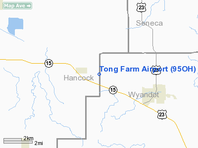
Location & QuickFacts
| FAA Information Effective: | 2008-09-25 |
| Airport Identifier: | 95OH |
| Airport Status: | Operational |
| Longitude/Latitude: | 083-27-29.7320W/40-58-15.1960N
-83.458259/40.970888 (Estimated) |
| Elevation: | 840 ft / 256.03 m (Estimated) |
| Land: | 0 acres |
| From nearest city: | 3 nautical miles NW of Carey, OH |
| Location: | Wyandot County, OH |
| Magnetic Variation: | 05W (1985) |
Owner & Manager
| Ownership: | Privately owned |
| Owner: | Gregory L. Tong |
| Address: | 03841 T.h.87
Carey, OH 43316 |
| Phone number: | 419-387-7012 |
| Address: |
|
Airport Operations and Facilities
| Airport Use: | Private
PERSONAL USE. |
| Wind indicator: | Yes |
| Segmented Circle: | No |
| Control Tower: | No |
| Landing fee charge: | No |
| Sectional chart: | Detroit |
| Region: | AGL - Great Lakes |
| Boundary ARTCC: | ZOB - Cleveland |
| Tie-in FSS: | CLE - Cleveland |
| FSS on Airport: | No |
| FSS Toll Free: | 1-800-WX-BRIEF |
Runway Information
Runway 18/36
| Dimension: | 3050 x 85 ft / 929.6 x 25.9 m |
| Surface: | TURF, |
| |
Runway 18 |
Runway 36 |
| Traffic Pattern: | Right | Left |
| Displaced threshold: | 500.00 ft | 0.00 ft |
|
Radio Navigation Aids
| ID |
Type |
Name |
Ch |
Freq |
Var |
Dist |
| BNR | NDB | Benton Ridge | | 334.00 | 05W | 10.0 nm |
| FZI | NDB | Fostoria | | 379.00 | 05W | 13.4 nm |
| TII | NDB | Tiffin | | 269.00 | 05W | 13.7 nm |
| PDR | NDB | Ottawa | | 233.00 | 05W | 23.7 nm |
| MNN | NDB | Marion | | 201.00 | 05W | 27.6 nm |
| LYL | NDB | Lima | | 362.00 | 04W | 30.3 nm |
| RUV | NDB | Rushsylvania | | 326.00 | 05W | 32.2 nm |
| EDJ | NDB | Bellefontaine | | 242.00 | 05W | 39.5 nm |
| PCW | NDB | Port Clinton | | 423.00 | 06W | 42.4 nm |
| DLZ | NDB | Delaware | | 215.00 | 06W | 44.7 nm |
| MRT | NDB | Marysville | | 403.00 | 05W | 45.0 nm |
| MF | NDB | Manns | | 372.00 | 06W | 47.7 nm |
| DFI | NDB | Defiance | | 246.00 | 05W | 49.0 nm |
| USE | NDB | Fulton | | 375.00 | 05W | 49.0 nm |
| TOL | TACAN | Toledo | 072X | | 05W | 40.5 nm |
| MAH | VOR | Marathon | | 114.90 | 05W | 9.7 nm |
| BUD | VOR | Buckeye | | 109.80 | 05W | 27.9 nm |
| AOH | VOR | Allen County | | 108.40 | 04W | 28.1 nm |
| VWV | VOR/DME | Waterville | 078X | 113.10 | 02W | 30.0 nm |
| SKY | VOR/DME | Sandusky | 029X | 109.20 | 04W | 45.8 nm |
| FDY | VORTAC | Findlay | 019X | 108.20 | 02W | 13.5 nm |
| MFD | VORTAC | Mansfield | 025X | 108.80 | 03W | 39.9 nm |
| ROD | VORTAC | Rosewood | 122X | 117.50 | 05W | 49.0 nm |
Remarks
- PRVDD OPNS ARE CONDUCTED ON S SIDE OF RWY.
Images and information placed above are from
http://www.airport-data.com/airport/95OH/
We thank them for the data!
| General Info
|
| Country |
United States
|
| State |
OHIO
|
| FAA ID |
95OH
|
| Latitude |
40-58-15.196N
|
| Longitude |
083-27-29.732W
|
| Elevation |
840 feet
|
| Near City |
CAREY
|
We don't guarantee the information is fresh and accurate. The data may
be wrong or outdated.
For more up-to-date information please refer to other sources.
|
|


