 |
|
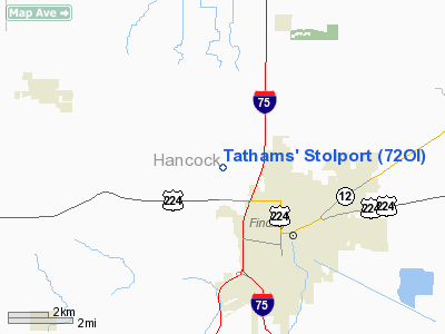
Tathams' Stolport Airport |
Location & QuickFacts
| FAA Information Effective: | 2008-09-25 |
| Airport Identifier: | 72OI |
| Airport Status: | Operational |
| Longitude/Latitude: | 083-41-04.7590W/41-04-25.1900N
-83.684655/41.073664 (Estimated) |
| Elevation: | 817 ft / 249.02 m (Estimated) |
| Land: | 0 acres |
| From nearest city: | 1 nautical miles W of Findlay, OH |
| Location: | Hancock County, OH |
| Magnetic Variation: | 04W (1985) |
Owner & Manager
| Ownership: | Privately owned |
| Owner: | Willard M. Tatham |
| Address: | 10375 Co Rd 95
Findlay, OH 45840 |
| Phone number: | 419-423-7075 |
| Address: |
|
Airport Operations and Facilities
| Airport Use: | Private |
| Segmented Circle: | No |
| Control Tower: | No |
| Sectional chart: | Detroit |
| Region: | AGL - Great Lakes |
| Boundary ARTCC: | ZOB - Cleveland |
| Tie-in FSS: | CLE - Cleveland |
| FSS Toll Free: | 1-800-WX-BRIEF |
Runway Information
Runway 09/27
| Dimension: | 400 x 100 ft / 121.9 x 30.5 m |
| Surface: | TURF, |
| |
Runway 09 |
Runway 27 |
| Traffic Pattern: | Left | Left |
| Obstruction: | 25 ft trees, 150.0 ft from runway | |
|
Radio Navigation Aids
| ID |
Type |
Name |
Ch |
Freq |
Var |
Dist |
| BNR | NDB | Benton Ridge | | 334.00 | 05W | 3.2 nm |
| PDR | NDB | Ottawa | | 233.00 | 05W | 13.4 nm |
| FZI | NDB | Fostoria | | 379.00 | 05W | 14.8 nm |
| TII | NDB | Tiffin | | 269.00 | 05W | 21.7 nm |
| LYL | NDB | Lima | | 362.00 | 04W | 27.0 nm |
| RUV | NDB | Rushsylvania | | 326.00 | 05W | 37.0 nm |
| DFI | NDB | Defiance | | 246.00 | 05W | 37.0 nm |
| USE | NDB | Fulton | | 375.00 | 05W | 38.0 nm |
| MNN | NDB | Marion | | 201.00 | 05W | 39.2 nm |
| EDJ | NDB | Bellefontaine | | 242.00 | 05W | 42.6 nm |
| BYN | NDB | Bryan | | 260.00 | 04W | 42.9 nm |
| VFU | NDB | Stanley | | 411.00 | 05W | 44.0 nm |
| PCW | NDB | Port Clinton | | 423.00 | 06W | 45.5 nm |
| TOL | TACAN | Toledo | 072X | | 05W | 31.7 nm |
| MAH | VOR | Marathon | | 114.90 | 05W | 3.7 nm |
| AOH | VOR | Allen County | | 108.40 | 04W | 25.5 nm |
| BUD | VOR | Buckeye | | 109.80 | 05W | 39.4 nm |
| VWV | VOR/DME | Waterville | 078X | 113.10 | 02W | 22.8 nm |
| FDY | VORTAC | Findlay | 019X | 108.20 | 02W | 7.8 nm |
| ROD | VORTAC | Rosewood | 122X | 117.50 | 05W | 50.0 nm |
Images and information placed above are from
http://www.airport-data.com/airport/72OI/
We thank them for the data!
| General Info
|
| Country |
United States
|
| State |
OHIO
|
| FAA ID |
72OI
|
| Latitude |
41-04-25.190N
|
| Longitude |
083-41-04.759W
|
| Elevation |
817 feet
|
| Near City |
FINDLAY
|
We don't guarantee the information is fresh and accurate. The data may
be wrong or outdated.
For more up-to-date information please refer to other sources.
|
|


