 |
|
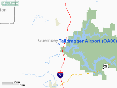
Location & QuickFacts
| FAA Information Effective: | 2008-09-25 |
| Airport Identifier: | OA00 |
| Airport Status: | Operational |
| Longitude/Latitude: | 081-34-16.4350W/40-07-01.2560N
-81.571232/40.117016 (Estimated) |
| Elevation: | 800 ft / 243.84 m (Estimated) |
| Land: | 0 acres |
| From nearest city: | 5 nautical miles N of Cambridge, OH |
| Location: | Guernsey County, OH |
| Magnetic Variation: | 06W (1985) |
Owner & Manager
| Ownership: | Privately owned |
| Owner: | Daniel T. Johnston |
| Address: | 69352 Tyner Rd
Cambridge, OH 43725 |
| Phone number: | 614-432-5921 |
| Address: |
|
Airport Operations and Facilities
| Airport Use: | Private |
| Wind indicator: | Yes |
| Segmented Circle: | No |
| Control Tower: | No |
| Sectional chart: | Cincinnati |
| Region: | AGL - Great Lakes |
| Boundary ARTCC: | ZOB - Cleveland |
| Tie-in FSS: | CLE - Cleveland |
| FSS Toll Free: | 1-800-WX-BRIEF |
Runway Information
Runway 14/32
| Dimension: | 2100 x 125 ft / 640.1 x 38.1 m |
| Surface: | TURF, |
| |
Runway 14 |
Runway 32 |
| Traffic Pattern: | Left | Left |
|
Radio Navigation Aids
| ID |
Type |
Name |
Ch |
Freq |
Var |
Dist |
| PKB | FAN MARKER | Marietta Ohio | | | 03W | 44.6 nm |
| HRA | NDB | Zanesville | | 204.00 | 06W | 20.4 nm |
| CFX | NDB | Cadiz | | 239.00 | 07W | 26.6 nm |
| MLR | NDB | Millersburg/dcmsnd | | 382.00 | 06W | 29.0 nm |
| TSO | NDB | Tolson | | 395.00 | 07W | 35.1 nm |
| HEH | NDB | Newark | | 524.00 | 06W | 41.4 nm |
| CTW | VOR/DME | Newcomerstown | 055X | 111.80 | 07W | 8.0 nm |
| ZZV | VOR/DME | Zanesville | 051X | 111.40 | 06W | 18.2 nm |
| TVT | VOR/DME | Tiverton | 112X | 116.50 | 03W | 32.7 nm |
| AIR | VOR/DME | Bellaire | 118X | 117.10 | 07W | 35.2 nm |
| BSV | VOR/DME | Briggs | 071X | 112.40 | 04W | 38.0 nm |
| HLG | VOR/DME | Wheeling | 059X | 112.20 | 07W | 46.8 nm |
| JPU | VORTAC | Parkersburg | 023X | 108.60 | 03W | 41.6 nm |
| APE | VORTAC | Appleton | 114X | 116.70 | 06W | 46.8 nm |
| CAK | VOT | Akron/canton Regional | | 110.60 | | 48.4 nm |
Images and information placed above are from
http://www.airport-data.com/airport/OA00/
We thank them for the data!
| General Info
|
| Country |
United States
|
| State |
OHIO
|
| FAA ID |
OA00
|
| Latitude |
40-07-01.256N
|
| Longitude |
081-34-16.435W
|
| Elevation |
800 feet
|
| Near City |
CAMBRIDGE
|
We don't guarantee the information is fresh and accurate. The data may
be wrong or outdated.
For more up-to-date information please refer to other sources.
|
|


