 |
|
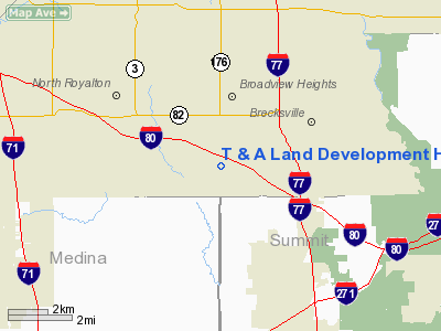
T & A Land Development Heliport |
Location & QuickFacts
| FAA Information Effective: | 2008-09-25 |
| Airport Identifier: | OI80 |
| Airport Status: | Operational |
| Longitude/Latitude: | 081-41-02.0000W/41-17-26.0000N
-81.683889/41.290556 (Estimated) |
| Elevation: | 1210 ft / 368.81 m (Estimated) |
| Land: | 7 acres |
| From nearest city: | 2 nautical miles N of Broadview Heights, OH |
| Location: | Cuyahoga County, OH |
| Magnetic Variation: | 07W (1995) |
Owner & Manager
| Ownership: | Privately owned |
| Owner: | T & A Land Development |
| Address: | 10135 Broadview Road
Broadview Heights, OH 44147 |
| Phone number: | 216-526-0526 |
| Manager: | Thomas P. Bencin |
| Address: | 10135 Broadview Road
Broadview Heights, OH 44147 |
| Phone number: | 216-526-0526 |
Airport Operations and Facilities
| Airport Use: | Private |
| Wind indicator: | Yes |
| Segmented Circle: | No |
| Control Tower: | No |
| Lighting Schedule: | PHONE REQ
FOR FLOOD LGTS CTC AMGR (216) 526-0526. |
| Sectional chart: | Detroit |
| Region: | AGL - Great Lakes |
| Boundary ARTCC: | ZOB - Cleveland |
| Tie-in FSS: | CLE - Cleveland |
| FSS on Airport: | No |
| FSS Toll Free: | 1-800-WX-BRIEF |
Runway Information
Helipad H1
| Dimension: | 200 x 100 ft / 61.0 x 30.5 m |
| Surface: | CONC-TURF, Good Condition |
| |
Runway H1 |
Runway |
| Traffic Pattern: | Left | Left |
|
Radio Navigation Aids
| ID |
Type |
Name |
Ch |
Freq |
Var |
Dist |
| EZE | NDB | Engel | | 226.00 | 07W | 12.1 nm |
| CL | NDB | Harri | | 344.00 | 07W | 13.0 nm |
| BKL | NDB | Burke Lakefront | | 416.00 | 07W | 14.3 nm |
| AK | NDB | Akron | | 362.00 | 07W | 18.9 nm |
| LQL | NDB | Lakeland | | 263.00 | 08W | 27.3 nm |
| AAU | NDB | Ashland | | 329.00 | 07W | 32.4 nm |
| MLR | NDB | Millersburg/dcmsnd | | 382.00 | 06W | 45.8 nm |
| MF | NDB | Manns | | 372.00 | 06W | 46.7 nm |
| DJB | VOR/DME | Dryer | 083X | 113.60 | 05W | 22.0 nm |
| ACO | VOR/DME | Akron | 091X | 114.40 | 04W | 24.4 nm |
| LNN | VOR/DME | Lost Nation | 039X | 110.20 | 08W | 27.1 nm |
| CXR | VOR/DME | Chardon | 074X | 112.70 | 05W | 27.1 nm |
| BSV | VOR/DME | Briggs | 071X | 112.40 | 04W | 35.0 nm |
| SKY | VOR/DME | Sandusky | 029X | 109.20 | 04W | 44.6 nm |
| YNG | VORTAC | Youngstown | 027X | 109.00 | 05W | 45.6 nm |
| MFD | VORTAC | Mansfield | 025X | 108.80 | 03W | 48.3 nm |
| CLE | VOT | Cleveland | | 110.40 | | 10.4 nm |
| CAK | VOT | Akron/canton Regional | | 110.60 | | 25.0 nm |
Remarks
- PRVDD APCH/DEP HELICOPTER OPNS CONDUCTED 070-090 & 270-290 USING PAD AS CENTER OF COMPASS ROSE; COMPLICANCE WITH FAR PART 91.126(B)(2); TKOF AREA CLEARLY MKD; NON-OBST WIND INDICATOR IS MAINTAINED ADJ TO TKOF/LNDG AREA.
Images and information placed above are from
http://www.airport-data.com/airport/OI80/
We thank them for the data!
| General Info
|
| Country |
United States
|
| State |
OHIO
|
| FAA ID |
OI80
|
| Latitude |
41-17-26.000N
|
| Longitude |
081-41-02.000W
|
| Elevation |
1210 feet
|
| Near City |
BROADVIEW HEIGHTS
|
We don't guarantee the information is fresh and accurate. The data may
be wrong or outdated.
For more up-to-date information please refer to other sources.
|
|


