 |
|
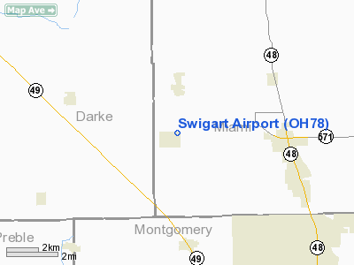
Location & QuickFacts
| FAA Information Effective: | 2008-09-25 |
| Airport Identifier: | OH78 |
| Airport Status: | Operational |
| Longitude/Latitude: | 084-24-31.8150W/39-58-03.1880N
-84.408838/39.967552 (Estimated) |
| Elevation: | 1005 ft / 306.32 m (Estimated) |
| Land: | 0 acres |
| From nearest city: | 1 nautical miles S of Laura, OH |
| Location: | Miami County, OH |
| Magnetic Variation: | 04W (1985) |
Owner & Manager
| Ownership: | Privately owned |
| Owner: | Kevin M. Swigart, Sr |
| Address: | 55 East Cross Street
Laura, OH 45337 |
| Phone number: | 513-947-1104 |
| Manager: | Colleen Swigart |
| Address: | 55 East Cross Street
Laura, OH 45337 |
| Phone number: | 513-947-1104 |
Airport Operations and Facilities
| Airport Use: | Private |
| Wind indicator: | Yes |
| Segmented Circle: | No |
| Control Tower: | No |
| Landing fee charge: | No |
| Sectional chart: | Cincinnati |
| Region: | AGL - Great Lakes |
| Boundary ARTCC: | ZID - Indianapolis |
| Tie-in FSS: | DAY - Dayton |
| FSS on Airport: | No |
| FSS Toll Free: | 1-800-WX-BRIEF |
Airport Services
| Airframe Repair: | NONE |
| Power Plant Repair: | NONE |
Runway Information
Runway 18/36
| Dimension: | 2450 x 60 ft / 746.8 x 18.3 m |
| Surface: | TURF, |
| |
Runway 18 |
Runway 36 |
| Traffic Pattern: | Left | Left |
| Obstruction: | 70 ft pline, 1800.0 ft from runway | 60 ft bldgs pline, 0.0 ft from runway |
|
Radio Navigation Aids
| ID |
Type |
Name |
Ch |
Freq |
Var |
Dist |
| VES | NDB | Versailles | | 356.00 | 04W | 15.3 nm |
| XEN | NDB | Xenia | | 395.00 | 03W | 26.8 nm |
| HKF | NDB | Hook Field | | 239.00 | 04W | 28.2 nm |
| CCJ | NDB | Clark County | | 341.00 | 04W | 29.6 nm |
| CQA | NDB | Lakefield | | 205.00 | 04W | 31.7 nm |
| OXD | NDB | Oxford | | 282.00 | 04W | 32.6 nm |
| HAO | NDB | Hamilton | | 260.00 | 04W | 36.5 nm |
| EDJ | NDB | Bellefontaine | | 242.00 | 05W | 36.5 nm |
| PLD | NDB | Portland | | 257.00 | 03W | 39.4 nm |
| IL | NDB | Airbo | | 407.00 | 04W | 42.2 nm |
| UWL | NDB | New Castle | | 385.00 | 02W | 42.3 nm |
| ISZ | NDB | Cincinnati-blue Ash | | 388.00 | 04W | 43.2 nm |
| UYF | NDB | London | | 263.00 | 06W | 43.5 nm |
| HW | NDB | Cubla | | 299.00 | 04W | 44.4 nm |
| MDE | NDB | Madeira | | 379.00 | 04W | 44.8 nm |
| RUV | NDB | Rushsylvania | | 326.00 | 05W | 45.0 nm |
| LYL | NDB | Lima | | 362.00 | 04W | 47.7 nm |
| LUK | NDB | Cincinnati | | 335.00 | 04W | 48.7 nm |
| FFO | TACAN | Patterson | 099X | | 04W | 18.6 nm |
| XSF | TACAN | Springfield | 065X | | 04W | 27.3 nm |
| AOH | VOR | Allen County | | 108.40 | 04W | 48.8 nm |
| DQN | VOR/DME | Dayton | 092X | 114.50 | 01W | 3.0 nm |
| SGH | VOR/DME | Springfield | 079X | 113.20 | 04W | 27.2 nm |
| MXQ | VOR/DME | Midwest | 076X | 112.90 | 04W | 42.8 nm |
| MIE | VOR/DME | Muncie | 091X | 114.40 | 03W | 48.1 nm |
| RID | VORTAC | Richmond | 043X | 110.60 | 03W | 23.6 nm |
| ROD | VORTAC | Rosewood | 122X | 117.50 | 05W | 25.6 nm |
| DAY | VOT | Dayton J M Cox-day | | 111.00 | | 9.6 nm |
Remarks
- PRACTICE LANDINGS & TAKEOFFS NOT PERMITTED.
- VFR OPNS ONLY.
Images and information placed above are from
http://www.airport-data.com/airport/OH78/
We thank them for the data!
|
|


