|
|
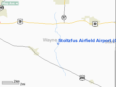
Stoltzfus Airfield Airport |
 |
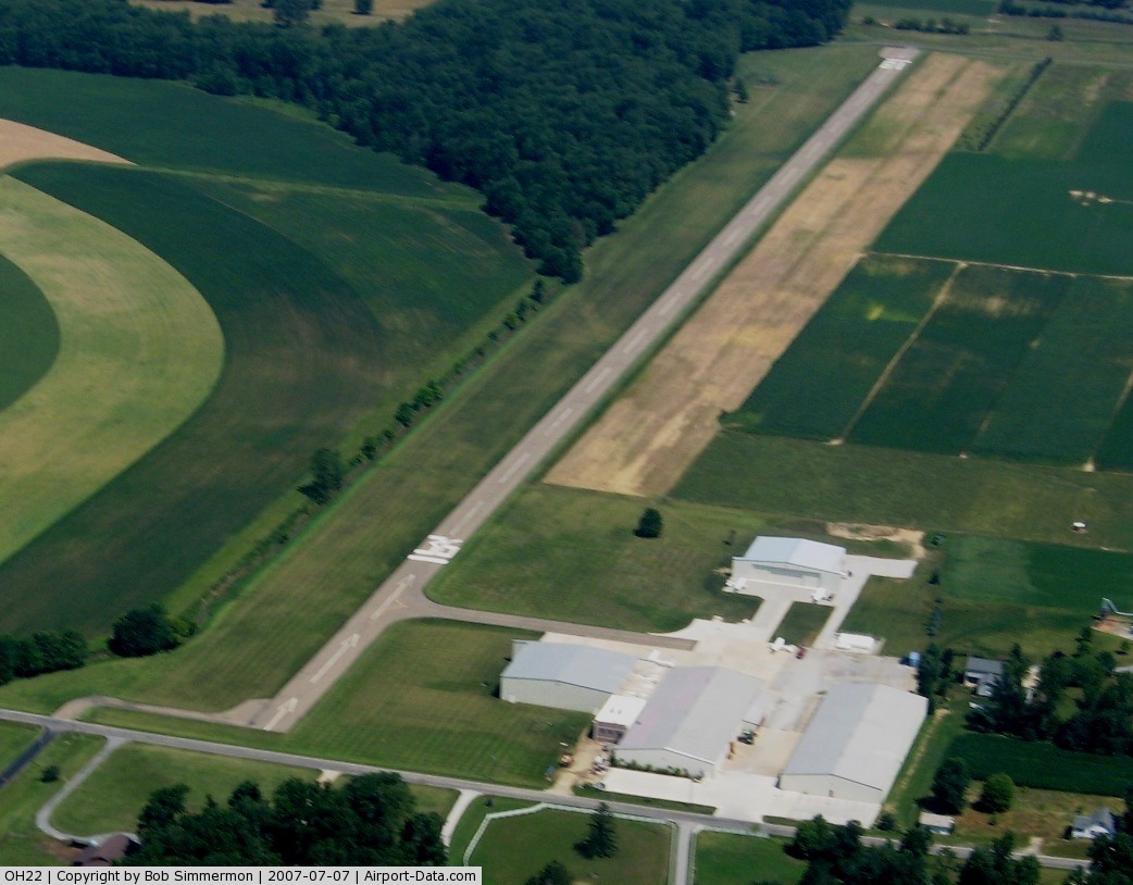
(Click on the photo to enlarge) |
 |
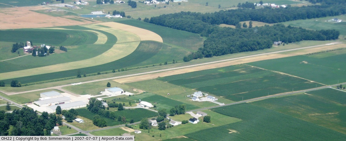
(Click on the photo to enlarge) |
Location & QuickFacts
| FAA Information Effective: | 2008-09-25 |
| Airport Identifier: | OH22 |
| Airport Status: | Operational |
| Longitude/Latitude: | 081-46-44.4800W/40-45-40.2000N
-81.779022/40.761167 (Estimated) |
| Elevation: | 1130 ft / 344.42 m (Estimated) |
| Land: | 0 acres |
| From nearest city: | 2 nautical miles NW of Kidron, OH |
| Location: | Wayne County, OH |
| Magnetic Variation: | 06W (1985) |
Owner & Manager
| Ownership: | Privately owned |
| Owner: | Ksb Enterprises |
| Address: | 11234 Hackett Rd
Apple Creek, OH 44606 |
| Phone number: | 330-698-0280 |
| Manager: | Ken Stoltzfus Jr. |
| Address: | 2815 S. Kansas Rd
Apple Creek, OH 44606
PREFERRED AIRPARTS, LLC, A DIVISION OF JILCO INDUSTRIES. |
| Phone number: | 330-698-0280 |
Airport Operations and Facilities
| Airport Use: | Private |
| Wind indicator: | Yes |
| Segmented Circle: | No |
| Control Tower: | No |
| Sectional chart: | Detroit |
| Region: | AGL - Great Lakes |
| Boundary ARTCC: | ZOB - Cleveland |
| Tie-in FSS: | CLE - Cleveland |
| FSS Toll Free: | 1-800-WX-BRIEF |
Runway Information
Runway N/S
| Dimension: | 3460 x 200 ft / 1054.6 x 61.0 m |
| Surface: | ASPH, |
| |
Runway N |
Runway S |
| Traffic Pattern: | Left | Left |
|
Radio Navigation Aids
| ID |
Type |
Name |
Ch |
Freq |
Var |
Dist |
| MLR | NDB | Millersburg/dcmsnd | | 382.00 | 06W | 13.9 nm |
| AAU | NDB | Ashland | | 329.00 | 07W | 24.8 nm |
| AK | NDB | Akron | | 362.00 | 07W | 25.7 nm |
| MF | NDB | Manns | | 372.00 | 06W | 30.3 nm |
| TSO | NDB | Tolson | | 395.00 | 07W | 34.1 nm |
| CL | NDB | Harri | | 344.00 | 07W | 35.7 nm |
| EZE | NDB | Engel | | 226.00 | 07W | 43.8 nm |
| BKL | NDB | Burke Lakefront | | 416.00 | 07W | 46.4 nm |
| CFX | NDB | Cadiz | | 239.00 | 07W | 47.1 nm |
| BSV | VOR/DME | Briggs | 071X | 112.40 | 04W | 15.8 nm |
| TVT | VOR/DME | Tiverton | 112X | 116.50 | 03W | 24.2 nm |
| ACO | VOR/DME | Akron | 091X | 114.40 | 04W | 33.5 nm |
| CTW | VOR/DME | Newcomerstown | 055X | 111.80 | 07W | 34.8 nm |
| DJB | VOR/DME | Dryer | 083X | 113.60 | 05W | 39.9 nm |
| ZZV | VOR/DME | Zanesville | 051X | 111.40 | 06W | 49.6 nm |
| MFD | VORTAC | Mansfield | 025X | 108.80 | 03W | 37.5 nm |
| CAK | VOT | Akron/canton Regional | | 110.60 | | 17.9 nm |
| CLE | VOT | Cleveland | | 110.40 | | 39.2 nm |
Remarks
Images and information placed above are from
http://www.airport-data.com/airport/OH22/
We thank them for the data!
| General Info
|
| Country |
United States
|
| State |
OHIO
|
| FAA ID |
OH22
|
| Latitude |
40-45-40.200N
|
| Longitude |
081-46-44.480W
|
| Elevation |
1130 feet
|
| Near City |
KIDRON
|
We don't guarantee the information is fresh and accurate. The data may
be wrong or outdated.
For more up-to-date information please refer to other sources.
|
|