 |
|
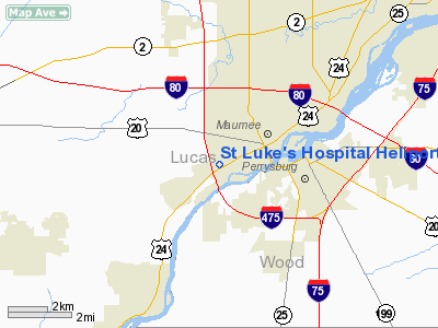
St Luke's Hospital Heliport |
Location & QuickFacts
| FAA Information Effective: | 2008-09-25 |
| Airport Identifier: | 3OI8 |
| Airport Status: | Operational |
| Longitude/Latitude: | 083-40-56.7700W/41-33-25.1860N
-83.682436/41.556996 (Estimated) |
| Elevation: | 638 ft / 194.46 m (Estimated) |
| Land: | 0 acres |
| From nearest city: | 2 nautical miles SW of Maumee, OH |
| Location: | Lucas County, OH |
| Magnetic Variation: | 05W (1985) |
Owner & Manager
| Ownership: | Privately owned |
| Owner: | St. Lukes Hospital |
| Address: | 5901 Monclova Road
Maumee, OH 43537 |
| Phone number: | 419-893-5911 |
| Manager: | Frank J. Bartell Iii |
| Address: | 5901 Monclova Road
Maumee, OH 43537 |
| Phone number: | 419-893-5903 |
Airport Operations and Facilities
| Airport Use: | Private
MEDICAL USE. |
| Wind indicator: | Yes |
| Segmented Circle: | No |
| Control Tower: | No |
| Lighting Schedule: | PHONE REQ
FOR RWY LGTS/ROTG BCN, PHONE 419-893-5900. |
| Beacon Color: | Clear-Green-Yellow (heliport) |
| Sectional chart: | Detroit |
| Region: | AGL - Great Lakes |
| Boundary ARTCC: | ZOB - Cleveland |
| Tie-in FSS: | CLE - Cleveland |
| FSS on Airport: | No |
| FSS Toll Free: | 1-800-WX-BRIEF |
Runway Information
Helipad H1
| Dimension: | 50 x 50 ft / 15.2 x 15.2 m |
| Surface: | CONC, |
| Edge Lights: | Low |
| |
Runway H1 |
Runway |
| Traffic Pattern: | Left | Left |
|
Radio Navigation Aids
| ID |
Type |
Name |
Ch |
Freq |
Var |
Dist |
| USE | NDB | Fulton | | 375.00 | 05W | 20.5 nm |
| FZI | NDB | Fostoria | | 379.00 | 05W | 25.6 nm |
| ADG | NDB | Adrian | | 278.00 | 06W | 25.8 nm |
| TCU | NDB | Tecumseh | | 239.00 | 04W | 30.1 nm |
| BNR | NDB | Benton Ridge | | 334.00 | 05W | 32.2 nm |
| PDR | NDB | Ottawa | | 233.00 | 05W | 34.3 nm |
| TII | NDB | Tiffin | | 269.00 | 05W | 34.9 nm |
| BYN | NDB | Bryan | | 260.00 | 04W | 35.6 nm |
| DFI | NDB | Defiance | | 246.00 | 05W | 36.1 nm |
| PCW | NDB | Port Clinton | | 423.00 | 06W | 36.7 nm |
| RYS | NDB | Grosse Ile | | 419.00 | 06W | 40.4 nm |
| PT | NDB | Pelee Island | | 283.00 | 05W | 47.4 nm |
| TOL | TACAN | Toledo | 072X | | 05W | 5.7 nm |
| MAH | VOR | Marathon | | 114.90 | 05W | 32.6 nm |
| VWV | VOR/DME | Waterville | 078X | 113.10 | 02W | 6.6 nm |
| DXO | VOR/DME | Detroit | 081X | 113.40 | 06W | 41.9 nm |
| SKY | VOR/DME | Sandusky | 029X | 109.20 | 04W | 46.8 nm |
| CRL | VORTAC | Carleton | 104X | 115.70 | 03W | 31.2 nm |
| FDY | VORTAC | Findlay | 019X | 108.20 | 02W | 36.3 nm |
| YIP | VOT | Willow Run | | 112.00 | | 41.3 nm |
| DTW | VOT | Detroit Met Wayne | | 109.80 | | 42.8 nm |
Remarks
- PROVIDED APCH/DEPARTURE ROUTE HELICOPTER OPERATIONS ARE CONDUCTED IN AN AREA FROM 080 DEGS CLOCKWISE TO 024 DEGS USING TOUCHDOWN PAD AS CENTER OF COMPASS ROSE. TAKEOFF/LANDING AREA IS APPROPRIATELY MARKED; NON-OBSTRUCTING WIND INDICATOR IS MAINTAINED ADJACENT TO THE TAKEOFF/LANDING AREA.
Images and information placed above are from
http://www.airport-data.com/airport/3OI8/
We thank them for the data!
| General Info
|
| Country |
United States
|
| State |
OHIO
|
| FAA ID |
3OI8
|
| Latitude |
41-33-25.186N
|
| Longitude |
083-40-56.770W
|
| Elevation |
638 feet
|
| Near City |
MAUMEE
|
We don't guarantee the information is fresh and accurate. The data may
be wrong or outdated.
For more up-to-date information please refer to other sources.
|
|


