|
|
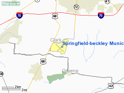
Springfield-beckley Muni Airport |
Coordinates: 39°50′25″N 083°50′25″W / 39.84028°N 83.84028°W / 39.84028; -83.84028
| Springfield-Beckley Municipal Airport |
 |
| IATA: SGH – ICAO: KSGH – FAA LID: SGH |
| Summary |
| Airport type |
Public |
| Owner |
City of Springfield |
| Serves |
Springfield, Ohio |
| Location |
Green Township, Clark County, near Springfield, Ohio |
| Elevation AMSL |
1,051 ft / 320 m |
| Website |
www.airparkohio.com/... |
| Runways |
| Direction |
Length |
Surface |
| ft |
m |
| 6/24 |
9,009 |
2,746 |
Asphalt/Concrete |
| 15/33 |
5,499 |
1,676 |
Asphalt |
| Statistics (2005) |
| Aircraft operations |
62,000 |
| Based aircraft |
81 |
| Source: Federal Aviation Administration |
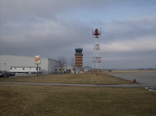
Springfield-Beckley Municipal Airport (IATA: SGH, ICAO: KSGH, FAA LID: SGH) is a public airport located five miles (8 km) south of the central business district of Springfield, a city in Clark County, Ohio, United States. It is owned by the city of Springfield.
The airport also serves three on-site divisions of the Ohio Air National Guard, including the 178th Fighter Wing.
Facilities and Aircraft
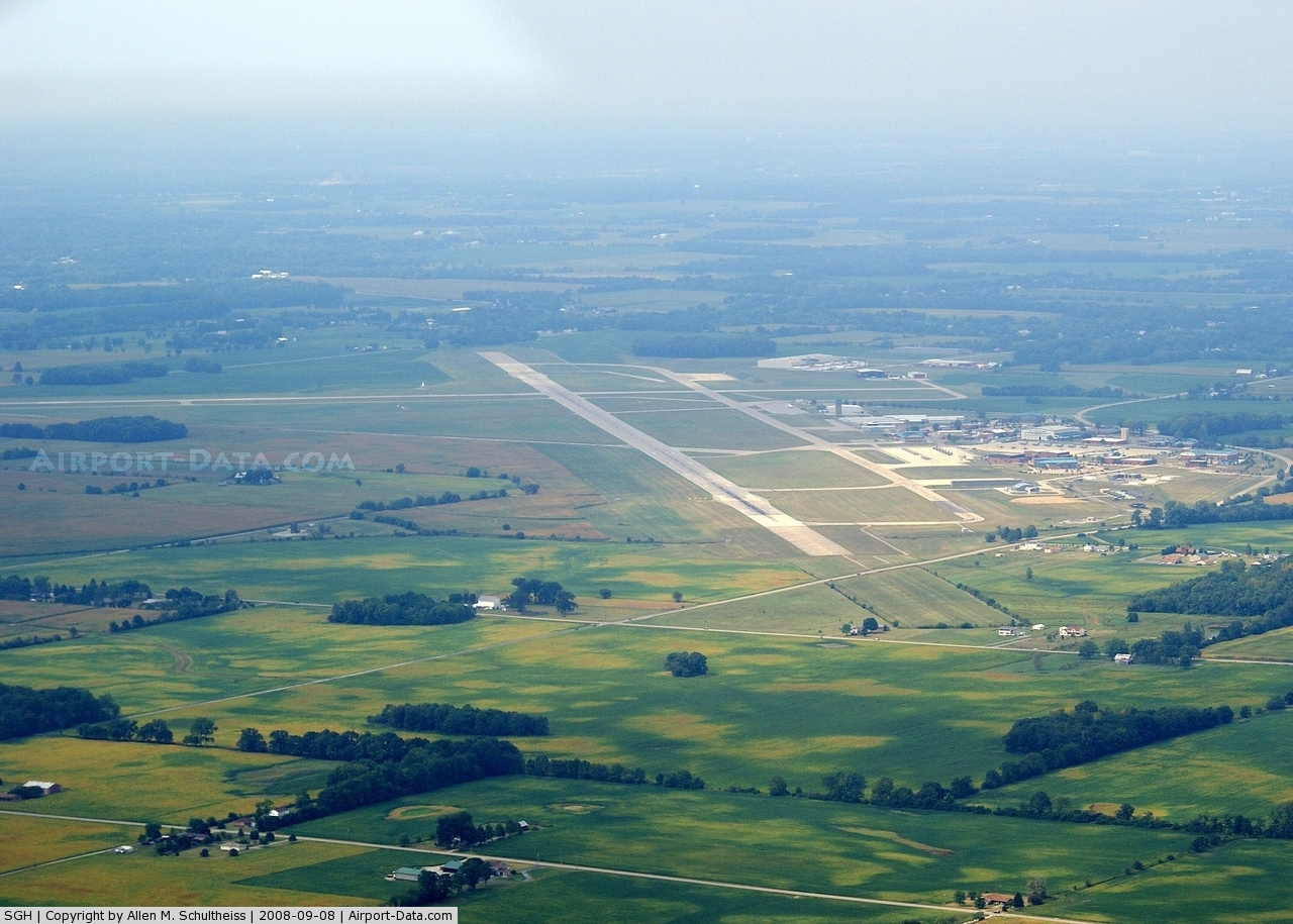
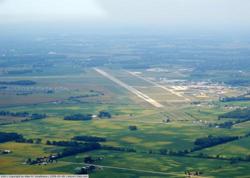
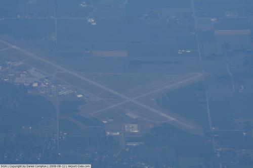
Springfield-Beckley Municipal Airport covers an area of 1,516 acres (614 ha) which contains two runways:
- Runway 6/24: 9,009 x 150 ft (2,746 x 46 m), Surface: Asphalt/Concrete
- Runway 15/33: 5,499 x 100 ft (1,676 x 30 m), Surface: Asphalt
For the 12-month period ending November 29, 2005, the airport had 62,000 aircraft operations, an average of 169 per day: 75% general aviation, 21% military and 4% air taxi. There are 81 aircraft based at this airport: 59% single-engine, 14% multi-engine, 1% jet, 1% ultralight and 25% military.
- Named after the Beckley family, a member of which knew the Wright Brothers, and witnessed and photographed their first flights.
The above content comes from Wikipedia and is published under free licenses – click here to read more.
 |
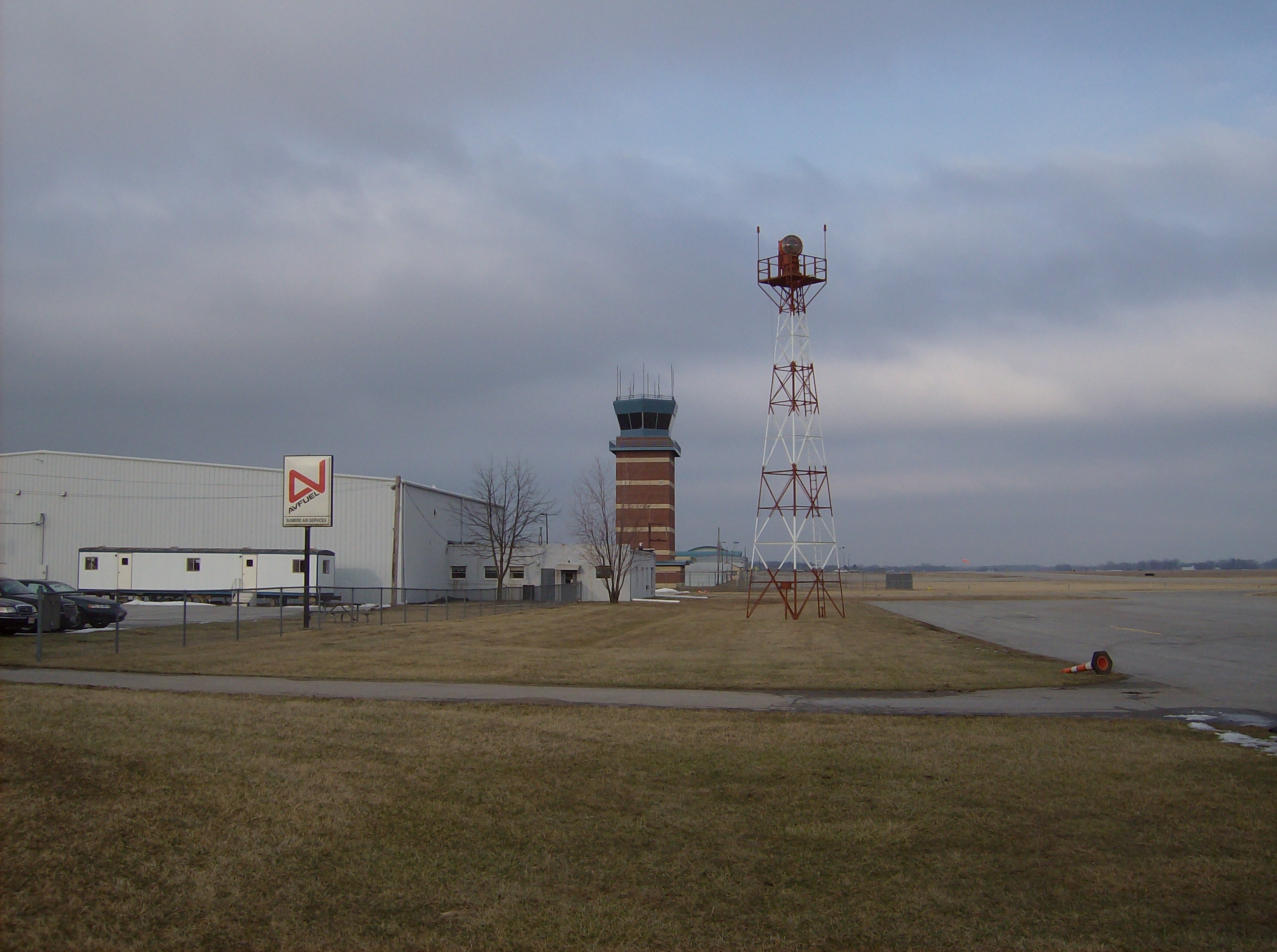
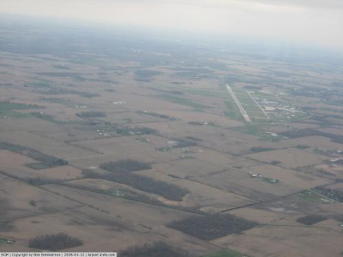
(Click on the photo to enlarge) |
 |
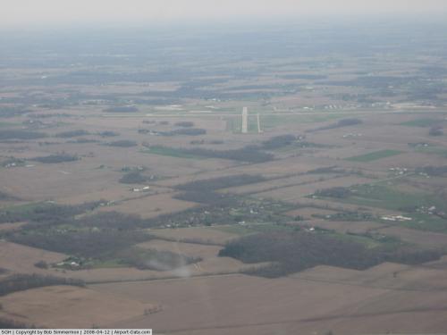
(Click on the photo to enlarge) |
 |
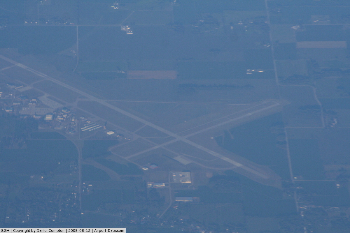
(Click on the photo to enlarge) |
 |
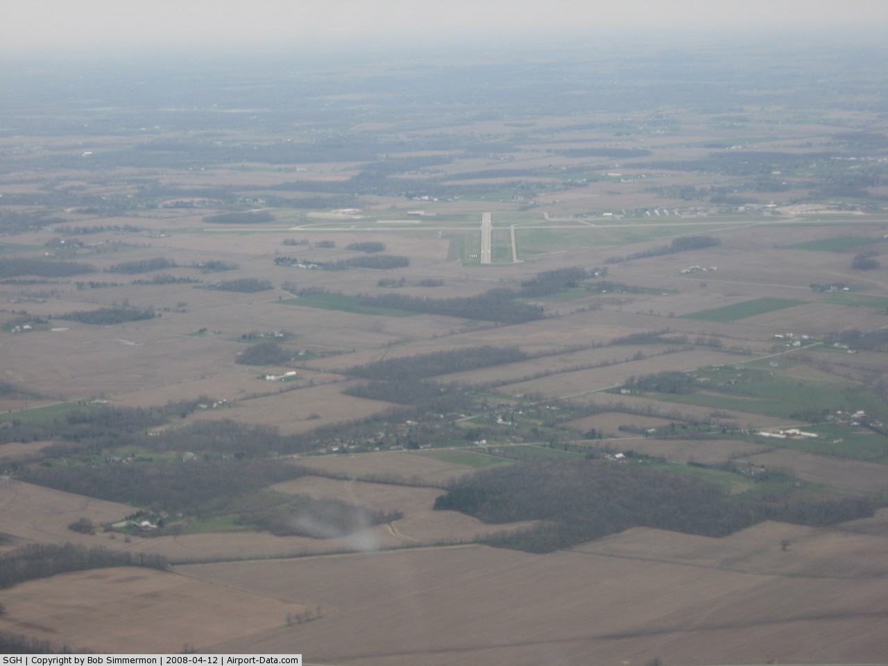
(Click on the photo to enlarge) |
Location & QuickFacts
| FAA Information Effective: | 2008-09-25 |
| Airport Identifier: | SGH |
| Airport Status: | Operational |
| Longitude/Latitude: | 083-50-24.5765W/39-50-25.0450N
-83.840160/39.840290 (Estimated) |
| Elevation: | 1051 ft / 320.34 m (Surveyed) |
| Land: | 1516 acres |
| From nearest city: | 5 nautical miles S of Springfield, OH |
| Location: | Clark County, OH |
| Magnetic Variation: | 04W (1985) |
Owner & Manager
| Ownership: | Publicly owned |
| Owner: | City Of Springfield |
| Address: | 76 E High St
Springfield, OH 45502 |
| Phone number: | 937-325-6108 |
| Manager: | Warren Lecocq |
| Address: | 1251 W. Blee Rd.
Springfield, OH 45502 |
| Phone number: | 937-325-6108 |
Airport Operations and Facilities
| Airport Use: | Open to public |
| Wind indicator: | Yes
WIND TEE OTS INDEFLY. |
| Segmented Circle: | Yes |
| Control Tower: | Yes |
| Lighting Schedule: | DUSK-DAWN
WHEN ATCT CLSD ACTVT ALSF2 RY 24, MIRL RY 15/33; REIL RYS 06, 15 & 33 - CTAF HIRL RY 06/24 PRESET ON MED INTST TO INCR INTST ACTVT - CTAF. |
| Beacon Color: | Clear-Green (lighted land airport) |
| Landing fee charge: | No |
| Sectional chart: | Cincinnati |
| Region: | AGL - Great Lakes |
| Traffic Pattern Alt: | 1049 ft |
| Boundary ARTCC: | ZID - Indianapolis |
| Tie-in FSS: | DAY - Dayton |
| FSS on Airport: | No |
| FSS Toll Free: | 1-800-WX-BRIEF |
| NOTAMs Facility: | SGH (NOTAM-d service avaliable) |
| Certification type/date: | IV A U 11/197
CLSD TO SCHEDULED ACR OPNS WITH GREATER THAN 9 PSGR SEATS & UNSCHEDULED ACR OPS GREATER THAN 30 PSGR SEATS. 90-DAY PPR; CALL AMGR 937-325-6108. |
| Federal Agreements: | NGY3 |
Airport Communications
| CTAF: | 120.700 |
| Unicom: | 122.950 |
Airport Services
| Fuel available: | 100LLA
J8 FUEL AVAILABLE. |
| Airframe Repair: | MAJOR |
| Power Plant Repair: | MAJOR |
| Bottled Oxygen: | NONE |
| Bulk Oxygen: | NONE |
Runway Information
Runway 06/24
| Dimension: | 9009 x 150 ft / 2745.9 x 45.7 m |
| Surface: | ASPH-CONC, Fair Condition
980 FT CONC NE END 1200" CONC SW END. |
| Surface Treatment: | Saw-cut or plastic Grooved |
| Pavement Class: | 60 /R/B/W/T |
| Weight Limit: | Single wheel: 50000 lbs.
Dual wheel: 60000 lbs.
LIMITED TO 25000 LBS SINGLE WHEEL LOAD CAPACITY OR LESS. |
| Edge Lights: | High |
| |
Runway 06 |
Runway 24 |
| Longitude: | 083-51-05.0108W | 083-49-31.3553W |
| Latitude: | 39-50-06.2422N | 39-50-58.3410N |
| Elevation: | 1051.00 ft | 1037.00 ft |
| Alignment: | 54 | 127 |
| ILS Type: | | LOC/GS
|
| Traffic Pattern: | Left | Left |
| Markings: | Non-precision instrument, Fair Condition | Precision instrument, Fair Condition |
| Arresting: | BAK12 | BAK12 |
| Crossing Height: | 43.00 ft | 54.00 ft |
| VASI: | 4-light PAPI on left side | 4-light PAPI on left side |
| Visual Glide Angle: | 3.00° | 3.00° |
| Approach lights: | | ALSF2 |
| Runway End Identifier: | Yes | |
| Obstruction: | 40 ft trees, 1400.0 ft from runway, 600 ft left of centerline, 30:1 slope to clear | 50 ft tree, 1325.0 ft from runway, 300 ft right of centerline, 22:1 slope to clear |
|
Runway 15/33
| Dimension: | 5499 x 100 ft / 1676.1 x 30.5 m |
| Surface: | ASPH, Fair Condition
980 FT CONC NE END 1200" CONC SW END. |
| Weight Limit: | Single wheel: 12000 lbs.
LIMITED TO 25000 LBS SINGLE WHEEL LOAD CAPACITY OR LESS. |
| Edge Lights: | Medium |
| |
Runway 15 |
Runway 33 |
| Longitude: | 083-50-55.6658W | 083-50-14.4261W |
| Latitude: | 39-50-35.1994N | 39-49-51.1339N |
| Elevation: | 1042.00 ft | 1041.00 ft |
| Alignment: | 127 | 127 |
| Traffic Pattern: | Left | Left |
| Markings: | Basic, Fair Condition | Basic, Fair Condition |
| Crossing Height: | 36.00 ft | 36.00 ft |
| VASI: | 4-light PAPI on left side | 4-light PAPI on left side |
| Visual Glide Angle: | 3.00° | 0.00° |
| Runway End Identifier: | Yes | Yes |
| Obstruction: | 38 ft trees, 850.0 ft from runway, 660 ft left of centerline, 17:1 slope to clear | 72 ft trees, 975.0 ft from runway, 700 ft right of centerline, 10:1 slope to clear |
|
Radio Navigation Aids
| ID |
Type |
Name |
Ch |
Freq |
Var |
Dist |
| CCJ | NDB | Clark County | | 341.00 | 04W | 3.5 nm |
| XEN | NDB | Xenia | | 395.00 | 03W | 8.6 nm |
| UYF | NDB | London | | 263.00 | 06W | 18.1 nm |
| IL | NDB | Airbo | | 407.00 | 04W | 21.5 nm |
| CSS | NDB | Court House | | 414.00 | 05W | 25.2 nm |
| HW | NDB | Cubla | | 299.00 | 04W | 29.3 nm |
| BU | NDB | Boutn | | 230.00 | 05W | 29.4 nm |
| EDJ | NDB | Bellefontaine | | 242.00 | 05W | 31.9 nm |
| MRT | NDB | Marysville | | 403.00 | 05W | 32.4 nm |
| OS | NDB | Fuler | | 515.00 | 05W | 32.7 nm |
| HKF | NDB | Hook Field | | 239.00 | 04W | 34.8 nm |
| DKG | NDB | Don Scott | | 348.00 | 05W | 37.9 nm |
| RUV | NDB | Rushsylvania | | 326.00 | 05W | 38.0 nm |
| VES | NDB | Versailles | | 356.00 | 04W | 38.4 nm |
| CHC | NDB | Grens | | 272.00 | 04W | 38.8 nm |
| HOC | NDB | Hillsboro | | 278.00 | 05W | 41.7 nm |
| DLZ | NDB | Delaware | | 215.00 | 06W | 42.9 nm |
| ISZ | NDB | Cincinnati-blue Ash | | 388.00 | 04W | 43.7 nm |
| HAO | NDB | Hamilton | | 260.00 | 04W | 44.0 nm |
| CYO | NDB | Circleville | | 366.00 | 05W | 44.1 nm |
| MDE | NDB | Madeira | | 379.00 | 04W | 44.1 nm |
| RZT | NDB | Ross County | | 236.00 | 05W | 44.7 nm |
| LUK | NDB | Cincinnati | | 335.00 | 04W | 47.1 nm |
| OXD | NDB | Oxford | | 282.00 | 04W | 47.9 nm |
| PWF | NDB | Sportys | | 245.00 | 04W | 49.1 nm |
| XSF | TACAN | Springfield | 065X | | 04W | 0.1 nm |
| FFO | TACAN | Patterson | 099X | | 04W | 10.0 nm |
| LCK | TACAN | Rickenbacker | 069X | | 05W | 42.1 nm |
| XUB | VOR | Yellow Bud | | 112.50 | 05W | 44.1 nm |
| SGH | VOR/DME | Springfield | 079X | 113.20 | 04W | 0.3 nm |
| MXQ | VOR/DME | Midwest | 076X | 112.90 | 04W | 24.7 nm |
| DQN | VOR/DME | Dayton | 092X | 114.50 | 01W | 27.8 nm |
| ROD | VORTAC | Rosewood | 122X | 117.50 | 05W | 28.5 nm |
| RID | VORTAC | Richmond | 043X | 110.60 | 03W | 46.4 nm |
| DAY | VOT | Dayton J M Cox-day | | 111.00 | | 17.9 nm |
| CMH | VOT | Port Columbus | | 111.00 | | 45.0 nm |
Remarks
- A-GEAR: CABLE RAISED BY BAK-14 DEVICE O/R TO TWR. BAK-12A(B) AVBL 1230-2200Z++ TUE-FRI; MAY BE EXTN BY NOTAM FOR MIL FLYING.
- JASU: 6(AM32A-60B)
- FUEL: J8(MIL) (NC-100LL, A)
- FLUID: PRESAIR LPOX LOX
- OIL: O-133-148-156(MIL) SOAP
- RSTD: MIL PRACTICE INST APCH NA WHEN TWR CLSD.
- CAUTION: BIRD WATCH COND PHASE I (DEC-JUN) INDICATES LGT BIRD ACT. PHASE II (JUL-NOV) INDICATES HVY BIRD ACT NML ASSOCIATED WITH MIGRATORY SEASON.
- NS ABTMT: AVOID OVERFLYING YELLOW SPRINGS 2 NM SW BLW 4000', PRACTICE CIR INST APCH NA BLW 2000' ESTAB ON FINAL.
- RY 15/33 & TWY F NOT AVBL FOR ACR OPNS.
- ANG: PPR AT ALL TIMES DSN 346-2319, C937-327-2319. RCR NOT AVBL. ALL TRAN ACFT CTC 178 F/W OPS.
- ANG: INBD ACFT ACCEPTING PENT AND RADAR VECTORS FR IND CNTR AND DAYTON APCH EXP EXTV LO ALT VECTORING. OPR 1300-2130Z++ TUE-FRI; MAY BE EXTN TIL 0200Z++ WED FOR MIL FLYING, OT BY NOTAM.
- AVOID OVER FLYING ANG RAMP.
- WEATHER OBS-RY 06 APCH END NOT VIS FR THE OFFICIAL POINT OF OBSERVATION. VIS IS LIMITED FR SW TO NW.
- DUR ATCT OPR HRS RY 24 IS THE PREFERRED RY, WIND 10 KT OR LESS.
- ANG: 0PR 1230- 2200Z++ TUE-FRI, MAY BE EXTN OT BY NOTAM FOR MIL FLYING.
- ANG: STD USAF RSRS APPLIES.
- BAK 12 35 FT BEYOND APPCH ENDS RY 06 & RY 24.
- DEER ON AND INVOF ARPT.
- RWY 06/24 ARRESTING DEVICE MAY BE UP WHEN ATCT CLSD.
- HEAVY BIRD ACTIVITY FALL & WINTER MONTHS.
Images and information placed above are from
http://www.airport-data.com/airport/SGH/
We thank them for the data!
| General Info
|
| Country |
United States
|
| State |
OHIO
|
| FAA ID |
SGH
|
| Latitude |
39-50-25.045N
|
| Longitude |
083-50-24.577W
|
| Elevation |
1051 feet
|
| Near City |
SPRINGFIELD
|
We don't guarantee the information is fresh and accurate. The data may
be wrong or outdated.
For more up-to-date information please refer to other sources.
|
|