 |
|
Location & QuickFacts
| FAA Information Effective: | 2008-09-25 |
| Airport Identifier: | 1OI4 |
| Airport Status: | Operational |
| Longitude/Latitude: | 081-26-35.4170W/41-26-27.1920N
-81.443171/41.440887 (Estimated) |
| Elevation: | 1050 ft / 320.04 m (Estimated) |
| Land: | 0 acres |
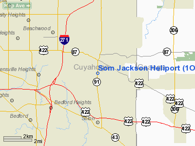
| From nearest city: | 1 nautical miles N of Moreland Hills, OH |
| Location: | Cuyahoga County, OH |
| Magnetic Variation: | 07W (1985) |
Owner & Manager
| Ownership: | Privately owned |
| Owner: | Beckett Aviation Corp |
| Address: | Cleveland Hopkins Airport
Cleveland, OH 44135 |
| Phone number: | 216-826-9252 |
| Manager: | C. H. Traweek |
| Address: |
|
| Phone number: | 216-826-9252 |
Airport Operations and Facilities
| Airport Use: | Private |
| Segmented Circle: | No |
| Control Tower: | No |
| Sectional chart: | Detroit |
| Region: | AGL - Great Lakes |
| Boundary ARTCC: | ZOB - Cleveland |
| Tie-in FSS: | CLE - Cleveland |
| FSS on Airport: | No |
| FSS Toll Free: | 1-800-WX-BRIEF |
Runway Information
Helipad H1
| Dimension: | 200 x 200 ft / 61.0 x 61.0 m |
| Surface: | TURF, |
| |
Runway H1 |
Runway |
| Traffic Pattern: | Left | Left |
|
Radio Navigation Aids
| ID |
Type |
Name |
Ch |
Freq |
Var |
Dist |
| BKL | NDB | Burke Lakefront | | 416.00 | 07W | 11.2 nm |
| EZE | NDB | Engel | | 226.00 | 07W | 12.9 nm |
| LQL | NDB | Lakeland | | 263.00 | 08W | 14.8 nm |
| AK | NDB | Akron | | 362.00 | 07W | 22.4 nm |
| CL | NDB | Harri | | 344.00 | 07W | 24.3 nm |
| HBD | NDB | Hubbard | | 408.00 | 08W | 44.7 nm |
| AAU | NDB | Ashland | | 329.00 | 07W | 46.5 nm |
| CXR | VOR/DME | Chardon | 074X | 112.70 | 05W | 13.4 nm |
| LNN | VOR/DME | Lost Nation | 039X | 110.20 | 08W | 14.8 nm |
| ACO | VOR/DME | Akron | 091X | 114.40 | 04W | 22.8 nm |
| DJB | VOR/DME | Dryer | 083X | 113.60 | 05W | 32.8 nm |
| JFN | VOR/DME | Jefferson | 099X | 115.20 | 05W | 36.7 nm |
| BSV | VOR/DME | Briggs | 071X | 112.40 | 04W | 42.1 nm |
| YNG | VORTAC | Youngstown | 027X | 109.00 | 05W | 35.3 nm |
| CLE | VOT | Cleveland | | 110.40 | | 18.4 nm |
| CAK | VOT | Akron/canton Regional | | 110.60 | | 31.5 nm |
Remarks
- E111: PRVDD ALL APCH/DEP RTE HEL OPNS ARE CONDUCTED IN AN AREA FROM 270 DEGS CLKWS TO 90 DEGS USING THE TD PAD AS THE CNTR OF A COMPASS ROSE; E111 CONT'D: TKOF/LNDG AREA IS APROPLY MARKED; NON-OBSTRUCTING WIND INDCR IS MAINTD ADJ TO THE TKOF/LNDG AREA.
Images and information placed above are from
http://www.airport-data.com/airport/1OI4/
We thank them for the data!
| General Info
|
| Country |
United States
|
| State |
OHIO
|
| FAA ID |
1OI4
|
| Latitude |
41-26-27.192N
|
| Longitude |
081-26-35.417W
|
| Elevation |
1050 feet
|
| Near City |
MORELAND HILLS
|
We don't guarantee the information is fresh and accurate. The data may
be wrong or outdated.
For more up-to-date information please refer to other sources.
|
|


