 |
|
Location & QuickFacts
| FAA Information Effective: | 2008-09-25 |
| Airport Identifier: | 33OI |
| Airport Status: | Operational |
| Longitude/Latitude: | 082-02-35.5290W/41-04-58.1980N
-82.043202/41.082833 (Estimated) |
| Elevation: | 950 ft / 289.56 m (Estimated) |
| Land: | 0 acres |
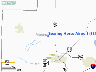
| From nearest city: | 1 nautical miles SW of Chatham Township, OH |
| Location: | Medina County, OH |
| Magnetic Variation: | 06W (1985) |
Owner & Manager
| Ownership: | Privately owned |
| Owner: | William R. Musolf Jr |
| Address: | 9790 Old Mill Rd
Spencer, OH 44275 |
| Phone number: | 330-667-2760 |
| Manager: | William R. Musolf Jr |
| Address: | 9790 Old Mill Rd
Spencer, OH 44275 |
| Phone number: | 330-667-2760 |
Airport Operations and Facilities
| Airport Use: | Private |
| Wind indicator: | Yes |
| Segmented Circle: | No |
| Control Tower: | No |
| Sectional chart: | Detroit |
| Region: | AGL - Great Lakes |
| Boundary ARTCC: | ZOB - Cleveland |
| Tie-in FSS: | CLE - Cleveland |
| FSS on Airport: | No |
| FSS Toll Free: | 1-800-WX-BRIEF |
Airport Services
Runway Information
Runway 01/19
| Dimension: | 2400 x 45 ft / 731.5 x 13.7 m |
| Surface: | TURF, |
| |
Runway 01 |
Runway 19 |
| Traffic Pattern: | Left | Left |
| Obstruction: | | 18 ft pline, 300.0 ft from runway |
|
Radio Navigation Aids
| ID |
Type |
Name |
Ch |
Freq |
Var |
Dist |
| AAU | NDB | Ashland | | 329.00 | 07W | 11.9 nm |
| CL | NDB | Harri | | 344.00 | 07W | 15.8 nm |
| MF | NDB | Manns | | 372.00 | 06W | 26.4 nm |
| EZE | NDB | Engel | | 226.00 | 07W | 28.4 nm |
| AK | NDB | Akron | | 362.00 | 07W | 29.7 nm |
| BKL | NDB | Burke Lakefront | | 416.00 | 07W | 31.8 nm |
| MLR | NDB | Millersburg/dcmsnd | | 382.00 | 06W | 33.4 nm |
| PCW | NDB | Port Clinton | | 423.00 | 06W | 45.6 nm |
| LQL | NDB | Lakeland | | 263.00 | 08W | 46.9 nm |
| DJB | VOR/DME | Dryer | 083X | 113.60 | 05W | 17.4 nm |
| BSV | VOR/DME | Briggs | 071X | 112.40 | 04W | 34.5 nm |
| SKY | VOR/DME | Sandusky | 029X | 109.20 | 04W | 34.8 nm |
| TVT | VOR/DME | Tiverton | 112X | 116.50 | 03W | 37.7 nm |
| ACO | VOR/DME | Akron | 091X | 114.40 | 04W | 38.2 nm |
| LNN | VOR/DME | Lost Nation | 039X | 110.20 | 08W | 46.7 nm |
| CXR | VOR/DME | Chardon | 074X | 112.70 | 05W | 47.5 nm |
| MFD | VORTAC | Mansfield | 025X | 108.80 | 03W | 28.0 nm |
| CLE | VOT | Cleveland | | 110.40 | | 21.6 nm |
| CAK | VOT | Akron/canton Regional | | 110.60 | | 29.0 nm |
Remarks
- PRVDD OBSTNS IN PRIM SFC ARE RMVD/LWRD OR THRS DSPLCD TO PRVD 20:1 SLOPE.
Images and information placed above are from
http://www.airport-data.com/airport/33OI/
We thank them for the data!
| General Info
|
| Country |
United States
|
| State |
OHIO
|
| FAA ID |
33OI
|
| Latitude |
41-04-58.198N
|
| Longitude |
082-02-35.529W
|
| Elevation |
950 feet
|
| Near City |
CHATHAM TOWNSHIP
|
We don't guarantee the information is fresh and accurate. The data may
be wrong or outdated.
For more up-to-date information please refer to other sources.
|
|


