 |
|
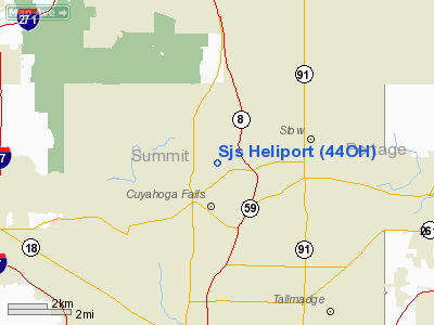
Location & QuickFacts
| FAA Information Effective: | 2008-09-25 |
| Airport Identifier: | 44OH |
| Airport Status: | Operational |
| Longitude/Latitude: | 081-29-36.4110W/41-09-58.2010N
-81.493448/41.166167 (Estimated) |
| Elevation: | 1025 ft / 312.42 m (Estimated) |
| Land: | 2 acres |
| From nearest city: | 2 nautical miles N of Cuyahoga Falls, OH |
| Location: | Summit County, OH |
| Magnetic Variation: | 07W (1990) |
Owner & Manager
| Ownership: | Privately owned |
| Owner: | Sjs Associates |
| Address: | 363 Remington Rd
Stow, OH 44224 |
| Phone number: | 216-928-6145 |
| Manager: | Bruce Sutphen |
| Address: | 363 Remington Rd
Stow, OH 44224 |
| Phone number: | 216-928-6145 |
Airport Operations and Facilities
| Airport Use: | Private |
| Wind indicator: | Yes |
| Segmented Circle: | No |
| Control Tower: | No |
| Sectional chart: | Detroit |
| Region: | AGL - Great Lakes |
| Boundary ARTCC: | ZOB - Cleveland |
| Tie-in FSS: | CLE - Cleveland |
| FSS Toll Free: | 1-800-WX-BRIEF |
Runway Information
Helipad H1
| Dimension: | 50 x 50 ft / 15.2 x 15.2 m |
| Surface: | CONC, |
| |
Runway H1 |
Runway |
| Traffic Pattern: | Left | Left |
|
Radio Navigation Aids
| ID |
Type |
Name |
Ch |
Freq |
Var |
Dist |
| AK | NDB | Akron | | 362.00 | 07W | 7.5 nm |
| EZE | NDB | Engel | | 226.00 | 07W | 22.0 nm |
| BKL | NDB | Burke Lakefront | | 416.00 | 07W | 23.1 nm |
| CL | NDB | Harri | | 344.00 | 07W | 23.7 nm |
| LQL | NDB | Lakeland | | 263.00 | 08W | 31.5 nm |
| AAU | NDB | Ashland | | 329.00 | 07W | 36.5 nm |
| TSO | NDB | Tolson | | 395.00 | 07W | 40.9 nm |
| MLR | NDB | Millersburg/dcmsnd | | 382.00 | 06W | 41.3 nm |
| HBD | NDB | Hubbard | | 408.00 | 08W | 43.5 nm |
| MF | NDB | Manns | | 372.00 | 06W | 49.4 nm |
| UCP | NDB | Castle | | 272.00 | 09W | 49.6 nm |
| ACO | VOR/DME | Akron | 091X | 114.40 | 04W | 13.7 nm |
| BSV | VOR/DME | Briggs | 071X | 112.40 | 04W | 25.7 nm |
| CXR | VOR/DME | Chardon | 074X | 112.70 | 05W | 25.8 nm |
| LNN | VOR/DME | Lost Nation | 039X | 110.20 | 08W | 31.5 nm |
| DJB | VOR/DME | Dryer | 083X | 113.60 | 05W | 32.3 nm |
| JFN | VOR/DME | Jefferson | 099X | 115.20 | 05W | 49.0 nm |
| YNG | VORTAC | Youngstown | 027X | 109.00 | 05W | 38.3 nm |
| CAK | VOT | Akron/canton Regional | | 110.60 | | 15.2 nm |
| CLE | VOT | Cleveland | | 110.40 | | 21.8 nm |
Remarks
- OPERATIONS COND FROM 020 TO 110 & 200 TO 290; AREA MKD; WIND IND MAINTAINED.
Images and information placed above are from
http://www.airport-data.com/airport/44OH/
We thank them for the data!
| General Info
|
| Country |
United States
|
| State |
OHIO
|
| FAA ID |
44OH
|
| Latitude |
41-09-58.201N
|
| Longitude |
081-29-36.411W
|
| Elevation |
1025 feet
|
| Near City |
CUYAHOGA FALLS
|
We don't guarantee the information is fresh and accurate. The data may
be wrong or outdated.
For more up-to-date information please refer to other sources.
|
|


