|
|
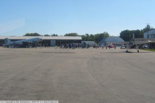 |
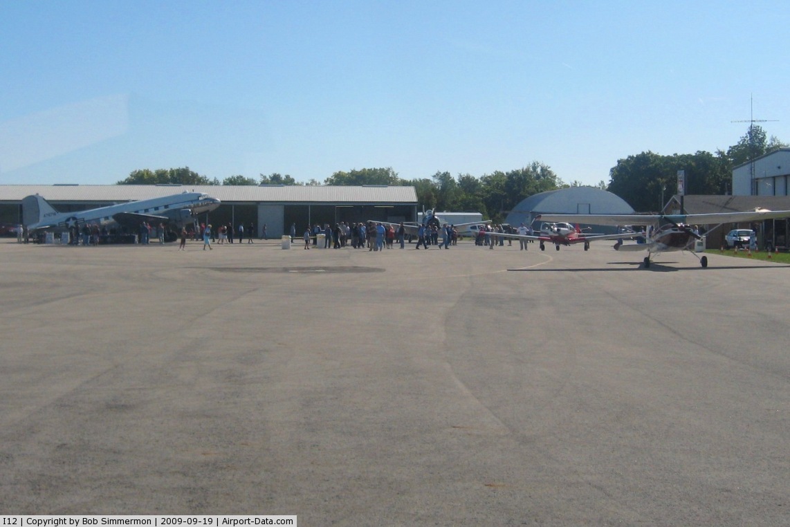
(Click on the photo to enlarge) |
Location & QuickFacts
| FAA Information Effective: | 2008-09-25 |
| Airport Identifier: | I12 |
| Airport Status: | Operational |
| Longitude/Latitude: | 084-09-03.1840W/40-14-29.1380N
-84.150884/40.241427 (Estimated) |
| Elevation: | 1044 ft / 318.21 m (Surveyed) |
| Land: | 83 acres |
| From nearest city: | 3 nautical miles S of Sidney, OH |
| Location: | Shelby County, OH |
| Magnetic Variation: | 05W (1995) |
Owner & Manager
| Ownership: | Publicly owned |
| Owner: | City Of Sidney |
| Address: | 201 W Poplar St
Sidney, OH 45365 |
| Phone number: | 937-498-2335 |
| Manager: | Patrick Beatty |
| Address: | 14833 Sidney-plattsville Rd
Sidney, OH 45365 |
| Phone number: | 937-492-9794 |
Airport Operations and Facilities
| Airport Use: | Open to public |
| Wind indicator: | Yes |
| Segmented Circle: | No |
| Control Tower: | No |
| Lighting Schedule: | DUSK-DAWN
ACTVT MIRL RY 10/28 & REIL RY 28 - CTAF. |
| Beacon Color: | Clear-Green (lighted land airport) |
| Sectional chart: | Detroit |
| Region: | AGL - Great Lakes |
| Traffic Pattern Alt: | 800 ft |
| Boundary ARTCC: | ZID - Indianapolis |
| Tie-in FSS: | DAY - Dayton |
| FSS on Airport: | No |
| FSS Toll Free: | 1-800-WX-BRIEF |
| NOTAMs Facility: | DAY (NOTAM-d service avaliable) |
| Federal Agreements: | NGY |
Airport Communications
| CTAF: | 123.050 |
| Unicom: | 123.050 |
Airport Services
| Fuel available: | 100LLA |
| Airframe Repair: | MINOR |
| Power Plant Repair: | MINOR |
| Bulk Oxygen: | NONE |
Runway Information
Runway 05/23
| Dimension: | 2981 x 50 ft / 908.6 x 15.2 m |
| Surface: | ASPH, |
| |
Runway 05 |
Runway 23 |
| Longitude: | 084-09-18.7080W | 084-08-54.0010W |
| Latitude: | 40-14-11.8560N | 40-14-34.4230N |
| Elevation: | 1035.00 ft | 1040.00 ft |
| Alignment: | 40 | 127 |
| Traffic Pattern: | Left | Left |
| Markings: | Non-precision instrument, Good Condition
RY 05/23 MARKINGS FADED. | Non-precision instrument, Good Condition |
| Runway End Identifier: | No | No |
| Centerline Lights: | No | No |
| Touchdown Lights: | No | No |
| Obstruction: | 15 ft road, 201.0 ft from runway, 134 ft right of centerline
RWY 05 +15 FT ROAD 0 FT FM RY END 117 FT R TO 200 FT FM 165 FT L | 76 ft pline, 2130.0 ft from runway, 536 ft right of centerline, 25:1 slope to clear
0:1 SLOPE TO CULTIVATION 0B 201 FT FM. |
|
Runway 10/28
| Dimension: | 4785 x 75 ft / 1458.5 x 22.9 m |
| Surface: | ASPH, Good Condition |
| Edge Lights: | Medium |
| |
Runway 10 |
Runway 28 |
| Longitude: | 084-09-31.9780W | 084-08-30.4390W |
| Latitude: | 40-14-34.6020N | 40-14-31.1470N |
| Elevation: | 1039.00 ft | 1044.00 ft |
| Alignment: | 94 | 127 |
| Traffic Pattern: | Left | Left |
| Markings: | Non-precision instrument, Good Condition
RY 10 DSPLCD THLD 482 FT NIGHT TIME ONLY. DAY TIME DSPLCD 490 FT. | Non-precision instrument, Good Condition
RY 28 THLD LOCATED 280 FT FM RY END. NOT MARKED AS DSPLCD. |
| Crossing Height: | 0.00 ft | 40.00 ft |
| Displaced threshold: | 480.00 ft | 0.00 ft |
| VASI: | 2-light PAPI on left side | 2-light PAPI on right side |
| Visual Glide Angle: | 0.00° | 3.00° |
| Runway End Identifier: | No | Yes |
| Centerline Lights: | No | No |
| Touchdown Lights: | No | No |
| Obstruction: | 42 ft trees, 330.0 ft from runway, 3:1 slope to clear
R/W 10 APPROACH SLOPE 19:1 TO DISPLACED THRESHOLD
RY 10 +10 FT TREE, 216L, 36 FT FM RY END. | 16 ft road, 267.0 ft from runway, 4:1 slope to clear |
|
Radio Navigation Aids
| ID |
Type |
Name |
Ch |
Freq |
Var |
Dist |
| VES | NDB | Versailles | | 356.00 | 04W | 17.2 nm |
| EDJ | NDB | Bellefontaine | | 242.00 | 05W | 17.3 nm |
| CQA | NDB | Lakefield | | 205.00 | 04W | 23.8 nm |
| RUV | NDB | Rushsylvania | | 326.00 | 05W | 25.7 nm |
| CCJ | NDB | Clark County | | 341.00 | 04W | 28.0 nm |
| LYL | NDB | Lima | | 362.00 | 04W | 28.4 nm |
| XEN | NDB | Xenia | | 395.00 | 03W | 33.2 nm |
| UYF | NDB | London | | 263.00 | 06W | 36.5 nm |
| MRT | NDB | Marysville | | 403.00 | 05W | 36.8 nm |
| PLD | NDB | Portland | | 257.00 | 03W | 40.2 nm |
| VFU | NDB | Stanley | | 411.00 | 05W | 42.9 nm |
| OS | NDB | Fuler | | 515.00 | 05W | 44.9 nm |
| HKF | NDB | Hook Field | | 239.00 | 04W | 46.7 nm |
| DLZ | NDB | Delaware | | 215.00 | 06W | 48.1 nm |
| PDR | NDB | Ottawa | | 233.00 | 05W | 48.1 nm |
| IL | NDB | Airbo | | 407.00 | 04W | 48.9 nm |
| FFO | TACAN | Patterson | 099X | | 04W | 25.8 nm |
| XSF | TACAN | Springfield | 065X | | 04W | 28.1 nm |
| AOH | VOR | Allen County | | 108.40 | 04W | 29.2 nm |
| DQN | VOR/DME | Dayton | 092X | 114.50 | 01W | 17.6 nm |
| SGH | VOR/DME | Springfield | 079X | 113.20 | 04W | 28.1 nm |
| ROD | VORTAC | Rosewood | 122X | 117.50 | 05W | 5.7 nm |
| RID | VORTAC | Richmond | 043X | 110.60 | 03W | 43.1 nm |
| FDY | VORTAC | Findlay | 019X | 108.20 | 02W | 46.5 nm |
| DAY | VOT | Dayton J M Cox-day | | 111.00 | | 20.7 nm |
Images and information placed above are from
http://www.airport-data.com/airport/I12/
We thank them for the data!
| General Info
|
| Country |
United States
|
| State |
OHIO
|
| FAA ID |
I12
|
| Latitude |
40-14-28.606N
|
| Longitude |
084-09-03.642W
|
| Elevation |
1044 feet
|
| Near City |
SIDNEY
|
We don't guarantee the information is fresh and accurate. The data may
be wrong or outdated.
For more up-to-date information please refer to other sources.
|
|