 |
|
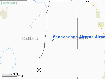
Shenandoah Airpark Airport |
Location & QuickFacts
| FAA Information Effective: | 2008-09-25 |
| Airport Identifier: | 70OH |
| Airport Status: | Operational |
| Longitude/Latitude: | 082-28-44.6070W/40-55-12.2000N
-82.479058/40.920056 (Estimated) |
| Elevation: | 1210 ft / 368.81 m (Estimated) |
| Land: | 3 acres |
| From nearest city: | 1 nautical miles NE of Shenandoah, OH |
| Location: | Richland County, OH |
| Magnetic Variation: | 06W (1985) |
Owner & Manager
| Ownership: | Privately owned |
| Owner: | La Vaughn Oswalt |
| Address: | 451 Wharton Road
Greenwich, OH 44837 |
| Phone number: | 419-895-1513 |
| Address: |
|
Airport Operations and Facilities
| Airport Use: | Private |
| Wind indicator: | Yes |
| Segmented Circle: | No |
| Control Tower: | No |
| Landing fee charge: | No |
| Sectional chart: | Detroit |
| Region: | AGL - Great Lakes |
| Boundary ARTCC: | ZOB - Cleveland |
| Tie-in FSS: | CLE - Cleveland |
| FSS on Airport: | No |
| FSS Toll Free: | 1-800-WX-BRIEF |
Airport Services
| Airframe Repair: | NONE |
| Power Plant Repair: | NONE |
| Bottled Oxygen: | NONE |
| Bulk Oxygen: | NONE |
Runway Information
Runway 09/27
| Dimension: | 2660 x 50 ft / 810.8 x 15.2 m |
| Surface: | TURF, Fair Condition |
| |
Runway 09 |
Runway 27 |
| Traffic Pattern: | Left | Left |
| Obstruction: | 15 ft road, 12.0 ft from runway, 105 ft left of centerline | 4 ft fence, 0.0 ft from runway, 125 ft right of centerline, 1:1 slope to clear |
|
Radio Navigation Aids
| ID |
Type |
Name |
Ch |
Freq |
Var |
Dist |
| MF | NDB | Manns | | 372.00 | 06W | 9.4 nm |
| AAU | NDB | Ashland | | 329.00 | 07W | 10.6 nm |
| MNN | NDB | Marion | | 201.00 | 05W | 32.5 nm |
| CL | NDB | Harri | | 344.00 | 07W | 34.3 nm |
| TII | NDB | Tiffin | | 269.00 | 05W | 34.7 nm |
| MLR | NDB | Millersburg/dcmsnd | | 382.00 | 06W | 35.8 nm |
| PCW | NDB | Port Clinton | | 423.00 | 06W | 40.1 nm |
| FZI | NDB | Fostoria | | 379.00 | 05W | 44.6 nm |
| DLZ | NDB | Delaware | | 215.00 | 06W | 48.0 nm |
| EZE | NDB | Engel | | 226.00 | 07W | 48.4 nm |
| BUD | VOR | Buckeye | | 109.80 | 05W | 32.3 nm |
| DJB | VOR/DME | Dryer | 083X | 113.60 | 05W | 30.0 nm |
| SKY | VOR/DME | Sandusky | 029X | 109.20 | 04W | 31.9 nm |
| TVT | VOR/DME | Tiverton | 112X | 116.50 | 03W | 32.1 nm |
| BSV | VOR/DME | Briggs | 071X | 112.40 | 04W | 48.8 nm |
| MFD | VORTAC | Mansfield | 025X | 108.80 | 03W | 6.0 nm |
| APE | VORTAC | Appleton | 114X | 116.70 | 06W | 46.5 nm |
| CLE | VOT | Cleveland | | 110.40 | | 41.0 nm |
| CAK | VOT | Akron/canton Regional | | 110.60 | | 47.1 nm |
Remarks
- ULTRALIGHT ON & INVOF ARPT.
- VFR WX CONDITIONS.
Images and information placed above are from
http://www.airport-data.com/airport/70OH/
We thank them for the data!
| General Info
|
| Country |
United States
|
| State |
OHIO
|
| FAA ID |
70OH
|
| Latitude |
40-55-12.200N
|
| Longitude |
082-28-44.607W
|
| Elevation |
1210 feet
|
| Near City |
SHENANDOAH
|
We don't guarantee the information is fresh and accurate. The data may
be wrong or outdated.
For more up-to-date information please refer to other sources.
|
|


