 |
|
| Seneca County Airport |
| IATA: none – ICAO: none – FAA LID: 16G |
| Summary |
| Airport type |
Public |
| Owner |
Seneca County |
| Serves |
Seneca County |
| Location |
Tiffin, Ohio |
| Elevation AMSL |
786 ft / 239.57 m |
| Coordinates |
41°05′38″N 083°12′45″W / 41.09389°N 83.2125°W / 41.09389; -83.2125 |
| Runways |
| Direction |
Length |
Surface |
| ft |
m |
| 6/24 |
4000 |
1219.2 |
Asphalt |
| Statistics (2008) |
| Aircraft operations |
60,165 |
| Based aircraft |
64 |
| Source: Federal Aviation Administration |
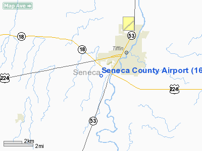
Seneca County Airport (FAA LID: 16G) is a county-owned public-use airport located 2 miles (3.2 km) southwest of the central business district of Tiffin, a city in Seneca County, Ohio, United States.
Facilities and aircraft
Seneca County Airport has one runway designated 6/24 with a 4000 x 75 ft (1219.2 x 22.9 m) asphalt pavement. For the 12-month period ending December 4, 2006, the airport had 60,165 aircraft operations, an average of 164 per day: 48% general aviation, 51% air taxi and <1% military. At that time there were 64 aircraft based at this airport: 75% single-engine, 23% multi-engine and 2% jet.
The above content comes from Wikipedia and is published under free licenses – click here to read more.
Location & QuickFacts
| FAA Information Effective: | 2008-09-25 |
| Airport Identifier: | 16G |
| Airport Status: | Operational |
| Longitude/Latitude: | 083-12-45.0000W/41-05-38.6000N
-83.212500/41.094056 (Estimated) |
| Elevation: | 786 ft / 239.57 m (Surveyed) |
| Land: | 132 acres |
| From nearest city: | 2 nautical miles SW of Tiffin, OH |
| Location: | Seneca County, OH |
| Magnetic Variation: | 05W (1985) |
Owner & Manager
| Ownership: | Publicly owned |
| Owner: | Seneca County Comsn |
| Address: | 81 Jefferson St
Tiffin, OH 44883 |
| Phone number: | 419-447-4550 |
| Manager: | Brad Newman |
| Address: | 1778 W. St. Rt 224
Tiffin, OH 44883 |
| Phone number: | 419-447-4263 |
Airport Operations and Facilities
| Airport Use: | Open to public |
| Wind indicator: | Yes |
| Segmented Circle: | Yes |
| Control Tower: | No |
| Lighting Schedule: | DUSK-DAWN
ACTVT MIRL RY 06/24; REIL & PAPI RYS O6 & 24 - CTAF. |
| Beacon Color: | Clear-Green (lighted land airport) |
| Landing fee charge: | No |
| Sectional chart: | Detroit |
| Region: | AGL - Great Lakes |
| Boundary ARTCC: | ZOB - Cleveland |
| Tie-in FSS: | CLE - Cleveland |
| FSS on Airport: | No |
| FSS Toll Free: | 1-800-WX-BRIEF |
| NOTAMs Facility: | CLE (NOTAM-d service avaliable) |
| Federal Agreements: | N |
Airport Communications
| CTAF: | 123.000 |
| Unicom: | 123.000 |
Airport Services
| Fuel available: | 100LLA
FUEL AVBL 24 HRS WITH CREDIT CARD. |
| Airframe Repair: | MAJOR |
| Power Plant Repair: | MAJOR |
| Bulk Oxygen: | HIGH/LOW |
Runway Information
Runway 06/24
| Dimension: | 4000 x 75 ft / 1219.2 x 22.9 m |
| Surface: | ASPH, Good Condition |
| Edge Lights: | Medium |
| |
Runway 06 |
Runway 24 |
| Longitude: | 083-13-06.7818W | 083-12-23.2405W |
| Latitude: | 41-05-27.6654N | 41-05-49.4938N |
| Elevation: | 786.00 ft | 781.00 ft |
| Alignment: | 56 | 127 |
| Traffic Pattern: | Left | Left |
| Markings: | Non-precision instrument, Good Condition | Non-precision instrument, Good Condition |
| Crossing Height: | 39.00 ft | 38.00 ft |
| Displaced threshold: | 0.00 ft | 115.00 ft |
| VASI: | 4-light PAPI on left side
RY 06 PAPI UNUSBL BYD 5 DEG LEFT OF CNTRLN. | 4-light PAPI on left side
UNUSBL BYD 5 DEG LEFT OF CNTRLN. |
| Visual Glide Angle: | 3.00° | 3.00° |
| Runway End Identifier: | Yes | Yes |
| Centerline Lights: | No | No |
| Touchdown Lights: | No | No |
| Obstruction: | 84 ft trees, 1350.0 ft from runway, 400 ft left of centerline, 13:1 slope to clear | 40 ft trees, 201.0 ft from runway, 168 ft left of centerline
RWY 24 APCH SLOPE 0:1 TO DSPLCD THLD DUE TO +40 FT TREES 0 FT FM 168 FT L.
RWY 24 +40-57 FT TREES 0-200 FT FROM THLD 168 FT LEFT. |
|
Radio Navigation Aids
| ID |
Type |
Name |
Ch |
Freq |
Var |
Dist |
| TII | NDB | Tiffin | | 269.00 | 05W | 0.3 nm |
| FZI | NDB | Fostoria | | 379.00 | 05W | 10.1 nm |
| BNR | NDB | Benton Ridge | | 334.00 | 05W | 21.2 nm |
| MNN | NDB | Marion | | 201.00 | 05W | 29.4 nm |
| PCW | NDB | Port Clinton | | 423.00 | 06W | 29.9 nm |
| PDR | NDB | Ottawa | | 233.00 | 05W | 34.8 nm |
| MF | NDB | Manns | | 372.00 | 06W | 40.0 nm |
| RUV | NDB | Rushsylvania | | 326.00 | 05W | 43.4 nm |
| LYL | NDB | Lima | | 362.00 | 04W | 43.6 nm |
| AAU | NDB | Ashland | | 329.00 | 07W | 44.2 nm |
| PT | NDB | Pelee Island | | 283.00 | 05W | 47.9 nm |
| DLZ | NDB | Delaware | | 215.00 | 06W | 49.4 nm |
| TOL | TACAN | Toledo | 072X | | 05W | 40.0 nm |
| MAH | VOR | Marathon | | 114.90 | 05W | 21.0 nm |
| BUD | VOR | Buckeye | | 109.80 | 05W | 29.5 nm |
| AOH | VOR | Allen County | | 108.40 | 04W | 41.5 nm |
| VWV | VOR/DME | Waterville | 078X | 113.10 | 02W | 28.8 nm |
| SKY | VOR/DME | Sandusky | 029X | 109.20 | 04W | 32.5 nm |
| FDY | VORTAC | Findlay | 019X | 108.20 | 02W | 26.0 nm |
| MFD | VORTAC | Mansfield | 025X | 108.80 | 03W | 31.3 nm |
Remarks
- AIRNIC 121.72 TO TOLEDO APPROACH - CLICK 4 TIMES.
Images and information placed above are from
http://www.airport-data.com/airport/16G/
We thank them for the data!
| General Info
|
| Country |
United States
|
| State |
OHIO
|
| FAA ID |
16G
|
| Latitude |
41-05-38.600N
|
| Longitude |
083-12-45.000W
|
| Elevation |
786 feet
|
| Near City |
TIFFIN
|
We don't guarantee the information is fresh and accurate. The data may
be wrong or outdated.
For more up-to-date information please refer to other sources.
|
|


