 |
|
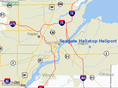
Seagate Helistop Heliport |
Location & QuickFacts
| FAA Information Effective: | 2008-09-25 |
| Airport Identifier: | 6T2 |
| Airport Status: | Operational |
| Longitude/Latitude: | 083-31-52.7600W/41-39-15.1770N
-83.531322/41.654216 (Estimated) |
| Elevation: | 650 ft / 198.12 m (Estimated) |
| Land: | 0 acres |
| From nearest city: | 0 nautical miles N of Toledo, OH |
| Location: | Lucas County, OH |
| Magnetic Variation: | 05W (1985) |
Owner & Manager
| Ownership: | Privately owned |
| Owner: | Toledo Police Dept |
| Address: | 525 N. Erie
Toledo, OH 43604 |
| Phone number: | 419-936-2730 |
| Manager: | Lt. Leo Eggart |
| Address: | 525 N. Erie
Toledo, OH 43604 |
| Phone number: | 419-936-2730 |
Airport Operations and Facilities
| Airport Use: | Open to public |
| Wind indicator: | Yes |
| Segmented Circle: | No |
| Control Tower: | No |
| Lighting Schedule: | RDO-CTL
ACTVT ORANGE PERIMETER LGTS - CTAF. |
| Landing fee charge: | No |
| Sectional chart: | Detroit |
| Region: | AGL - Great Lakes |
| Boundary ARTCC: | ZOB - Cleveland |
| Tie-in FSS: | CLE - Cleveland |
| FSS Toll Free: | 1-800-WX-BRIEF |
| NOTAMs Facility: | CLE (NOTAM-d service avaliable) |
Airport Communications
| CTAF: | 123.050 |
| Unicom: | 123.050 |
Airport Services
Runway Information
Helipad H1
| Dimension: | 50 x 50 ft / 15.2 x 15.2 m |
| Surface: | CONC, Good Condition
ROOFTOP. |
| |
Runway H1 |
Runway |
| Traffic Pattern: | Left | Left |
| Markings: | Nonstandard, Good Condition
NOT MARKED WITH 'H'. | ,
NOT MARKED WITH 'H'. |
| VASI: | nonstandard system
NSTD 1-BOX (2 VASIS). |
NSTD 1-BOX (2 VASIS). |
|
Radio Navigation Aids
| ID |
Type |
Name |
Ch |
Freq |
Var |
Dist |
| USE | NDB | Fulton | | 375.00 | 05W | 27.2 nm |
| ADG | NDB | Adrian | | 278.00 | 06W | 27.7 nm |
| TCU | NDB | Tecumseh | | 239.00 | 04W | 27.8 nm |
| FZI | NDB | Fostoria | | 379.00 | 05W | 28.6 nm |
| PCW | NDB | Port Clinton | | 423.00 | 06W | 30.9 nm |
| RYS | NDB | Grosse Ile | | 419.00 | 06W | 31.8 nm |
| TII | NDB | Tiffin | | 269.00 | 05W | 36.5 nm |
| BNR | NDB | Benton Ridge | | 334.00 | 05W | 38.6 nm |
| PT | NDB | Pelee Island | | 283.00 | 05W | 39.4 nm |
| G | NDB | Golf | | 398.00 | 05W | 41.5 nm |
| PDR | NDB | Ottawa | | 233.00 | 05W | 42.5 nm |
| BYN | NDB | Bryan | | 260.00 | 04W | 43.3 nm |
| DFI | NDB | Defiance | | 246.00 | 05W | 44.7 nm |
| QG | NDB | Windsor | | 353.00 | 06W | 49.4 nm |
| VQ | NDB | Cargl | | 230.00 | 05W | 49.4 nm |
| TOL | TACAN | Toledo | 072X | | 05W | 12.6 nm |
| MAH | VOR | Marathon | | 114.90 | 05W | 38.9 nm |
| VWV | VOR/DME | Waterville | 078X | 113.10 | 02W | 13.1 nm |
| DXO | VOR/DME | Detroit | 081X | 113.40 | 06W | 34.4 nm |
| SKY | VOR/DME | Sandusky | 029X | 109.20 | 04W | 41.6 nm |
| YQG | VOR/DME | Windsor | 085X | 113.80 | 06W | 47.6 nm |
| CRL | VORTAC | Carleton | 104X | 115.70 | 03W | 23.9 nm |
| FDY | VORTAC | Findlay | 019X | 108.20 | 02W | 43.2 nm |
| SVM | VORTAC | Salem | 090X | 114.30 | 03W | 45.4 nm |
| YIP | VOT | Willow Run | | 112.00 | | 34.9 nm |
| DTW | VOT | Detroit Met Wayne | | 109.80 | | 35.3 nm |
Remarks
- APP/DEP CORRIDOR 040-110 DEG MAG, PPR.
- PRVDD AREA APROPLY MKD. WIND INDCR MAINTD. FINAL APVL UPON FLT EVAL. NO NGT OPNS. UNAUZD PERSONS RSTRD. FIRE PROTECTION PRVDD.
Images and information placed above are from
http://www.airport-data.com/airport/6T2/
We thank them for the data!
|
|


