 |
|
Location & QuickFacts
| FAA Information Effective: | 2008-09-25 |
| Airport Identifier: | OI35 |
| Airport Status: | Operational |
| Longitude/Latitude: | 083-35-35.7650W/41-38-23.1800N
-83.593268/41.639772 (Estimated) |
| Elevation: | 620 ft / 188.98 m (Estimated) |
| Land: | 0 acres |
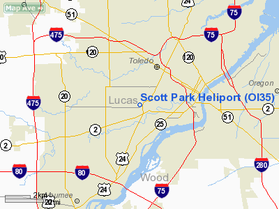
| From nearest city: | 3 nautical miles SW of Toledo, OH |
| Location: | Lucas County, OH |
| Magnetic Variation: | 07W (2000) |
Owner & Manager
| Ownership: | Publicly owned |
| Owner: | University Of Toledo |
| Address: | 2801 West Bancroft
Toledo, OH 43606 |
| Phone number: | 419-537-2072 |
| Address: |
|
Airport Operations and Facilities
| Airport Use: | Private |
| Wind indicator: | No |
| Segmented Circle: | No |
| Control Tower: | No |
| Landing fee charge: | No |
| Sectional chart: | Detroit |
| Region: | AGL - Great Lakes |
| Boundary ARTCC: | ZOB - Cleveland |
| Tie-in FSS: | CLE - Cleveland |
| FSS on Airport: | No |
| FSS Toll Free: | 1-800-WX-BRIEF |
Runway Information
Helipad H1
| Dimension: | 380 x 261 ft / 115.8 x 79.6 m |
| Surface: | TURF, |
| |
Runway H1 |
Runway |
| Traffic Pattern: | Left | Left |
|
Radio Navigation Aids
| ID |
Type |
Name |
Ch |
Freq |
Var |
Dist |
| USE | NDB | Fulton | | 375.00 | 05W | 24.3 nm |
| ADG | NDB | Adrian | | 278.00 | 06W | 25.7 nm |
| TCU | NDB | Tecumseh | | 239.00 | 04W | 27.1 nm |
| FZI | NDB | Fostoria | | 379.00 | 05W | 28.5 nm |
| PCW | NDB | Port Clinton | | 423.00 | 06W | 33.4 nm |
| RYS | NDB | Grosse Ile | | 419.00 | 06W | 34.0 nm |
| TII | NDB | Tiffin | | 269.00 | 05W | 36.9 nm |
| BNR | NDB | Benton Ridge | | 334.00 | 05W | 37.3 nm |
| BYN | NDB | Bryan | | 260.00 | 04W | 40.4 nm |
| PDR | NDB | Ottawa | | 233.00 | 05W | 40.4 nm |
| DFI | NDB | Defiance | | 246.00 | 05W | 41.8 nm |
| PT | NDB | Pelee Island | | 283.00 | 05W | 42.3 nm |
| G | NDB | Golf | | 398.00 | 05W | 43.8 nm |
| TOL | TACAN | Toledo | 072X | | 05W | 9.7 nm |
| MAH | VOR | Marathon | | 114.90 | 05W | 37.7 nm |
| VWV | VOR/DME | Waterville | 078X | 113.10 | 02W | 11.5 nm |
| DXO | VOR/DME | Detroit | 081X | 113.40 | 06W | 35.9 nm |
| SKY | VOR/DME | Sandusky | 029X | 109.20 | 04W | 44.0 nm |
| CRL | VORTAC | Carleton | 104X | 115.70 | 03W | 25.3 nm |
| FDY | VORTAC | Findlay | 019X | 108.20 | 02W | 41.8 nm |
| SVM | VORTAC | Salem | 090X | 114.30 | 03W | 46.2 nm |
| YIP | VOT | Willow Run | | 112.00 | | 35.9 nm |
| DTW | VOT | Detroit Met Wayne | | 109.80 | | 36.8 nm |
Remarks
- PROVIDED APCH/DEP OPNS ARE CONDUCTED IN AN AREA 170 DEG CLOCKWISE TO 045 DEG USING THE PAD AS THE CENTER OF A COMPASS ROSE; NO NIGHT OPNS ARE. CONDUCTED UNLESS SUITABLE LIGHTING OF THE AREA IS PROVIDED IN ACCORDANCE WITH AC 150/5390-1; A NON-OBSTRUCTING WIND INDICATOR IS PROVIDED.
Images and information placed above are from
http://www.airport-data.com/airport/OI35/
We thank them for the data!
|
|


