 |
|
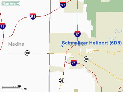
Location & QuickFacts
| FAA Information Effective: | 2008-09-25 |
| Airport Identifier: | 6D5 |
| Airport Status: | Operational |
| Longitude/Latitude: | 081-39-37.4490W/41-08-50.1970N
-81.660403/41.147277 (Estimated) |
| Elevation: | 992 ft / 302.36 m (Surveyed) |
| Land: | 13 acres |
| From nearest city: | 7 nautical miles NW of Akron, OH |
| Location: | Summit County, OH |
| Magnetic Variation: | 07W (1985) |
Owner & Manager
| Ownership: | Privately owned |
| Owner: | J. Schmeltzer |
| Address: | 440 Crystal Lake Rd
Akron, OH 44313 |
| Phone number: | 330-666-8528 |
| Manager: | Julius Schmeltzer |
| Address: | 440 Crystal Lake Rd
Akron, OH 44313 |
| Phone number: | 330-666-8528
WORK PHONE 330-923-0464. |
Airport Operations and Facilities
| Airport Use: | Open to public |
| Wind indicator: | No |
| Segmented Circle: | No |
| Control Tower: | No |
| Sectional chart: | Detroit |
| Region: | AGL - Great Lakes |
| Boundary ARTCC: | ZOB - Cleveland |
| Tie-in FSS: | CLE - Cleveland |
| FSS Toll Free: | 1-800-WX-BRIEF |
| NOTAMs Facility: | CLE (NOTAM-d service avaliable) |
Airport Communications
Runway Information
Helipad H1
| Dimension: | 50 x 50 ft / 15.2 x 15.2 m |
| Surface: | TURF, Good Condition |
| |
Runway H1 |
Runway |
| Traffic Pattern: | Left | Left |
|
Radio Navigation Aids
| ID |
Type |
Name |
Ch |
Freq |
Var |
Dist |
| AK | NDB | Akron | | 362.00 | 07W | 13.2 nm |
| CL | NDB | Harri | | 344.00 | 07W | 17.9 nm |
| EZE | NDB | Engel | | 226.00 | 07W | 20.7 nm |
| BKL | NDB | Burke Lakefront | | 416.00 | 07W | 22.9 nm |
| AAU | NDB | Ashland | | 329.00 | 07W | 29.1 nm |
| LQL | NDB | Lakeland | | 263.00 | 08W | 34.6 nm |
| MLR | NDB | Millersburg/dcmsnd | | 382.00 | 06W | 37.7 nm |
| MF | NDB | Manns | | 372.00 | 06W | 42.3 nm |
| TSO | NDB | Tolson | | 395.00 | 07W | 44.0 nm |
| ACO | VOR/DME | Akron | 091X | 114.40 | 04W | 20.9 nm |
| DJB | VOR/DME | Dryer | 083X | 113.60 | 05W | 26.0 nm |
| BSV | VOR/DME | Briggs | 071X | 112.40 | 04W | 26.5 nm |
| CXR | VOR/DME | Chardon | 074X | 112.70 | 05W | 31.6 nm |
| LNN | VOR/DME | Lost Nation | 039X | 110.20 | 08W | 34.5 nm |
| TVT | VOR/DME | Tiverton | 112X | 116.50 | 03W | 46.5 nm |
| SKY | VOR/DME | Sandusky | 029X | 109.20 | 04W | 48.1 nm |
| MFD | VORTAC | Mansfield | 025X | 108.80 | 03W | 45.4 nm |
| YNG | VORTAC | Youngstown | 027X | 109.00 | 05W | 45.9 nm |
| CAK | VOT | Akron/canton Regional | | 110.60 | | 17.1 nm |
| CLE | VOT | Cleveland | | 110.40 | | 18.0 nm |
Remarks
- ALL OPNS ARE CONDUCTED IN AREA 070-080 & 160-300 DEGS CLKWS, AREA IS APROPLY MKD, WIND INDCR MAINTD.
Images and information placed above are from
http://www.airport-data.com/airport/6D5/
We thank them for the data!
| General Info
|
| Country |
United States
|
| State |
OHIO
|
| FAA ID |
6D5
|
| Latitude |
41-08-50.197N
|
| Longitude |
081-39-37.449W
|
| Elevation |
992 feet
|
| Near City |
AKRON
|
We don't guarantee the information is fresh and accurate. The data may
be wrong or outdated.
For more up-to-date information please refer to other sources.
|
|


