 |
|
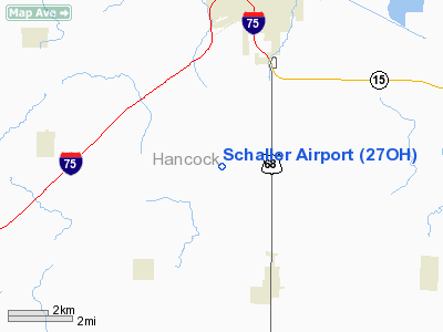
Location & QuickFacts
| FAA Information Effective: | 2008-09-25 |
| Airport Identifier: | 27OH |
| Airport Status: | Operational |
| Longitude/Latitude: | 083-40-47.7600W/40-56-48.1900N
-83.679933/40.946719 (Estimated) |
| Elevation: | 830 ft / 252.98 m (Estimated) |
| Land: | 0 acres |
| From nearest city: | 5 nautical miles SW of Findlay, OH |
| Location: | Hancock County, OH |
| Magnetic Variation: | 05W (1990) |
Owner & Manager
| Ownership: | Privately owned |
| Owner: | Larry D Schaller |
| Address: | 10373 Co Rd 37
Findlay, OH 45840 |
| Phone number: | 419-326-4164 |
| Manager: | Larry D Schaller |
| Address: | 10373 Co Rd 37
Findlay, OH 45840 |
| Phone number: | 419-326-4164 |
Airport Operations and Facilities
| Airport Use: | Private |
| Wind indicator: | Yes |
| Segmented Circle: | No |
| Control Tower: | No |
| Sectional chart: | Detroit |
| Region: | AGL - Great Lakes |
| Boundary ARTCC: | ZOB - Cleveland |
| Tie-in FSS: | CLE - Cleveland |
| FSS on Airport: | No |
| FSS Toll Free: | 1-800-WX-BRIEF |
Runway Information
Runway 18/36
| Dimension: | 2580 x 70 ft / 786.4 x 21.3 m |
| Surface: | TURF, |
| |
Runway 18 |
Runway 36 |
| Traffic Pattern: | Left | Left |
| Displaced threshold: | 480.00 ft | 180.00 ft |
| Obstruction: | 21 ft plines | 4 ft fence, 0.0 ft from runway |
|
Radio Navigation Aids
| ID |
Type |
Name |
Ch |
Freq |
Var |
Dist |
| BNR | NDB | Benton Ridge | | 334.00 | 05W | 4.5 nm |
| PDR | NDB | Ottawa | | 233.00 | 05W | 14.3 nm |
| FZI | NDB | Fostoria | | 379.00 | 05W | 19.4 nm |
| LYL | NDB | Lima | | 362.00 | 04W | 21.3 nm |
| TII | NDB | Tiffin | | 269.00 | 05W | 23.3 nm |
| RUV | NDB | Rushsylvania | | 326.00 | 05W | 29.3 nm |
| MNN | NDB | Marion | | 201.00 | 05W | 34.1 nm |
| EDJ | NDB | Bellefontaine | | 242.00 | 05W | 35.1 nm |
| DFI | NDB | Defiance | | 246.00 | 05W | 41.1 nm |
| VFU | NDB | Stanley | | 411.00 | 05W | 42.7 nm |
| USE | NDB | Fulton | | 375.00 | 05W | 44.8 nm |
| MRT | NDB | Marysville | | 403.00 | 05W | 45.8 nm |
| BYN | NDB | Bryan | | 260.00 | 04W | 47.9 nm |
| DLZ | NDB | Delaware | | 215.00 | 06W | 48.1 nm |
| CQA | NDB | Lakefield | | 205.00 | 04W | 49.0 nm |
| TOL | TACAN | Toledo | 072X | | 05W | 39.3 nm |
| MAH | VOR | Marathon | | 114.90 | 05W | 4.2 nm |
| AOH | VOR | Allen County | | 108.40 | 04W | 19.5 nm |
| BUD | VOR | Buckeye | | 109.80 | 05W | 34.4 nm |
| VWV | VOR/DME | Waterville | 078X | 113.10 | 02W | 30.4 nm |
| FDY | VORTAC | Findlay | 019X | 108.20 | 02W | 3.5 nm |
| ROD | VORTAC | Rosewood | 122X | 117.50 | 05W | 42.9 nm |
| MFD | VORTAC | Mansfield | 025X | 108.80 | 03W | 49.7 nm |
Remarks
- (E111-1) (CONT'D) ALL OBJECTS ABOVE 7:1 SLOPE FROM THE EDGE OF THE PRIMARY SFC SHOULD BE REMOVED AND WHEN THE CONTROL ZONE IS IFR, COMMUNICATIONS ARE REQUIRED WITH TOLEDO APCH CTL BEFORE TKOF/LNDG OPNS AT THE ARPT.
- PRVDD ANY OBSTNS IN THE RY APCH SLOPE SFC ARE REMOVED/LOWERED OR THE RY THR IS DSPLCD & CLEARLY MARKED TO PROVIDE A MINIMUM 20:1 APCH CLNC OVER THE OBSTNS. THE PRIMARY SFC 125 FT EITHER SIDE OF RY CNTRLN & 200 FT OFF RY END SHOULD BE CLEAR OFANY OBSTN;
Images and information placed above are from
http://www.airport-data.com/airport/27OH/
We thank them for the data!
| General Info
|
| Country |
United States
|
| State |
OHIO
|
| FAA ID |
27OH
|
| Latitude |
40-56-48.190N
|
| Longitude |
083-40-47.760W
|
| Elevation |
830 feet
|
| Near City |
FINDLAY
|
We don't guarantee the information is fresh and accurate. The data may
be wrong or outdated.
For more up-to-date information please refer to other sources.
|
|


