 |
|
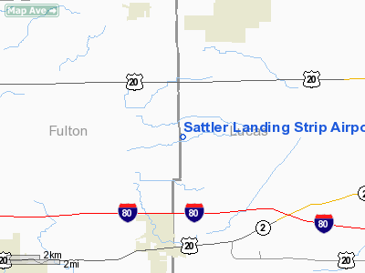
Sattler Landing Strip Airport |
Location & QuickFacts
| FAA Information Effective: | 2008-09-25 |
| Airport Identifier: | 71OH |
| Airport Status: | Operational |
| Longitude/Latitude: | 083-52-29.7900W/41-38-30.1850N
-83.874942/41.641718 (Estimated) |
| Elevation: | 700 ft / 213.36 m (Estimated) |
| Land: | 0 acres |
| From nearest city: | 3 nautical miles N of Swanton, OH |
| Location: | Lucas County, OH |
| Magnetic Variation: | 05W (1985) |
Owner & Manager
| Ownership: | Privately owned |
| Address: |
|
| Manager: | Lavern J. Sattler |
| Address: | 13807 Frankfort Rd
Swanton, OH 43558 |
| Phone number: | 419-826-7342 |
Airport Operations and Facilities
| Airport Use: | Private |
| Wind indicator: | Yes |
| Segmented Circle: | No |
| Control Tower: | No |
| Landing fee charge: | No |
| Sectional chart: | Detroit |
| Region: | AGL - Great Lakes |
| Boundary ARTCC: | ZOB - Cleveland |
| Tie-in FSS: | CLE - Cleveland |
| FSS on Airport: | No |
| FSS Toll Free: | 1-800-WX-BRIEF |
Runway Information
Runway N/S
| Dimension: | 1300 x 50 ft / 396.2 x 15.2 m |
| Surface: | TURF, |
| |
Runway N |
Runway S |
| Traffic Pattern: | Left | Left |
|
Radio Navigation Aids
| ID |
Type |
Name |
Ch |
Freq |
Var |
Dist |
| USE | NDB | Fulton | | 375.00 | 05W | 11.7 nm |
| ADG | NDB | Adrian | | 278.00 | 06W | 16.5 nm |
| TCU | NDB | Tecumseh | | 239.00 | 04W | 23.7 nm |
| BYN | NDB | Bryan | | 260.00 | 04W | 28.3 nm |
| DFI | NDB | Defiance | | 246.00 | 05W | 31.0 nm |
| FZI | NDB | Fostoria | | 379.00 | 05W | 34.7 nm |
| PDR | NDB | Ottawa | | 233.00 | 05W | 37.0 nm |
| BNR | NDB | Benton Ridge | | 334.00 | 05W | 38.4 nm |
| RYS | NDB | Grosse Ile | | 419.00 | 06W | 42.5 nm |
| TII | NDB | Tiffin | | 269.00 | 05W | 44.4 nm |
| PCW | NDB | Port Clinton | | 423.00 | 06W | 45.8 nm |
| TOL | TACAN | Toledo | 072X | | 05W | 4.5 nm |
| MAH | VOR | Marathon | | 114.90 | 05W | 38.9 nm |
| VWV | VOR/DME | Waterville | 078X | 113.10 | 02W | 15.6 nm |
| DXO | VOR/DME | Detroit | 081X | 113.40 | 06W | 41.2 nm |
| JXN | VOR/DME | Jackson | 033X | 109.60 | 05W | 45.4 nm |
| LFD | VOR/DME | Litchfield | 049X | 111.20 | 05W | 47.2 nm |
| CRL | VORTAC | Carleton | 104X | 115.70 | 03W | 30.8 nm |
| FDY | VORTAC | Findlay | 019X | 108.20 | 02W | 41.6 nm |
| SVM | VORTAC | Salem | 090X | 114.30 | 03W | 47.8 nm |
| YIP | VOT | Willow Run | | 112.00 | | 38.9 nm |
| DTW | VOT | Detroit Met Wayne | | 109.80 | | 42.0 nm |
Remarks
- PERSNL LNDG STRIP NOT OWNED BY MGR.
- PLINE (ENDING FM E) 260' NORTH (ALIGNED E SIDE).
- VFR ONLY.
Images and information placed above are from
http://www.airport-data.com/airport/71OH/
We thank them for the data!
| General Info
|
| Country |
United States
|
| State |
OHIO
|
| FAA ID |
71OH
|
| Latitude |
41-38-30.185N
|
| Longitude |
083-52-29.790W
|
| Elevation |
700 feet
|
| Near City |
SWANTON
|
We don't guarantee the information is fresh and accurate. The data may
be wrong or outdated.
For more up-to-date information please refer to other sources.
|
|


