 |
|
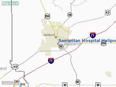
Samaritan Hospital Heliport |
Location & QuickFacts
| FAA Information Effective: | 2008-09-25 |
| Airport Identifier: | 5OH1 |
| Airport Status: | Operational |
| Longitude/Latitude: | 082-18-38.5820W/40-51-23.2030N
-82.310717/40.856445 (Estimated) |
| Elevation: | 1120 ft / 341.38 m (Estimated) |
| Land: | 0 acres |
| From nearest city: | 1 nautical miles N of Ashland, OH |
| Location: | Ashland County, OH |
| Magnetic Variation: | 06W (1985) |
Owner & Manager
| Ownership: | Privately owned |
| Owner: | Samaritan Hospital |
| Address: | 1025 Center Street
Ashland, OH 44805 |
| Phone number: | 419-289-0491 |
| Manager: | William C Kelley, Jr |
| Address: | 1025 Center St
Ashland, OH 44805 |
| Phone number: | 419-289-0491 |
Airport Operations and Facilities
| Airport Use: | Private
MEDICAL USE. |
| Wind indicator: | Yes |
| Segmented Circle: | No |
| Control Tower: | No |
| Lighting Schedule: | PHONE REQ
FOR ROTG BCN & PERIMETER LGTS CALL 419-289-0491. |
| Beacon Color: | Clear-Yellow (lighted seaplan base) |
| Landing fee charge: | No |
| Sectional chart: | Detroit |
| Region: | AGL - Great Lakes |
| Boundary ARTCC: | ZOB - Cleveland |
| Tie-in FSS: | CLE - Cleveland |
| FSS on Airport: | No |
| FSS Toll Free: | 1-800-WX-BRIEF |
Airport Services
| Airframe Repair: | NONE |
| Power Plant Repair: | NONE |
Runway Information
Helipad H1
| Dimension: | 50 x 30 ft / 15.2 x 9.1 m |
| Surface: | ASPH, |
| |
Runway H1 |
Runway |
| Traffic Pattern: | Left | Left |
| Markings: | Basic, | , |
|
Radio Navigation Aids
| ID |
Type |
Name |
Ch |
Freq |
Var |
Dist |
| AAU | NDB | Ashland | | 329.00 | 07W | 6.9 nm |
| MF | NDB | Manns | | 372.00 | 06W | 8.2 nm |
| MLR | NDB | Millersburg/dcmsnd | | 382.00 | 06W | 27.5 nm |
| CL | NDB | Harri | | 344.00 | 07W | 33.0 nm |
| MNN | NDB | Marion | | 201.00 | 05W | 37.5 nm |
| TII | NDB | Tiffin | | 269.00 | 05W | 43.2 nm |
| AK | NDB | Akron | | 362.00 | 07W | 43.8 nm |
| EZE | NDB | Engel | | 226.00 | 07W | 46.4 nm |
| PCW | NDB | Port Clinton | | 423.00 | 06W | 47.1 nm |
| BKL | NDB | Burke Lakefront | | 416.00 | 07W | 49.9 nm |
| BUD | VOR | Buckeye | | 109.80 | 05W | 37.2 nm |
| TVT | VOR/DME | Tiverton | 112X | 116.50 | 03W | 25.4 nm |
| DJB | VOR/DME | Dryer | 083X | 113.60 | 05W | 30.9 nm |
| SKY | VOR/DME | Sandusky | 029X | 109.20 | 04W | 38.1 nm |
| BSV | VOR/DME | Briggs | 071X | 112.40 | 04W | 40.6 nm |
| MFD | VORTAC | Mansfield | 025X | 108.80 | 03W | 12.8 nm |
| APE | VORTAC | Appleton | 114X | 116.70 | 06W | 44.3 nm |
| CLE | VOT | Cleveland | | 110.40 | | 39.3 nm |
| CAK | VOT | Akron/canton Regional | | 110.60 | | 39.6 nm |
Remarks
Images and information placed above are from
http://www.airport-data.com/airport/5OH1/
We thank them for the data!
| General Info
|
| Country |
United States
|
| State |
OHIO
|
| FAA ID |
5OH1
|
| Latitude |
40-51-23.203N
|
| Longitude |
082-18-38.582W
|
| Elevation |
1120 feet
|
| Near City |
ASHLAND
|
We don't guarantee the information is fresh and accurate. The data may
be wrong or outdated.
For more up-to-date information please refer to other sources.
|
|


