 |
|
Location & QuickFacts
| FAA Information Effective: | 2008-09-25 |
| Airport Identifier: | 08G |
| Airport Status: | Operational |
| Longitude/Latitude: | 081-31-34.4300W/40-06-39.2550N
-81.526231/40.110904 (Estimated) |
| Elevation: | 960 ft / 292.61 m (Estimated) |
| Land: | 1 acres |
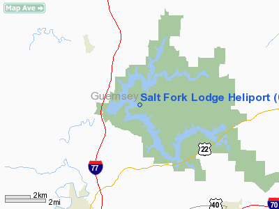
| From nearest city: | 6 nautical miles NE of Cambridge, OH |
| Location: | Guernsey County, OH |
| Magnetic Variation: | 06W (1985) |
Owner & Manager
| Ownership: | Publicly owned |
| Owner: | Ohio Dept Of Natural Resources |
| Address: | 1952 Belcher Dr C3
Columbus, OH 43224 |
| Phone number: | 614-265-6536 |
| Manager: | George Ayers |
| Address: | 14755 Cadiz Rd
Lore City, OH 43755 |
| Phone number: | 740-439-3521 |
Airport Operations and Facilities
| Airport Use: | Open to public |
| Wind indicator: | Yes
FLAG AT LODGE |
| Segmented Circle: | No |
| Control Tower: | No |
| Landing fee charge: | No |
| Sectional chart: | Detroit |
| Region: | AGL - Great Lakes |
| Boundary ARTCC: | ZOB - Cleveland |
| Tie-in FSS: | CLE - Cleveland |
| FSS on Airport: | No |
| FSS Toll Free: | 1-800-WX-BRIEF |
| NOTAMs Facility: | CLE (NOTAM-d service avaliable) |
Airport Communications
Airport Services
| Airframe Repair: | NONE |
| Power Plant Repair: | NONE |
| Bottled Oxygen: | NONE |
| Bulk Oxygen: | NONE |
Runway Information
Helipad H1
| Dimension: | 60 x 56 ft / 18.3 x 17.1 m |
| Surface: | ASPH, Good Condition |
| |
Runway H1 |
Runway |
| Traffic Pattern: | Left | Left |
|
Radio Navigation Aids
| ID |
Type |
Name |
Ch |
Freq |
Var |
Dist |
| PKB | FAN MARKER | Marietta Ohio | | | 03W | 43.9 nm |
| HRA | NDB | Zanesville | | 204.00 | 06W | 21.9 nm |
| CFX | NDB | Cadiz | | 239.00 | 07W | 24.7 nm |
| MLR | NDB | Millersburg/dcmsnd | | 382.00 | 06W | 30.4 nm |
| TSO | NDB | Tolson | | 395.00 | 07W | 34.1 nm |
| HEH | NDB | Newark | | 524.00 | 06W | 43.4 nm |
| CTW | VOR/DME | Newcomerstown | 055X | 111.80 | 07W | 7.5 nm |
| ZZV | VOR/DME | Zanesville | 051X | 111.40 | 06W | 19.7 nm |
| AIR | VOR/DME | Bellaire | 118X | 117.10 | 07W | 33.1 nm |
| TVT | VOR/DME | Tiverton | 112X | 116.50 | 03W | 34.6 nm |
| BSV | VOR/DME | Briggs | 071X | 112.40 | 04W | 38.1 nm |
| HLG | VOR/DME | Wheeling | 059X | 112.20 | 07W | 44.9 nm |
| JPU | VORTAC | Parkersburg | 023X | 108.60 | 03W | 40.9 nm |
| APE | VORTAC | Appleton | 114X | 116.70 | 06W | 48.9 nm |
| CAK | VOT | Akron/canton Regional | | 110.60 | | 48.6 nm |
Remarks
- CAUTION: APRX 2 DEG DOWNSLOPE TO S ON HELIPAD.
- PRVDD INGRESS/EGRESS OPNS ARE CONDD ONLY IN AREA 340-080 DEG CLKWS.
Images and information placed above are from
http://www.airport-data.com/airport/08G/
We thank them for the data!
| General Info
|
| Country |
United States
|
| State |
OHIO
|
| FAA ID |
08G
|
| Latitude |
40-06-39.255N
|
| Longitude |
081-31-34.430W
|
| Elevation |
960 feet
|
| Near City |
CAMBRIDGE
|
We don't guarantee the information is fresh and accurate. The data may
be wrong or outdated.
For more up-to-date information please refer to other sources.
|
|


