 |
|
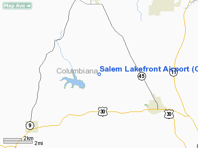
Location & QuickFacts
| FAA Information Effective: | 2008-09-25 |
| Airport Identifier: | OH27 |
| Airport Status: | Operational |
| Longitude/Latitude: | 080-50-43.2970W/40-48-28.2140N
-80.845360/40.807837 (Estimated) |
| Elevation: | 1170 ft / 356.62 m (Estimated) |
| Land: | 0 acres |
| From nearest city: | 6 nautical miles S of Salem, OH |
| Location: | Columbiana County, OH |
| Magnetic Variation: | 07W (1985) |
Owner & Manager
| Ownership: | Privately owned |
| Owner: | William R. Rousseau |
| Address: | 34447 Teegarden Rd
Salem, OH 44460 |
| Phone number: | 330-337-6208 |
| Manager: | William R. Rousseau |
| Address: | 3447 Teegarden Rd
Salem, OH 44460 |
| Phone number: | 216-222-1424 |
Airport Operations and Facilities
| Airport Use: | Private |
| Wind indicator: | Yes |
| Segmented Circle: | No |
| Control Tower: | No |
| Landing fee charge: | No |
| Sectional chart: | Detroit |
| Region: | AGL - Great Lakes |
| Boundary ARTCC: | ZOB - Cleveland |
| Tie-in FSS: | CLE - Cleveland |
| FSS on Airport: | No |
| FSS Toll Free: | 1-800-WX-BRIEF |
Airport Services
| Airframe Repair: | NONE |
| Power Plant Repair: | NONE |
| Bottled Oxygen: | NONE |
| Bulk Oxygen: | NONE |
Runway Information
Runway 03/21
| Dimension: | 2110 x 100 ft / 643.1 x 30.5 m |
| Surface: | TURF, |
| |
Runway 03 |
Runway 21 |
| Traffic Pattern: | Left | Left |
| Runway End Identifier: | No | No |
| Centerline Lights: | No | No |
| Touchdown Lights: | No | No |
| Obstruction: | 45 ft tree, 85 ft right of centerline | 40 ft trees, 0.0 ft from runway, 90 ft left of centerline |
|
Radio Navigation Aids
| ID |
Type |
Name |
Ch |
Freq |
Var |
Dist |
| TSO | NDB | Tolson | | 395.00 | 07W | 18.1 nm |
| UCP | NDB | Castle | | 272.00 | 09W | 23.4 nm |
| HBD | NDB | Hubbard | | 408.00 | 08W | 25.2 nm |
| AK | NDB | Akron | | 362.00 | 07W | 29.2 nm |
| CFX | NDB | Cadiz | | 239.00 | 07W | 35.2 nm |
| MLR | NDB | Millersburg/dcmsnd | | 382.00 | 06W | 49.5 nm |
| ACO | VOR/DME | Akron | 091X | 114.40 | 04W | 24.2 nm |
| BSV | VOR/DME | Briggs | 071X | 112.40 | 04W | 27.0 nm |
| HLG | VOR/DME | Wheeling | 059X | 112.20 | 07W | 35.3 nm |
| CXR | VOR/DME | Chardon | 074X | 112.70 | 05W | 45.0 nm |
| CTW | VOR/DME | Newcomerstown | 055X | 111.80 | 07W | 45.2 nm |
| AIR | VOR/DME | Bellaire | 118X | 117.10 | 07W | 47.6 nm |
| AGC | VOR/DME | Allegheny | 037X | 110.00 | 09W | 48.6 nm |
| EWC | VORTAC | Ellwood City | 105X | 115.80 | 08W | 28.9 nm |
| YNG | VORTAC | Youngstown | 027X | 109.00 | 05W | 32.4 nm |
| MMJ | VORTAC | Montour | 057X | 112.00 | 08W | 35.4 nm |
| CAK | VOT | Akron/canton Regional | | 110.60 | | 27.9 nm |
Remarks
Images and information placed above are from
http://www.airport-data.com/airport/OH27/
We thank them for the data!
| General Info
|
| Country |
United States
|
| State |
OHIO
|
| FAA ID |
OH27
|
| Latitude |
40-48-28.214N
|
| Longitude |
080-50-43.297W
|
| Elevation |
1170 feet
|
| Near City |
SALEM
|
We don't guarantee the information is fresh and accurate. The data may
be wrong or outdated.
For more up-to-date information please refer to other sources.
|
|


