 |
|
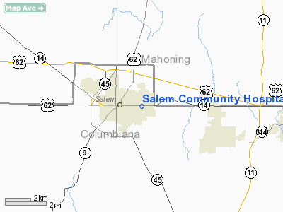
Salem Community Hospital Heliport |
Location & QuickFacts
| FAA Information Effective: | 2008-09-25 |
| Airport Identifier: | 97OI |
| Airport Status: | Operational |
| Longitude/Latitude: | 080-49-58.2960W/40-54-01.2120N
-80.832860/40.900337 (Estimated) |
| Elevation: | 1305 ft / 397.76 m (Estimated) |
| Land: | 0 acres |
| From nearest city: | 0 nautical miles E of Salem, OH |
| Location: | Columbiana County, OH |
| Magnetic Variation: | 07W (1985) |
Owner & Manager
| Ownership: | Privately owned |
| Owner: | Salem Community Hospital |
| Address: | 1995 East State St.
Salem, OH 44460 |
| Phone number: | 216-332-1551 |
| Manager: | Thomas E. Griggs |
| Address: |
|
Airport Operations and Facilities
| Airport Use: | Private
MEDICAL USE. |
| Wind indicator: | Yes |
| Segmented Circle: | No |
| Control Tower: | No |
| Lighting Schedule: | PHONE REQ |
| Beacon Color: | Clear-Green-Yellow (heliport) |
| Sectional chart: | Cincinnati |
| Region: | AGL - Great Lakes |
| Boundary ARTCC: | ZOB - Cleveland |
| Tie-in FSS: | CLE - Cleveland |
| FSS Toll Free: | 1-800-WX-BRIEF |
Runway Information
Helipad H1
| Dimension: | 37 x 37 ft / 11.3 x 11.3 m |
| Surface: | ASPH, |
| |
Runway H1 |
Runway |
| Traffic Pattern: | Left | Left |
|
Radio Navigation Aids
| ID |
Type |
Name |
Ch |
Freq |
Var |
Dist |
| UCP | NDB | Castle | | 272.00 | 09W | 20.3 nm |
| HBD | NDB | Hubbard | | 408.00 | 08W | 20.4 nm |
| TSO | NDB | Tolson | | 395.00 | 07W | 23.2 nm |
| AK | NDB | Akron | | 362.00 | 07W | 27.1 nm |
| CFX | NDB | Cadiz | | 239.00 | 07W | 40.7 nm |
| ACO | VOR/DME | Akron | 091X | 114.40 | 04W | 20.9 nm |
| BSV | VOR/DME | Briggs | 071X | 112.40 | 04W | 28.9 nm |
| CXR | VOR/DME | Chardon | 074X | 112.70 | 05W | 40.0 nm |
| HLG | VOR/DME | Wheeling | 059X | 112.20 | 07W | 40.3 nm |
| CTW | VOR/DME | Newcomerstown | 055X | 111.80 | 07W | 49.9 nm |
| YNG | VORTAC | Youngstown | 027X | 109.00 | 05W | 26.9 nm |
| EWC | VORTAC | Ellwood City | 105X | 115.80 | 08W | 28.6 nm |
| MMJ | VORTAC | Montour | 057X | 112.00 | 08W | 38.2 nm |
| CAK | VOT | Akron/canton Regional | | 110.60 | | 27.7 nm |
Remarks
- INGRESS/EGRESS 040 TO 095 AND 175 TO 210; AREA IS MARKED; WIND INDICATOR IS MAINTAINED.
Images and information placed above are from
http://www.airport-data.com/airport/97OI/
We thank them for the data!
| General Info
|
| Country |
United States
|
| State |
OHIO
|
| FAA ID |
97OI
|
| Latitude |
40-54-01.212N
|
| Longitude |
080-49-58.296W
|
| Elevation |
1305 feet
|
| Near City |
SALEM
|
We don't guarantee the information is fresh and accurate. The data may
be wrong or outdated.
For more up-to-date information please refer to other sources.
|
|


