 |
|
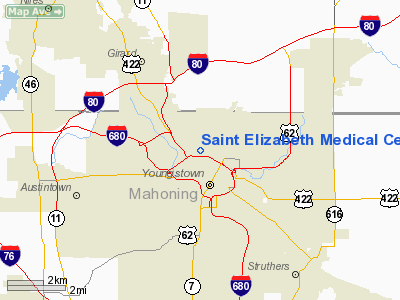
Saint Elizabeth Medical Center Heliport |
Location & QuickFacts
| FAA Information Effective: | 2008-09-25 |
| Airport Identifier: | 06O1 |
| Airport Status: | Operational |
| Longitude/Latitude: | 080-39-25.2710W/41-06-53.2090N
-80.657020/41.114780 (Estimated) |
| Elevation: | 1020 ft / 310.90 m (Estimated) |
| Land: | 0 acres |
| From nearest city: | 1 nautical miles N of Youngstown, OH |
| Location: | Mahoning County, OH |
| Magnetic Variation: | 08W (1990) |
Owner & Manager
| Ownership: | Privately owned |
| Owner: | St Elizabeth Hospital Med Ctr |
| Address: | 1044 Belmont Avenue
Youngstown, OH 44501-1790 |
| Phone number: | 216-746-7211 |
| Manager: | Dir Of Plant Engineer/maint |
| Address: | 1044 Belmont Avenue
Youngstown, OH 44501-1790 |
| Phone number: | 216-746-7211 |
Airport Operations and Facilities
| Airport Use: | Private
MEDICAL USE. |
| Wind indicator: | Yes |
| Segmented Circle: | No |
| Control Tower: | No |
| Sectional chart: | Detroit |
| Region: | AGL - Great Lakes |
| Boundary ARTCC: | ZOB - Cleveland |
| Tie-in FSS: | CLE - Cleveland |
| FSS on Airport: | No |
| FSS Toll Free: | 1-800-WX-BRIEF |
Runway Information
Helipad H1
| Dimension: | 40 x 40 ft / 12.2 x 12.2 m |
| Surface: | CONC, |
| |
Runway H1 |
Runway |
| Traffic Pattern: | Left | Left |
|
Radio Navigation Aids
| ID |
Type |
Name |
Ch |
Freq |
Var |
Dist |
| HBD | NDB | Hubbard | | 408.00 | 08W | 6.1 nm |
| UCP | NDB | Castle | | 272.00 | 09W | 12.2 nm |
| AK | NDB | Akron | | 362.00 | 07W | 33.2 nm |
| TSO | NDB | Tolson | | 395.00 | 07W | 38.3 nm |
| LQL | NDB | Lakeland | | 263.00 | 08W | 47.2 nm |
| FKL | VOR | Franklin | | 109.60 | 06W | 41.1 nm |
| ACO | VOR/DME | Akron | 091X | 114.40 | 04W | 24.7 nm |
| CXR | VOR/DME | Chardon | 074X | 112.70 | 05W | 33.3 nm |
| JFN | VOR/DME | Jefferson | 099X | 115.20 | 05W | 39.0 nm |
| BSV | VOR/DME | Briggs | 071X | 112.40 | 04W | 41.8 nm |
| LNN | VOR/DME | Lost Nation | 039X | 110.20 | 08W | 47.6 nm |
| YNG | VORTAC | Youngstown | 027X | 109.00 | 05W | 13.0 nm |
| EWC | VORTAC | Ellwood City | 105X | 115.80 | 08W | 26.7 nm |
| MMJ | VORTAC | Montour | 057X | 112.00 | 08W | 43.2 nm |
| CAK | VOT | Akron/canton Regional | | 110.60 | | 37.6 nm |
Remarks
- PRVDD APCH/DEP RTE OPNS TO/FROM 090 DEG OR TO/FROM 270 DEG; TKOF/LNDG AREA MKD; WIND INDICATOR MNTND.
Images and information placed above are from
http://www.airport-data.com/airport/06O1/
We thank them for the data!
| General Info
|
| Country |
United States
|
| State |
OHIO
|
| FAA ID |
06O1
|
| Latitude |
41-06-53.209N
|
| Longitude |
080-39-25.271W
|
| Elevation |
1020 feet
|
| Near City |
YOUNGSTOWN
|
We don't guarantee the information is fresh and accurate. The data may
be wrong or outdated.
For more up-to-date information please refer to other sources.
|
|


