 |
|
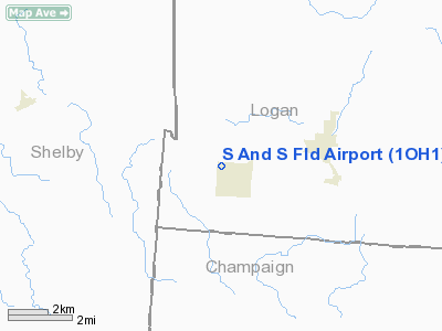
Location & QuickFacts
| FAA Information Effective: | 2008-09-25 |
| Airport Identifier: | 1OH1 |
| Airport Status: | Operational |
| Longitude/Latitude: | 083-58-33.7780W/40-18-05.1850N
-83.976049/40.301440 (Estimated) |
| Elevation: | 1057 ft / 322.17 m (Estimated) |
| Land: | 5 acres |
| From nearest city: | 0 nautical miles NW of Quincy, OH |
| Location: | Logan County, OH |
| Magnetic Variation: | 04W (1985) |
Owner & Manager
| Ownership: | Privately owned |
| Owner: | Bernie L. Stewart |
| Address: | 317 East Main St
Quincy, OH 43343 |
| Phone number: | 513-585-6896 |
| Manager: | Bernie L. Stewart |
| Address: | 317 East Main St
Quincy, OH 43343 |
| Phone number: | 513-585-6896 |
Airport Operations and Facilities
| Airport Use: | Private |
| Wind indicator: | Yes |
| Segmented Circle: | No |
| Control Tower: | No |
| Landing fee charge: | No |
| Sectional chart: | Detroit |
| Region: | AGL - Great Lakes |
| Boundary ARTCC: | ZID - Indianapolis |
| Tie-in FSS: | DAY - Dayton |
| FSS on Airport: | No |
| FSS Toll Free: | 1-800-WX-BRIEF |
Airport Services
| Airframe Repair: | NONE |
| Power Plant Repair: | NONE |
Runway Information
Runway 18/36
| Dimension: | 2100 x 60 ft / 640.1 x 18.3 m |
| Surface: | TURF, |
| |
Runway 18 |
Runway 36 |
| Traffic Pattern: | Left | Left |
| Obstruction: | | 40 ft pline, 0.0 ft from runway |
|
Radio Navigation Aids
| ID |
Type |
Name |
Ch |
Freq |
Var |
Dist |
| EDJ | NDB | Bellefontaine | | 242.00 | 05W | 8.5 nm |
| RUV | NDB | Rushsylvania | | 326.00 | 05W | 17.0 nm |
| LYL | NDB | Lima | | 362.00 | 04W | 24.3 nm |
| VES | NDB | Versailles | | 356.00 | 04W | 25.7 nm |
| CCJ | NDB | Clark County | | 341.00 | 04W | 27.3 nm |
| CQA | NDB | Lakefield | | 205.00 | 04W | 29.0 nm |
| MRT | NDB | Marysville | | 403.00 | 05W | 29.1 nm |
| UYF | NDB | London | | 263.00 | 06W | 32.2 nm |
| XEN | NDB | Xenia | | 395.00 | 03W | 35.3 nm |
| OS | NDB | Fuler | | 515.00 | 05W | 38.3 nm |
| DLZ | NDB | Delaware | | 215.00 | 06W | 40.0 nm |
| DKG | NDB | Don Scott | | 348.00 | 05W | 43.3 nm |
| PDR | NDB | Ottawa | | 233.00 | 05W | 43.9 nm |
| VFU | NDB | Stanley | | 411.00 | 05W | 44.6 nm |
| BNR | NDB | Benton Ridge | | 334.00 | 05W | 45.5 nm |
| MNN | NDB | Marion | | 201.00 | 05W | 45.6 nm |
| BU | NDB | Boutn | | 230.00 | 05W | 45.8 nm |
| CHC | NDB | Grens | | 272.00 | 04W | 46.9 nm |
| PLD | NDB | Portland | | 257.00 | 03W | 47.0 nm |
| IL | NDB | Airbo | | 407.00 | 04W | 49.9 nm |
| CSS | NDB | Court House | | 414.00 | 05W | 50.0 nm |
| XSF | TACAN | Springfield | 065X | | 04W | 28.5 nm |
| FFO | TACAN | Patterson | 099X | | 04W | 29.2 nm |
| AOH | VOR | Allen County | | 108.40 | 04W | 24.4 nm |
| MAH | VOR | Marathon | | 114.90 | 05W | 45.2 nm |
| BUD | VOR | Buckeye | | 109.80 | 05W | 45.8 nm |
| DQN | VOR/DME | Dayton | 092X | 114.50 | 01W | 25.8 nm |
| SGH | VOR/DME | Springfield | 079X | 113.20 | 04W | 28.6 nm |
| ROD | VORTAC | Rosewood | 122X | 117.50 | 05W | 3.2 nm |
| FDY | VORTAC | Findlay | 019X | 108.20 | 02W | 40.6 nm |
| DAY | VOT | Dayton J M Cox-day | | 111.00 | | 26.5 nm |
Remarks
Images and information placed above are from
http://www.airport-data.com/airport/1OH1/
We thank them for the data!
| General Info
|
| Country |
United States
|
| State |
OHIO
|
| FAA ID |
1OH1
|
| Latitude |
40-18-05.185N
|
| Longitude |
083-58-33.778W
|
| Elevation |
1057 feet
|
| Near City |
QUINCY
|
We don't guarantee the information is fresh and accurate. The data may
be wrong or outdated.
For more up-to-date information please refer to other sources.
|
|


