 |
|
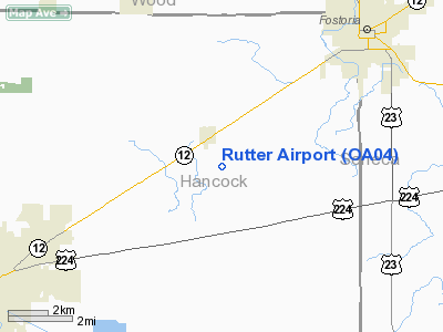
Location & QuickFacts
| FAA Information Effective: | 2008-09-25 |
| Airport Identifier: | OA04 |
| Airport Status: | Operational |
| Longitude/Latitude: | 083-30-09.7390W/41-05-51.1930N
-83.502705/41.097554 (Estimated) |
| Elevation: | 815 ft / 248.41 m (Estimated) |
| Land: | 0 acres |
| From nearest city: | 1 nautical miles S of Arcadia, OH |
| Location: | Hancock County, OH |
| Magnetic Variation: | 06W (1995) |
Owner & Manager
| Ownership: | Privately owned |
| Owner: | Thomas E. Rutter |
| Address: | 19706 T.r. 214
Arcadia, OH 44804 |
| Phone number: | 419-894-6888 |
| Manager: | Thomas E. Rutter |
| Address: | 19706 T.r. 214
Arcadia, OH 44804 |
| Phone number: | 419-894-6888 |
Airport Operations and Facilities
| Airport Use: | Private |
| Wind indicator: | Yes |
| Segmented Circle: | No |
| Control Tower: | No |
| Sectional chart: | Detroit |
| Region: | AGL - Great Lakes |
| Boundary ARTCC: | ZOB - Cleveland |
| Tie-in FSS: | CLE - Cleveland |
| FSS on Airport: | No |
| FSS Toll Free: | 1-800-WX-BRIEF |
Runway Information
Runway 18/36
| Dimension: | 2200 x 60 ft / 670.6 x 18.3 m |
| Surface: | TURF, |
| |
Runway 18 |
Runway 36 |
| Traffic Pattern: | Left | Left |
| Obstruction: | 55 ft trees, 60.0 ft from runway | 38 ft bldg, 10.0 ft from runway |
|
Radio Navigation Aids
| ID |
Type |
Name |
Ch |
Freq |
Var |
Dist |
| FZI | NDB | Fostoria | | 379.00 | 05W | 7.3 nm |
| BNR | NDB | Benton Ridge | | 334.00 | 05W | 8.8 nm |
| TII | NDB | Tiffin | | 269.00 | 05W | 13.4 nm |
| PDR | NDB | Ottawa | | 233.00 | 05W | 21.8 nm |
| LYL | NDB | Lima | | 362.00 | 04W | 33.4 nm |
| MNN | NDB | Marion | | 201.00 | 05W | 34.9 nm |
| PCW | NDB | Port Clinton | | 423.00 | 06W | 38.2 nm |
| RUV | NDB | Rushsylvania | | 326.00 | 05W | 39.1 nm |
| USE | NDB | Fulton | | 375.00 | 05W | 41.9 nm |
| DFI | NDB | Defiance | | 246.00 | 05W | 44.1 nm |
| EDJ | NDB | Bellefontaine | | 242.00 | 05W | 45.9 nm |
| BYN | NDB | Bryan | | 260.00 | 04W | 49.2 nm |
| TOL | TACAN | Toledo | 072X | | 05W | 32.7 nm |
| MAH | VOR | Marathon | | 114.90 | 05W | 8.9 nm |
| AOH | VOR | Allen County | | 108.40 | 04W | 31.6 nm |
| BUD | VOR | Buckeye | | 109.80 | 05W | 35.1 nm |
| VWV | VOR/DME | Waterville | 078X | 113.10 | 02W | 22.1 nm |
| SKY | VOR/DME | Sandusky | 029X | 109.20 | 04W | 43.3 nm |
| FDY | VORTAC | Findlay | 019X | 108.20 | 02W | 14.3 nm |
| MFD | VORTAC | Mansfield | 025X | 108.80 | 03W | 43.6 nm |
Remarks
- PRVDD THLDS LOCATED OR DSPLCD TO PROVIDE 20:1 APCH SLOPE; ADEQUATE LENGTH REMAINS TO PROVIDE SAFE OPNS; TREES REMOVED/LOWERED WITHIN 125 FT OF CNTRLN.
Images and information placed above are from
http://www.airport-data.com/airport/OA04/
We thank them for the data!
| General Info
|
| Country |
United States
|
| State |
OHIO
|
| FAA ID |
OA04
|
| Latitude |
41-05-51.193N
|
| Longitude |
083-30-09.739W
|
| Elevation |
815 feet
|
| Near City |
ARCADIA
|
We don't guarantee the information is fresh and accurate. The data may
be wrong or outdated.
For more up-to-date information please refer to other sources.
|
|


