 |
|
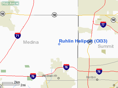
Location & QuickFacts
| FAA Information Effective: | 2008-09-25 |
| Airport Identifier: | OI33 |
| Airport Status: | Operational |
| Longitude/Latitude: | 081-43-45.4650W/41-05-11.1950N
-81.729296/41.086443 (Estimated) |
| Elevation: | 1035 ft / 315.47 m (Surveyed) |
| Land: | 75 acres |
| From nearest city: | 1 nautical miles SE of Sharon Center, OH |
| Location: | Medina County, OH |
| Magnetic Variation: | 06W (1985) |
Owner & Manager
| Ownership: | Privately owned |
| Owner: | The Ruhlin Co |
| Address: | P.o. Box 190
Sharon Center, OH 44274 |
| Phone number: | 216-239-2800 |
| Manager: | Jeffrey M. Peecook |
| Address: | P.o. Box 190
Sharon Center, ON 44274 |
| Phone number: | 216-239-2570 |
Airport Operations and Facilities
| Airport Use: | Private |
| Wind indicator: | Yes |
| Segmented Circle: | No |
| Control Tower: | No |
| Landing fee charge: | No |
| Sectional chart: | Detroit |
| Region: | AGL - Great Lakes |
| Boundary ARTCC: | ZOB - Cleveland |
| Tie-in FSS: | CLE - Cleveland |
| FSS on Airport: | No |
| FSS Toll Free: | 1-800-WX-BRIEF |
Airport Services
| Airframe Repair: | NONE |
| Power Plant Repair: | NONE |
| Bottled Oxygen: | NONE |
| Bulk Oxygen: | NONE |
Runway Information
Helipad H1
| Dimension: | 15 x 15 ft / 4.6 x 4.6 m
HELIPAD IS CIRCULAR. |
| Surface: | CONC, |
| |
Runway H1 |
Runway |
| Traffic Pattern: | Left | Left |
|
Radio Navigation Aids
| ID |
Type |
Name |
Ch |
Freq |
Var |
Dist |
| AK | NDB | Akron | | 362.00 | 07W | 15.5 nm |
| CL | NDB | Harri | | 344.00 | 07W | 18.5 nm |
| EZE | NDB | Engel | | 226.00 | 07W | 24.2 nm |
| AAU | NDB | Ashland | | 329.00 | 07W | 24.9 nm |
| BKL | NDB | Burke Lakefront | | 416.00 | 07W | 26.8 nm |
| MLR | NDB | Millersburg/dcmsnd | | 382.00 | 06W | 33.4 nm |
| MF | NDB | Manns | | 372.00 | 06W | 37.8 nm |
| LQL | NDB | Lakeland | | 263.00 | 08W | 39.2 nm |
| TSO | NDB | Tolson | | 395.00 | 07W | 43.2 nm |
| ACO | VOR/DME | Akron | 091X | 114.40 | 04W | 23.9 nm |
| BSV | VOR/DME | Briggs | 071X | 112.40 | 04W | 24.8 nm |
| DJB | VOR/DME | Dryer | 083X | 113.60 | 05W | 25.5 nm |
| CXR | VOR/DME | Chardon | 074X | 112.70 | 05W | 36.4 nm |
| LNN | VOR/DME | Lost Nation | 039X | 110.20 | 08W | 39.1 nm |
| TVT | VOR/DME | Tiverton | 112X | 116.50 | 03W | 41.9 nm |
| SKY | VOR/DME | Sandusky | 029X | 109.20 | 04W | 46.8 nm |
| MFD | VORTAC | Mansfield | 025X | 108.80 | 03W | 41.2 nm |
| YNG | VORTAC | Youngstown | 027X | 109.00 | 05W | 49.9 nm |
| CAK | VOT | Akron/canton Regional | | 110.60 | | 16.6 nm |
| CLE | VOT | Cleveland | | 110.40 | | 20.2 nm |
Remarks
- PROVIDED TRAFFIC PATTERNS ARE CONDUCTED ON NORTH SIDE OF RUNWAY. HEL ASP: PRVDD INGRESS/EGRESS OPNS ARE CONDUCTED IN AN AREA 360-270 DEGS CLKWS USING THE PAD AS THE CENTER OF A COMPASS ROSE.
Images and information placed above are from
http://www.airport-data.com/airport/OI33/
We thank them for the data!
| General Info
|
| Country |
United States
|
| State |
OHIO
|
| FAA ID |
OI33
|
| Latitude |
41-05-11.195N
|
| Longitude |
081-43-45.465W
|
| Elevation |
1035 feet
|
| Near City |
SHARON CENTER
|
We don't guarantee the information is fresh and accurate. The data may
be wrong or outdated.
For more up-to-date information please refer to other sources.
|
|


