 |
|
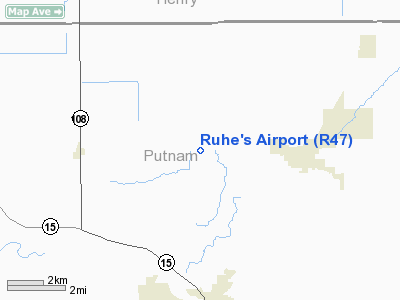
Location & QuickFacts
| FAA Information Effective: | 2008-09-25 |
| Airport Identifier: | R47 |
| Airport Status: | Operational |
| Longitude/Latitude: | 084-03-06.7990W/41-06-11.1830N
-84.051889/41.103106 (Estimated) |
| Elevation: | 801 ft / 244.14 m (Estimated) |
| Land: | 10 acres |
| From nearest city: | 3 nautical miles W of Leipsic, OH |
| Location: | Putnam County, OH |
| Magnetic Variation: | 04W (1985) |
Owner & Manager
| Ownership: | Privately owned |
| Owner: | Bob Ruhe Agriculture Service |
| Address: | 5450 St. Rt. 109
Leipsic, OH 45856 |
| Phone number: | 419-943-3352 |
| Manager: | Robert Ruhe |
| Address: | 5450 S.r. 109
Leipsic, OH 45856 |
| Phone number: | 419-943-3352 |
Airport Operations and Facilities
| Airport Use: | Open to public |
| Wind indicator: | Yes |
| Segmented Circle: | No |
| Control Tower: | No |
| Lighting Schedule: | PHONE REQ
FOR LIRL RY 09/27 CALL 419-943-3352. |
| Sectional chart: | Detroit |
| Region: | AGL - Great Lakes |
| Boundary ARTCC: | ZOB - Cleveland |
| Tie-in FSS: | CLE - Cleveland |
| FSS on Airport: | No |
| FSS Toll Free: | 1-800-WX-BRIEF |
| NOTAMs Facility: | CLE (NOTAM-d service avaliable) |
Airport Communications
| CTAF: | 123.000 |
| Unicom: | 123.000 |
Airport Services
| Airframe Repair: | MAJOR |
| Power Plant Repair: | MAJOR |
Runway Information
Runway 09/27
| Dimension: | 4455 x 65 ft / 1357.9 x 19.8 m |
| Surface: | ASPH, Good Condition |
| Edge Lights: | Non-standard lighting system
NSTD LIRL. THLD LGTD WITH 360 DEGS GREEN LGTS & RY LGTS SOUTH SIDE OFFSET 20 FT. |
| |
Runway 09 |
Runway 27 |
| Traffic Pattern: | Left | Left |
| Markings: | Basic, Good Condition | Basic, Good Condition |
| Obstruction: | 25 ft rr, 1200.0 ft from runway, 225 ft left of centerline, 42:1 slope to clear
RWY 09 +1' - 8' CULTIVATION, 40' FROM RWY END; O' BOTH SIDES OF RUNWAY. | 42 ft ant, 403.0 ft from runway, 116 ft right of centerline, 4:1 slope to clear
15 FT ACFT & TRUCKS PARKED IN PRIM SFC 0-200 FT FM 32-125 FT R. |
|
Radio Navigation Aids
| ID |
Type |
Name |
Ch |
Freq |
Var |
Dist |
| PDR | NDB | Ottawa | | 233.00 | 05W | 5.5 nm |
| BNR | NDB | Benton Ridge | | 334.00 | 05W | 18.0 nm |
| DFI | NDB | Defiance | | 246.00 | 05W | 21.9 nm |
| LYL | NDB | Lima | | 362.00 | 04W | 24.0 nm |
| VFU | NDB | Stanley | | 411.00 | 05W | 29.3 nm |
| BYN | NDB | Bryan | | 260.00 | 04W | 29.4 nm |
| FZI | NDB | Fostoria | | 379.00 | 05W | 30.1 nm |
| USE | NDB | Fulton | | 375.00 | 05W | 30.6 nm |
| TII | NDB | Tiffin | | 269.00 | 05W | 38.2 nm |
| RUV | NDB | Rushsylvania | | 326.00 | 05W | 42.5 nm |
| CQA | NDB | Lakefield | | 205.00 | 04W | 44.0 nm |
| EDJ | NDB | Bellefontaine | | 242.00 | 05W | 45.3 nm |
| ADG | NDB | Adrian | | 278.00 | 06W | 46.1 nm |
| TOL | TACAN | Toledo | 072X | | 05W | 31.6 nm |
| MAH | VOR | Marathon | | 114.90 | 05W | 18.3 nm |
| AOH | VOR | Allen County | | 108.40 | 04W | 24.1 nm |
| VWV | VOR/DME | Waterville | 078X | 113.10 | 02W | 28.1 nm |
| FDY | VORTAC | Findlay | 019X | 108.20 | 02W | 16.1 nm |
| ROD | VORTAC | Rosewood | 122X | 117.50 | 05W | 49.0 nm |
Remarks
- FLD PRIM FOR DUSTING/SPRAYING OPNS. MOST TKOFS TO W; LNDGS E; NO TFC PAT FOR AGRI PLANES.
- PRVDD OBSTNS IN APP SFC ARE RMVD/LWRD OR THRS DSPLCD TO PRVD 20:1 APP SLOPE.
Images and information placed above are from
http://www.airport-data.com/airport/R47/
We thank them for the data!
| General Info
|
| Country |
United States
|
| State |
OHIO
|
| FAA ID |
R47
|
| Latitude |
41-06-11.183N
|
| Longitude |
084-03-06.799W
|
| Elevation |
801 feet
|
| Near City |
LEIPSIC
|
We don't guarantee the information is fresh and accurate. The data may
be wrong or outdated.
For more up-to-date information please refer to other sources.
|
|


