 |
|
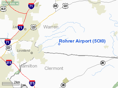
Location & QuickFacts
| FAA Information Effective: | 2008-09-25 |
| Airport Identifier: | 5OI0 |
| Airport Status: | Operational |
| Longitude/Latitude: | 084-12-40.7690W/39-17-03.2130N
-84.211325/39.284226 (Estimated) |
| Elevation: | 800 ft / 243.84 m (Estimated) |
| Land: | 0 acres |
| From nearest city: | 3 nautical miles SW of Loveland, OH |
| Location: | Warren County, OH |
| Magnetic Variation: | 04W (1985) |
Owner & Manager
| Ownership: | Privately owned |
| Owner: | Jed A. Rohrer |
| Address: | Po Box 498
Loveland, OH 45140 |
| Phone number: | 513-677-2109 |
| Address: |
|
Airport Operations and Facilities
| Airport Use: | Private |
| Wind indicator: | Yes |
| Segmented Circle: | No |
| Control Tower: | No |
| Landing fee charge: | No |
| Sectional chart: | Cincinnati |
| Region: | AGL - Great Lakes |
| Boundary ARTCC: | ZID - Indianapolis |
| Tie-in FSS: | DAY - Dayton |
| FSS on Airport: | No |
| FSS Toll Free: | 1-800-WX-BRIEF |
Runway Information
Runway 07/25
| Dimension: | 1650 x 50 ft / 502.9 x 15.2 m |
| Surface: | TURF, |
| |
Runway 07 |
Runway 25 |
| Traffic Pattern: | Left | Left |
|
Radio Navigation Aids
| ID |
Type |
Name |
Ch |
Freq |
Var |
Dist |
| MDE | NDB | Madeira | | 379.00 | 04W | 7.7 nm |
| ISZ | NDB | Cincinnati-blue Ash | | 388.00 | 04W | 8.6 nm |
| LUK | NDB | Cincinnati | | 335.00 | 04W | 9.6 nm |
| PWF | NDB | Sportys | | 245.00 | 04W | 12.5 nm |
| HW | NDB | Cubla | | 299.00 | 04W | 16.1 nm |
| HKF | NDB | Hook Field | | 239.00 | 04W | 16.9 nm |
| HAO | NDB | Hamilton | | 260.00 | 04W | 17.6 nm |
| IL | NDB | Airbo | | 407.00 | 04W | 25.3 nm |
| XEN | NDB | Xenia | | 395.00 | 03W | 29.0 nm |
| OXD | NDB | Oxford | | 282.00 | 04W | 29.7 nm |
| UR | NDB | Burln | | 321.00 | 04W | 29.8 nm |
| HOC | NDB | Hillsboro | | 278.00 | 05W | 31.7 nm |
| AMT | NDB | West Union | | 359.00 | 04W | 39.7 nm |
| CCJ | NDB | Clark County | | 341.00 | 04W | 40.7 nm |
| CSS | NDB | Court House | | 414.00 | 05W | 42.5 nm |
| PZO | NDB | Peebles | | 329.00 | 02W | 46.7 nm |
| HLB | NDB | Batesville | | 254.00 | 02W | 48.8 nm |
| FFO | TACAN | Patterson | 099X | | 04W | 32.9 nm |
| XSF | TACAN | Springfield | 065X | | 04W | 37.5 nm |
| MXQ | VOR/DME | Midwest | 076X | 112.90 | 04W | 21.0 nm |
| SGH | VOR/DME | Springfield | 079X | 113.20 | 04W | 37.3 nm |
| FLM | VOR/DME | Falmouth | 117X | 117.00 | 04W | 38.4 nm |
| DQN | VOR/DME | Dayton | 092X | 114.50 | 01W | 44.8 nm |
| CVG | VORTAC | Cincinnati | 120X | 117.30 | 04W | 28.0 nm |
| RID | VORTAC | Richmond | 043X | 110.60 | 03W | 40.6 nm |
| LUK | VOT | Cincinnati Muni/lunken | | 108.40 | | 13.4 nm |
| DAY | VOT | Dayton J M Cox-day | | 111.00 | | 37.1 nm |
Remarks
- PRVDD THE PRIVATE GRAVEL DRIVEWAY THAT CROSSES THROUGH THE WEST END OF RWY HAVE STOP SIGNS ON BOTH SIDES OF RWY AT LEAST 125' EITHER SIDE OF RWY CNTRLN.
Images and information placed above are from
http://www.airport-data.com/airport/5OI0/
We thank them for the data!
| General Info
|
| Country |
United States
|
| State |
OHIO
|
| FAA ID |
5OI0
|
| Latitude |
39-17-03.213N
|
| Longitude |
084-12-40.769W
|
| Elevation |
800 feet
|
| Near City |
LOVELAND
|
We don't guarantee the information is fresh and accurate. The data may
be wrong or outdated.
For more up-to-date information please refer to other sources.
|
|


