 |
|
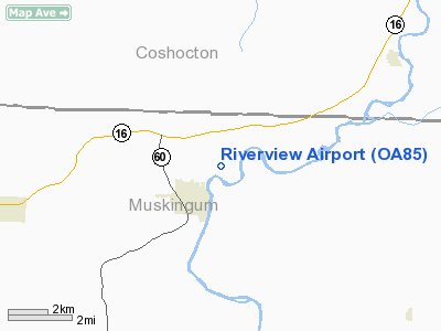
Location & QuickFacts
| FAA Information Effective: | 2008-09-25 |
| Airport Identifier: | OA85 |
| Airport Status: | Operational |
| Longitude/Latitude: | 081-59-37.4880W/40-08-11.2490N
-81.993747/40.136458 (Estimated) |
| Elevation: | 730 ft / 222.50 m (Estimated) |
| Land: | 5 acres |
| From nearest city: | 2 nautical miles NE of Dresden, OH |
| Location: | Muskingum County, OH |
| Magnetic Variation: | 06W (1985) |
Owner & Manager
| Ownership: | Privately owned |
| Owner: | William C. Jennings |
| Address: | 229 Ames Drive
Dresden, OH 43821 |
| Phone number: | 740-754-1427 |
| Manager: | William C. Jennings
MGR SON LIVES ON ARPT. |
| Address: | 229 Ames Drive
Dresden, OH 43821 |
| Phone number: | 740-754-1427 |
Airport Operations and Facilities
| Airport Use: | Private |
| Wind indicator: | No |
| Segmented Circle: | No |
| Control Tower: | No |
| Lighting Schedule: | RDO-CTL
ACTVT LIRL RY 10/28 - 122.9. |
| Landing fee charge: | No |
| Sectional chart: | Detroit |
| Region: | AGL - Great Lakes |
| Boundary ARTCC: | ZID - Indianapolis |
| Tie-in FSS: | CLE - Cleveland |
| FSS on Airport: | No |
| FSS Toll Free: | 1-800-WX-BRIEF |
Airport Services
| Airframe Repair: | NONE |
| Power Plant Repair: | NONE |
| Bottled Oxygen: | NONE |
| Bulk Oxygen: | NONE |
Runway Information
Runway 10/28
| Dimension: | 2560 x 78 ft / 780.3 x 23.8 m |
| Surface: | TURF, Good Condition |
| Edge Lights: | Non-standard lighting system
NSTD LIRL; THLD LGTS ALL GREEN; RY 10 FIRST 180 FT UNLIGHTED; RY 28 FIRST 155 FT UNLIGHTED. |
| |
Runway 10 |
Runway 28 |
| Traffic Pattern: | Left | Left |
| Displaced threshold: | 180.00 ft | 155.00 ft |
| Runway End Identifier: | No | No |
| Centerline Lights: | No | No |
| Touchdown Lights: | No | No |
| Obstruction: | 10 ft road
RY 10 10:1 DSPLCD THLD DUE TO +111 FT CROPS 0 FT FM THLD 40 FT L/R. | 20 ft road, 5.0 ft from runway
RY 28 0:1 TO DSPLCD THLD DUE TO 11 FT CROPS 0 FT FM THLD 40 FT L/R. |
|
Radio Navigation Aids
| ID |
Type |
Name |
Ch |
Freq |
Var |
Dist |
| HRA | NDB | Zanesville | | 204.00 | 06W | 14.3 nm |
| HEH | NDB | Newark | | 524.00 | 06W | 22.6 nm |
| MLR | NDB | Millersburg/dcmsnd | | 382.00 | 06W | 25.0 nm |
| CM | NDB | Sumie | | 391.00 | 05W | 36.1 nm |
| MF | NDB | Manns | | 372.00 | 06W | 43.1 nm |
| CFX | NDB | Cadiz | | 239.00 | 07W | 45.4 nm |
| CHC | NDB | Grens | | 272.00 | 04W | 48.2 nm |
| TSO | NDB | Tolson | | 395.00 | 07W | 49.2 nm |
| DKG | NDB | Don Scott | | 348.00 | 05W | 50.0 nm |
| LCK | TACAN | Rickenbacker | 069X | | 05W | 47.4 nm |
| ZZV | VOR/DME | Zanesville | 051X | 111.40 | 06W | 12.6 nm |
| TVT | VOR/DME | Tiverton | 112X | 116.50 | 03W | 20.3 nm |
| CTW | VOR/DME | Newcomerstown | 055X | 111.80 | 07W | 24.4 nm |
| BSV | VOR/DME | Briggs | 071X | 112.40 | 04W | 44.5 nm |
| APE | VORTAC | Appleton | 114X | 116.70 | 06W | 27.3 nm |
| CMH | VOT | Port Columbus | | 111.00 | | 41.9 nm |
Remarks
- USE IN VFR CONDITIONS ONLY.
Images and information placed above are from
http://www.airport-data.com/airport/OA85/
We thank them for the data!
| General Info
|
| Country |
United States
|
| State |
OHIO
|
| FAA ID |
OA85
|
| Latitude |
40-08-11.249N
|
| Longitude |
081-59-37.488W
|
| Elevation |
730 feet
|
| Near City |
DRESDEN
|
We don't guarantee the information is fresh and accurate. The data may
be wrong or outdated.
For more up-to-date information please refer to other sources.
|
|


