|
|
Rickenbacker Intl Airport |
| Rickenbacker International Airport |
 |
| IATA: LCK – ICAO: KLCK – FAA LID: LCK |
| Summary |
| Airport type |
Public |
| Operator |
Columbus Regional Airport Authority |
| Serves |
Columbus, OH |
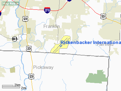
| Location |
Franklin / Pickaway counties, near Columbus, Ohio |
| Hub for |
- AirNet Express
- Evergreen International Airlines
|
| Elevation AMSL |
744 ft / 227 m |
| Coordinates |
39°48′50″N 082°55′40″W / 39.81389°N 82.92778°W / 39.81389; -82.92778 |
| Website |
www.rickenbacker.org |
| Runways |
| Direction |
Length |
Surface |
| ft |
m |
| 5R/23L |
12,102 |
3,689 |
Asphalt/Concrete |
| 5L/23R |
11,937 |
3,638 |
Asphalt |
| Statistics (2005) |
| Aircraft operations |
56,998 |
| Based aircraft |
72 |
| Source: Federal Aviation Administration |
Rickenbacker International Airport (IATA: LCK, ICAO: KLCK, FAA LID: LCK) is a joint civil-military public airport located 10 miles (16 km) south of the central business district of Columbus, near the village of Lockbourne in extreme southern Franklin County, Ohio, United States. The southern end of the airport extends into northern Pickaway County. The base was named for the famous early aviator and Columbus native Eddie Rickenbacker. It is managed by the Columbus Regional Airport Authority, which also operates Port Columbus International Airport and Bolton Field. Rickenbacker International is used primarily as a cargo airport for the city of Columbus and a growing number of passenger charter carriers are using the airport as well.
The United States Air Force maintains a presence in the form of the Ohio Air National Guard's 121st Air Refueling Wing, the first Air National Guard unit to fly KC-135 Stratotankers. Rickenbacker International is also the headquarters for the Ohio Military Reserve, one of the state defense forces of Ohio. Operations
 | |
Rickenbacker Airport |
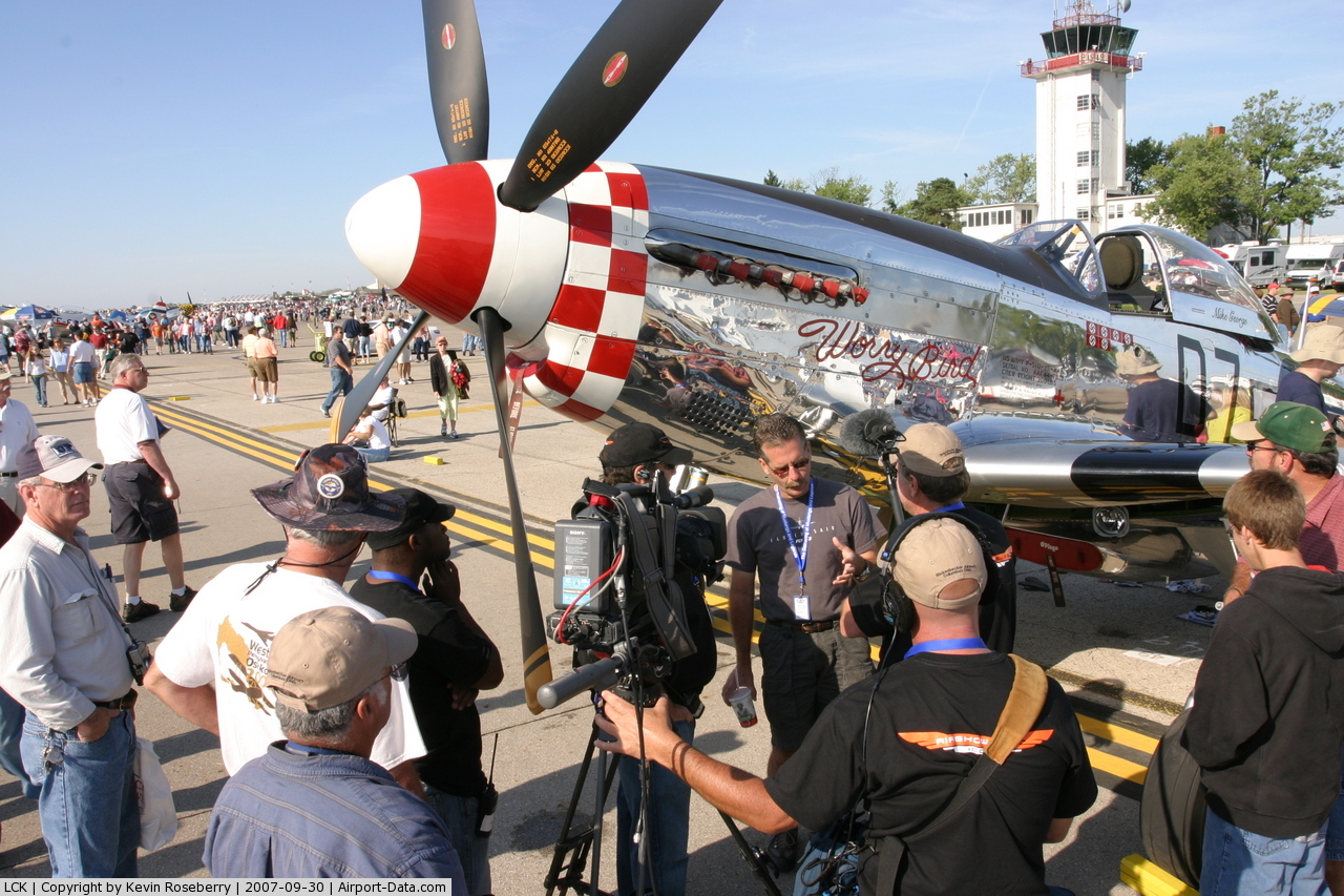
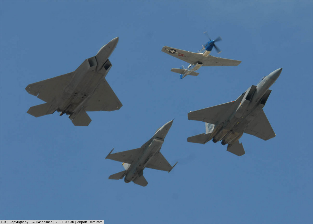
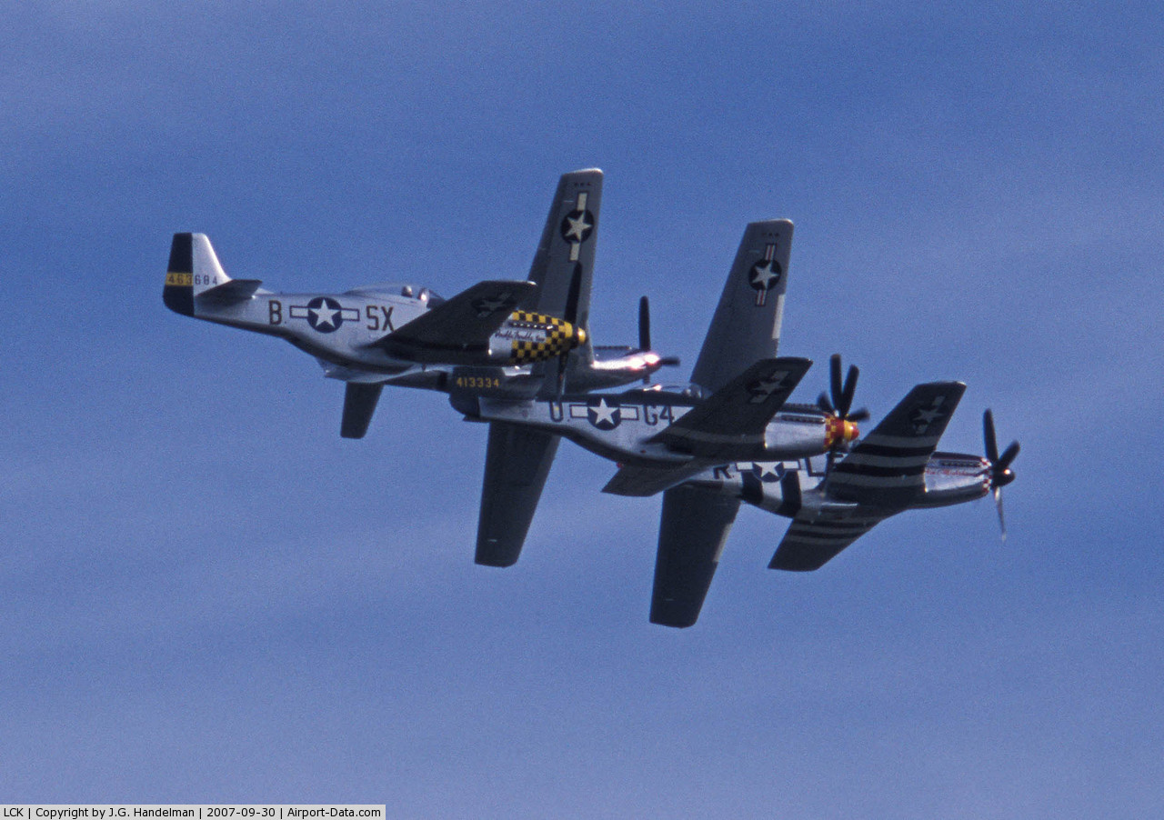
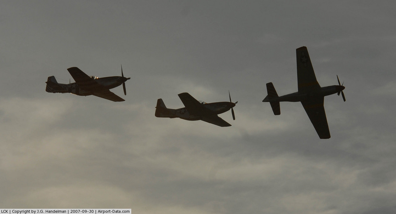
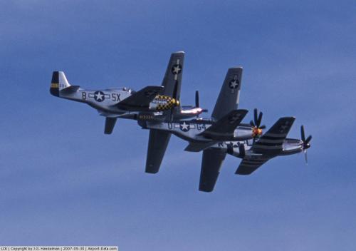
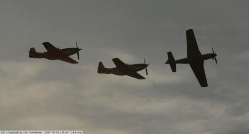
Rickenbacker used to be run by the Rickenbacker Port Authority, until merging in 2003 with Port Columbus and Bolton field creating the Columbus Regional Airport Authority. As of July 2006, Rickenbacker is the world's 126th busiest cargo airport according to Air Cargo World. Rickenbacker ranks as one of the worlds top 20 fastest growing cargo airports in July 2006 with 112,888 tons, a 15.3% increase from the previous year. This is mainly due to the transfer of AirNet Systems operations from Port Columbus International Airport to Rickenbacker. This number is expected to increase with the introduction of the new intermodal facility that is under construction. As of now it has scheduled service from FedEx Express along with FedEx Feeder contractors, Mountain Air Cargo and CSA Air and UPS Airlines along with contractors Air Cargo Carriers. Multi-weekly 747 freighter service is operated by Evergreen International Airlines, Atlas Air, and Kalitta Air. Another airline based at Rickenbacker is Snow Aviation. Rickenbacker International Airport was also the site for filming all aircraft exterior shots in the movie Air Force One starring Harrison Ford. In 2007, Rickenbacker hosted the Gathering of Mustangs and Legends air show, one of the largest-ever gatherings of operable classic warbirds, especially the P-51 Mustang.
Facilities and aircraft
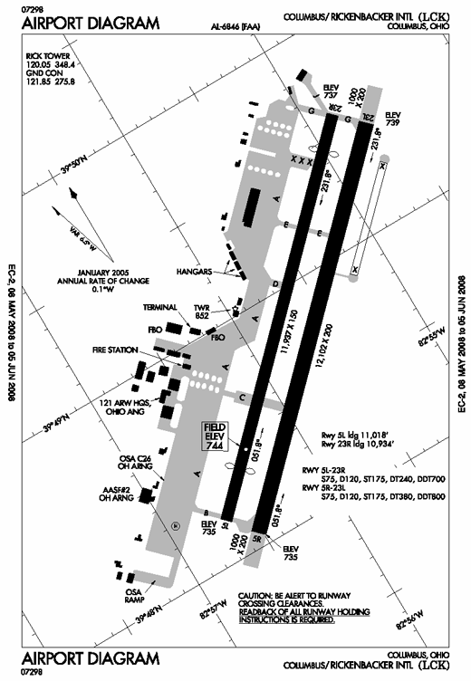 | |
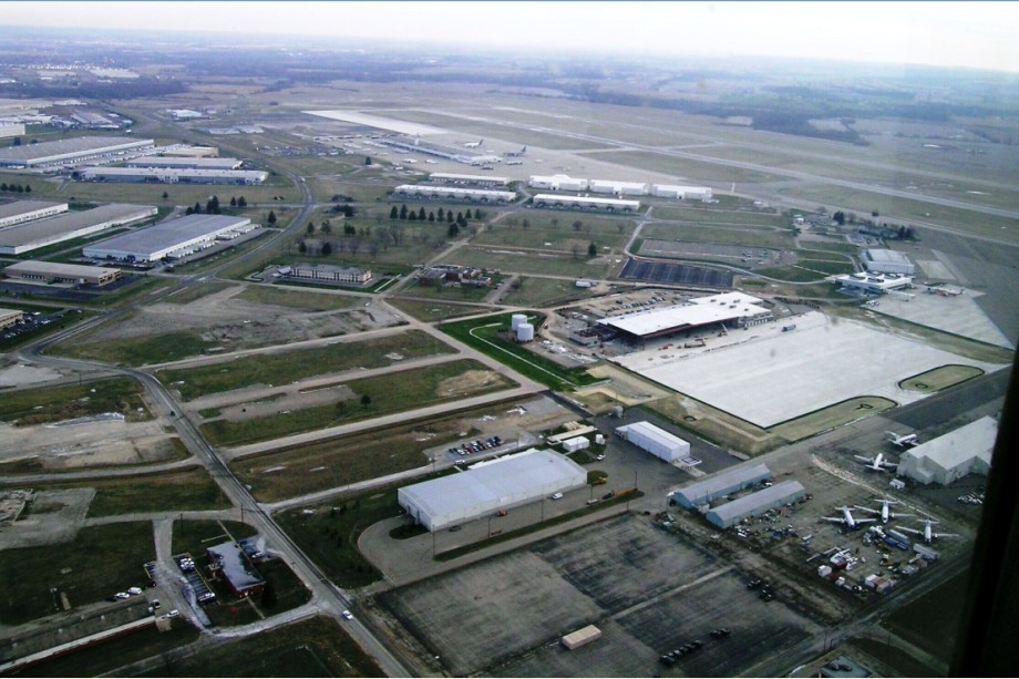
Rickenbacker Diagram |
Rickenbacker International Airport covers an area of 4,342 acres (1,757 ha) which contains two runways:
- Runway 5R/23L: 12,102 x 200 ft (3,689 x 61 m), Surface: Asphalt/Concrete
- Runway 5L/23R: 11,937 x 150 ft (3,638 x 46 m), Surface: Asphalt
For the 12-month period ending December 31, 2005, the airport had 56,998 aircraft operations, an average of 156 per day: 41% air taxi, 28% military, 23% general aviation and 9% scheduled commercial. There are 72 aircraft based at this airport: 14% single engine, 6% multi-engine, 6% jet aircraft, 44% helicopters and 31% military aircraft.
In December, 2006 PlanetSpace entered negotiations with the Ohio government to build a spaceport at Rickenbacker.
Passenger airlines and destinations
Passenger Airlines and destinations
| Airlines |
Destinations |
| Direct Air operated by USA Jet and Falcon Air Express |
Myrtle Beach |
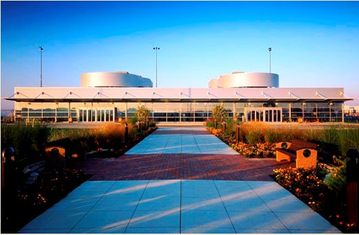 | |
Rickenbacker Terminal |
Cargo airline service
- Evergreen International Airlines (Anchorage, New York-JFK)
- FedEx Express (inbound Memphis, Minneapolis/St. Paul, Indianapolis, Baltimore/Washington outbound Memphis, Indianapolis, Minneapolis/St. Paul, Newark)
- FedEx Feeder operated by Mountain Air Cargo (Indianapolis, Memphis, Charleston)
- FedEx Feeder operated by CSA Air (Charleston)
- UPS Airlines (Louisville)
- UPS Airlines operated by Air Cargo Carriers (Louisville)
- Atlas Air (Anchorage, New York-JFK)
- Kalitta Air (Newark)
- AirNet Systems (various cities)
History
The facility was originally opened in June 1942 as Lockbourne Army Airfield (named after the nearby village of Lockbourne). It was then named the Northeastern Training Center of the Army Air Corps, and provided basic pilot training and military support.
During the Cold War the facility was known as Lockbourne Air Force Base and was assigned to the USAF Strategic Air Command. Lockbourne AFB was redesignated Rickenbacker Air Force Base on 18 May 1974, by Department of the Air Force Special Order GA-11 of 6 March 1974, to honor Columbus native Eddie Rickenbacker, the leading American fighter pilot of World War I.
The base was transferred from the Strategic Air Command to the Air National Guard and redesignated Rickenbacker Air National Guard Base on 1 April 1980.
The base was recommended for closure by the 1991 Commission, but as a result of a proposal by the State of Ohio, the 1993 Commission recommended that Rickenbacker ANGB be realigned rather than closed. The Commission decided to retain the 121st Air Refueling Wing and the 160th Air Refueling Group in a military cantonment area at Rickenbacker ANGB instead of realigning to Wright-Patterson AFB. The Air National Guard would continue to operate as tenants of the Rickenbacker Port Authority (RPA) on the RPA's airport and the military facilities were realigned as Rickenbacker Air National Guard Station on 30 September 1994 by the 1991 Congressional Base Closure and Realignment Commission.
In August 2001 a groundbreaking ceremony was held to mark the start of construction for a new, consolidated Navy and Marine Corps Air Reserve Center at Rickenbacker International Airport. The $10 million center, scheduled for completion in early 2003, will be located at the intersection of 2nd Avenue and Club Street adjacent to the Air National Guard facility at Rickenbacker. Being developed by the Navy Reserve, the project will consolidate the Naval Air Reserve Center at Rickenbacker with the Navy and Marine Corps Reserve Center currently located on Yearling Road in Columbus. When completed, the nearly 1,000 Navy and Marine Corps reservists currently located at the two existing reserve centers will shift their activities to this new facility. Once the new center opens, the site of the existing Naval Air Reserve Center at Rickenbacker will be redeveloped by the Columbus Regional Airport Authority, which operates the 5,000-acre (2,023 ha) airport.
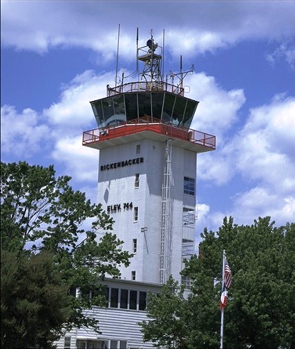 | |
Rickenbacker Tower |
 | |
Rickenbacker Airport |
The above content comes from Wikipedia and is published under free licenses – click here to read more.
 |
(Click on the photo to enlarge) |
 |
(Click on the photo to enlarge) |
 |
(Click on the photo to enlarge) |
 |
(Click on the photo to enlarge) |
 |
(Click on the photo to enlarge) |
 |
(Click on the photo to enlarge) |
Location & QuickFacts
| FAA Information Effective: | 2008-09-25 |
| Airport Identifier: | LCK |
| Airport Status: | Operational |
| Longitude/Latitude: | 082-55-40.1615W/39-48-49.6290N
-82.927823/39.813786 (Estimated) |
| Elevation: | 744 ft / 226.77 m (Surveyed) |
| Land: | 4342 acres |
| From nearest city: | 10 nautical miles S of Columbus, OH |
| Location: | Franklin County, OH |
| Magnetic Variation: | 05W (1985) |
Owner & Manager
| Ownership: | Publicly owned |
| Owner: | Columbus Regional Arpt Athry |
| Address: | 4600 International Gateway
Columbus, OH 43219 |
| Phone number: | 614-239-4000 |
| Manager: | Charles J. Goodwin |
| Address: | 7161 2nd Street
Columbus, OH 43217 |
| Phone number: | 614-409-3636 |
Airport Operations and Facilities
| Airport Use: | Open to public |
| Wind indicator: | Yes |
| Segmented Circle: | No |
| Control Tower: | Yes |
| Lighting Schedule: | DUSK-DAWN |
| Beacon Color: | Clear-Green (lighted land airport) |
| Landing fee charge: | No |
| Sectional chart: | Cincinnati |
| Region: | AGL - Great Lakes |
| Boundary ARTCC: | ZID - Indianapolis |
| Tie-in FSS: | DAY - Dayton |
| FSS on Airport: | No |
| FSS Toll Free: | 1-800-WX-BRIEF |
| NOTAMs Facility: | LCK (NOTAM-d service avaliable) |
| Certification type/date: | I A U 01/2005
PPR FOR UNSCHEDULED ACR OPNS WITH MORE THAN 30 PSGR SEATS. INDEX E ARFF EQUIP AVBL 24 HRS; CTC ARPT OPNS 614-492-2436.. |
| Federal Agreements: | NPY |
Airport Communications
Airport Services
| Fuel available: | 100LLA |
| Airframe Repair: | MAJOR |
| Power Plant Repair: | MAJOR |
Runway Information
Runway 05L/23R
| Dimension: | 11937 x 150 ft / 3638.4 x 45.7 m
HAS 1000 FT STWY ON BOTH ENDS; NOT AVBL FOR ASDA. |
| Surface: | ASPH, Fair Condition |
| Surface Treatment: | Saw-cut or plastic Grooved |
| Weight Limit: | Single wheel: 75000 lbs.
Dual wheel: 120000 lbs.
Dual tandem wheel: 240000 lbs.
Dual dual tandem wheel: 700000 lbs. |
| Edge Lights: | High |
| |
Runway 05L |
Runway 23R |
| Longitude: | 082-56-38.7373W | 082-54-49.9919W |
| Latitude: | 39-48-11.9303N | 39-49-34.8907N |
| Elevation: | 735.00 ft | 737.00 ft |
| Alignment: | 45 | 127 |
| ILS Type: | ILS/DME
| |
| Traffic Pattern: | Left | Left |
| Markings: | Precision instrument, Good Condition | Precision instrument, Good Condition |
| Crossing Height: | 75.00 ft | 75.00 ft |
| Displaced threshold: | 919.00 ft | 1003.00 ft |
| VASI: | 4-light PAPI on left side | 4-light PAPI on left side |
| Visual Glide Angle: | 3.00° | 3.00° |
| Approach lights: | MALSR | |
| Runway End Identifier: | Yes
OTS INDEFLY. | Yes |
| Centerline Lights: | No | No |
| Touchdown Lights: | No | No |
|
Runway 05R/23L
| Dimension: | 12102 x 200 ft / 3688.7 x 61.0 m
HAS 1000 FT STWY ON BOTH ENDS; NOT AVBL FOR ASDA. |
| Surface: | ASPH-CONC, Good Condition |
| Surface Treatment: | Saw-cut or plastic Grooved |
| Weight Limit: | Single wheel: 75000 lbs.
Dual wheel: 120000 lbs.
Dual tandem wheel: 380000 lbs.
Dual dual tandem wheel: 800000 lbs. |
| Edge Lights: | High |
| |
Runway 05R |
Runway 23L |
| Longitude: | 082-56-31.1182W | 082-54-40.8767W |
| Latitude: | 39-48-03.8372N | 39-49-27.9463N |
| Elevation: | 735.00 ft | 739.00 ft |
| Alignment: | 45 | 127 |
| ILS Type: | ILS/DME
| ILS
|
| Traffic Pattern: | Left | Left |
| Markings: | Precision instrument, Good Condition | Precision instrument, Good Condition |
| Arresting: | BAK9B | BAK12 |
| Crossing Height: | 66.00 ft | 74.00 ft |
| VASI: | 4-light PAPI on left side
RY 05R/23L PAPI & ILS RPI NOT COINCIDENTAL. | 4-light PAPI on left side |
| Visual Glide Angle: | 3.00° | 3.00° |
| RVR Equipment: | touchdown | touchdown |
| Approach lights: | ALSF2
ALSF II UNMONITORED INDEFLY. | MALSR |
| Centerline Lights: | Yes | Yes |
| Touchdown Lights: | Yes | Yes |
|
Radio Navigation Aids
| ID |
Type |
Name |
Ch |
Freq |
Var |
Dist |
| CHC | NDB | Grens | | 272.00 | 04W | 12.7 nm |
| BU | NDB | Boutn | | 230.00 | 05W | 12.8 nm |
| CM | NDB | Sumie | | 391.00 | 05W | 13.1 nm |
| DKG | NDB | Don Scott | | 348.00 | 05W | 17.5 nm |
| CYO | NDB | Circleville | | 366.00 | 05W | 17.6 nm |
| OS | NDB | Fuler | | 515.00 | 05W | 20.0 nm |
| RZT | NDB | Ross County | | 236.00 | 05W | 23.1 nm |
| HEH | NDB | Newark | | 524.00 | 06W | 24.9 nm |
| CSS | NDB | Court House | | 414.00 | 05W | 25.0 nm |
| UYF | NDB | London | | 263.00 | 06W | 25.9 nm |
| DLZ | NDB | Delaware | | 215.00 | 06W | 29.0 nm |
| MRT | NDB | Marysville | | 403.00 | 05W | 31.5 nm |
| EOP | NDB | Waverly | | 385.00 | 06W | 38.9 nm |
| CCJ | NDB | Clark County | | 341.00 | 04W | 39.5 nm |
| IL | NDB | Airbo | | 407.00 | 04W | 42.1 nm |
| XEN | NDB | Xenia | | 395.00 | 03W | 46.7 nm |
| HRA | NDB | Zanesville | | 204.00 | 06W | 46.9 nm |
| HOC | NDB | Hillsboro | | 278.00 | 05W | 47.4 nm |
| MNN | NDB | Marion | | 201.00 | 05W | 48.7 nm |
| LCK | TACAN | Rickenbacker | 069X | | 05W | 0.3 nm |
| XSF | TACAN | Springfield | 065X | | 04W | 42.2 nm |
| XUB | VOR | Yellow Bud | | 112.50 | 05W | 17.4 nm |
| BUD | VOR | Buckeye | | 109.80 | 05W | 48.7 nm |
| SGH | VOR/DME | Springfield | 079X | 113.20 | 04W | 42.4 nm |
| MXQ | VOR/DME | Midwest | 076X | 112.90 | 04W | 46.6 nm |
| ZZV | VOR/DME | Zanesville | 051X | 111.40 | 06W | 48.4 nm |
| APE | VORTAC | Appleton | 114X | 116.70 | 06W | 25.6 nm |
| CMH | VOT | Port Columbus | | 111.00 | | 11.0 nm |
Remarks
- RSTD: ALL F/W MIL ACFT REQUIRING PARKING AND/OR SERVICE ON 121 ARW RAMP MUST HAVE PPR NR 48 HR PRIOR FR BASE OPS CALL DSN 696-4595 OR C614-492-4595.
- RSTD; AMC ACFT OPR RSTD DUR BIRD WATCH CONDITION MODERATE (TKOF AND LDG PERMS ONLY WHEN DEP/ARR RTE AVOID IDENT BIRD ACT, NO LCL IFR/VFR TFC PAT) AND SEVERE(TKOF AND LDG PROH WO OG/CC APVL). CTC COMD POST FOR CURRENT BIRD WATCH COND CODE.
- ANG; 121 ARW KC-135 R COMD POST DSN696-4468. LTD TRAN SVC AVBL , WKD 1200-2000++ EXE HOL. LTD TRAN FUEL/PRK, TRAN AIRCREW MUST ASSIST/PERFORM REFUEL OPR. FUEL AVBL ON ANG RAMP ON PRIOR REQ ONLY. ACFT SUPPORT NOT COORD BY PPR 48 HR PRIOR WITH 121 ARW MAY NOT BE AVBL.
- ARNG; OPR 1200-2100Z++ WKD EXC HOL. NO TRAN SVC AFTER 1900Z++, DSN346-6411,C614-336-6411.
- REMARK; SEE FLIP AP/1 SUPPLEMENTARY ARPT RMK.
- LGT; BDRY LGT AVBL.
- JASU; 2(A/M-32A-86) (MA-1A) 3(AM32-95).
- FLUID: SP PRESAIR LHOX.
- OIL; O-128.
- TRAN ALERT; LTD SVC AVBL. NO ANG TRAN SVC OFF ANG RAMP.
- RWY 5R/23L PAPI AND ILS RPI NOT COINCIDENTAL.
- ARNG; CTC C-26 OPS PRIOR TO ENTERING C-26 RAMP/PARKING AREA. DSN346-6473, C6143366473.
- BIRDS & DEER ON & INVOF ARPT.
- TWY J CLSD TO GROUP V ACFT.
- CONTACT GND CTL FOR CLNC PRIOR TO PUSHBACK ONTO TWY 'A' FM CARGO RAMP 2.
- NOISE ABATEMENT PROCEDURES IN EFFECT FM 2300-0700; DEPS RYS 23L & 23R WINDS 10 KNOTS OR LESS; ARRS RYS 05L & 05R WINDS 10 KNOTS OR LESS; ARPT OPNS 614-492-2436.
Images and information placed above are from
http://www.airport-data.com/airport/LCK/
We thank them for the data!
| General Info
|
| Country |
United States
|
| State |
OHIO
|
| FAA ID |
LCK
|
| Latitude |
39-48-49.629N
|
| Longitude |
082-55-40.162W
|
| Elevation |
744 feet
|
| Near City |
COLUMBUS
|
We don't guarantee the information is fresh and accurate. The data may
be wrong or outdated.
For more up-to-date information please refer to other sources.
|
|