 |
|
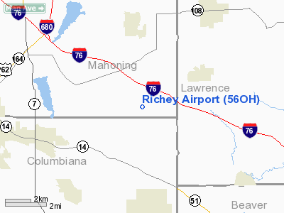
Location & QuickFacts
| FAA Information Effective: | 2008-09-25 |
| Airport Identifier: | 56OH |
| Airport Status: | Operational |
| Longitude/Latitude: | 080-33-05.2520W/40-54-26.2190N
-80.551459/40.907283 (Estimated) |
| Elevation: | 1195 ft / 364.24 m (Estimated) |
| Land: | 5 acres |
| From nearest city: | 2 nautical miles SW of Petersburg, OH |
| Location: | Mahoning County, OH |
| Magnetic Variation: | 07W (1985) |
Owner & Manager
| Ownership: | Privately owned |
| Owner: | Bill Richey |
| Address: | 14689 Hofmeister
Petersburg, OH 44454 |
| Phone number: | 216-542-2043 |
| Manager: | Bill Richey |
| Address: | 14689 Hofmeister
Petersburg, OH 44454 |
| Phone number: | 216-542-3188 |
Airport Operations and Facilities
| Airport Use: | Private |
| Wind indicator: | Yes |
| Segmented Circle: | No |
| Control Tower: | No |
| Landing fee charge: | No |
| Sectional chart: | Detroit |
| Region: | AGL - Great Lakes |
| Boundary ARTCC: | ZOB - Cleveland |
| Tie-in FSS: | CLE - Cleveland |
| FSS on Airport: | No |
| FSS Toll Free: | 1-800-WX-BRIEF |
Airport Communications
Airport Services
| Airframe Repair: | NONE |
| Power Plant Repair: | NONE |
Runway Information
Runway E/W
| Dimension: | 1500 x 75 ft / 457.2 x 22.9 m |
| Surface: | TURF, |
| |
Runway E |
Runway W |
| Traffic Pattern: | Left | Left |
|
Radio Navigation Aids
| ID |
Type |
Name |
Ch |
Freq |
Var |
Dist |
| UCP | NDB | Castle | | 272.00 | 09W | 9.3 nm |
| HBD | NDB | Hubbard | | 408.00 | 08W | 14.8 nm |
| TSO | NDB | Tolson | | 395.00 | 07W | 31.7 nm |
| AK | NDB | Akron | | 362.00 | 07W | 39.2 nm |
| CFX | NDB | Cadiz | | 239.00 | 07W | 45.5 nm |
| MKP | NDB | Mc Keesport | | 287.00 | 07W | 48.3 nm |
| PNU | NDB | Washington County | | 255.00 | 08W | 49.2 nm |
| FKL | VOR | Franklin | | 109.60 | 06W | 44.8 nm |
| ACO | VOR/DME | Akron | 091X | 114.40 | 04W | 31.9 nm |
| HLG | VOR/DME | Wheeling | 059X | 112.20 | 07W | 38.9 nm |
| BSV | VOR/DME | Briggs | 071X | 112.40 | 04W | 41.3 nm |
| AGC | VOR/DME | Allegheny | 037X | 110.00 | 09W | 44.4 nm |
| CXR | VOR/DME | Chardon | 074X | 112.70 | 05W | 45.9 nm |
| EWC | VORTAC | Ellwood City | 105X | 115.80 | 08W | 16.2 nm |
| YNG | VORTAC | Youngstown | 027X | 109.00 | 05W | 26.1 nm |
| MMJ | VORTAC | Montour | 057X | 112.00 | 08W | 30.0 nm |
| CAK | VOT | Akron/canton Regional | | 110.60 | | 40.5 nm |
Remarks
- UNABLE ESTABLISH COMPATIBLE TRAFFIC PATTERN WITH ADJACENT AIRPORT.
Images and information placed above are from
http://www.airport-data.com/airport/56OH/
We thank them for the data!
| General Info
|
| Country |
United States
|
| State |
OHIO
|
| FAA ID |
56OH
|
| Latitude |
40-54-26.219N
|
| Longitude |
080-33-05.252W
|
| Elevation |
1195 feet
|
| Near City |
PETERSBURG
|
We don't guarantee the information is fresh and accurate. The data may
be wrong or outdated.
For more up-to-date information please refer to other sources.
|
|


